Open-File Report 20151057
Field Observations of Artificial Sand and Oil Agglomerates
Title Page | List of Figures | List of Tables | Conversion Factors | Abbreviations | Abstract | Introduction | Methods | Data Processing | Data Catalog | Acknowledgments | References Cited | Index
 |
||
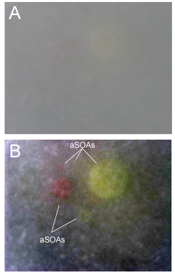
| Figure 10. A, raw image taken with the Along-Track Reef Imaging System (ATRIS camera of one ellipsoid artificial sand and oil agglomerate (aSOA) of each of the five size classes. B, the same image, processed to increase the contrast and visibility by expanding over the range of intensities in the image. All five pink and yellow aSOAs are now visible. | ||

![]() U.S. Department of the Interior |
U.S. Geological Survey
U.S. Department of the Interior |
U.S. Geological Survey
URL: http://pubsdata.usgs.gov/pubs/of/2015/1057/ofr2015-1057_figure10.html
Page Contact Information: GS Pubs Web Contact
Page Last Modified: Wednesday, 07-Dec-2016 21:42:25 EST
