Open-File Report 20151057
Field Observations of Artificial Sand and Oil Agglomerates
Title Page | List of Figures | List of Tables | Conversion Factors | Abbreviations | Abstract | Introduction | Methods | Data Processing | Data Catalog | Acknowledgments | References Cited | Index
 |
||
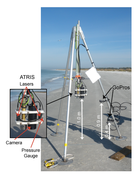
| Figure 7. Instrumented tripod deployed in approximately 1.5-meters water depth. Indicated are the Along-Track Reef Imaging System (ATRIS) and GoPro video cameras used to capture images of the artificial sand and oil agglomerates (aSOAs) on the seafloor, along with the lasers used to determine if aSOAs were placed within the ATRIS field of view, and the pressure gauge. Distance is expressed in meters (m). | ||

![]() U.S. Department of the Interior |
U.S. Geological Survey
U.S. Department of the Interior |
U.S. Geological Survey
URL: http://pubsdata.usgs.gov/pubs/of/2015/1057/ofr2015-1057_figure7.html
Page Contact Information: GS Pubs Web Contact
Page Last Modified: Wednesday, 07-Dec-2016 21:42:24 EST
