Open-File Report 20151057
Field Observations of Artificial Sand and Oil Agglomerates
Title Page | List of Figures | List of Tables | Conversion Factors | Abbreviations | Abstract | Introduction | Methods | Data Processing | Data Catalog | Acknowledgments | References Cited | Index
 |
||
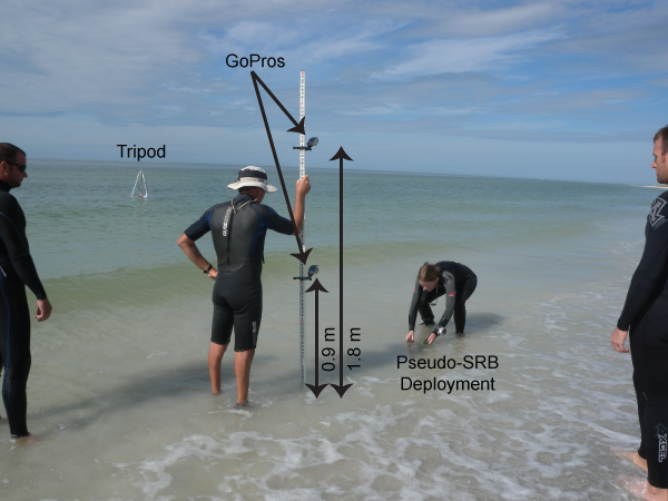
| Figure 9. Swash zone deployment of artificial sand and oil agglomerates (aSOAs). GoPro cameras mounted to a stadia rod at heights of 0.9 meters and 1.8 meters captured the movement of aSOAs deployed in the swash zone. In the background, the tripod is visible, still collecting pressure data with the Along-Track Reef Imaging System (ATRIS). Distance is expressed in meters (m). | ||

![]() U.S. Department of the Interior |
U.S. Geological Survey
U.S. Department of the Interior |
U.S. Geological Survey
URL: http://pubsdata.usgs.gov/pubs/of/2015/1057/ofr2015-1057_figure9.html
Page Contact Information: GS Pubs Web Contact
Page Last Modified: Wednesday, 07-Dec-2016 21:42:25 EST
