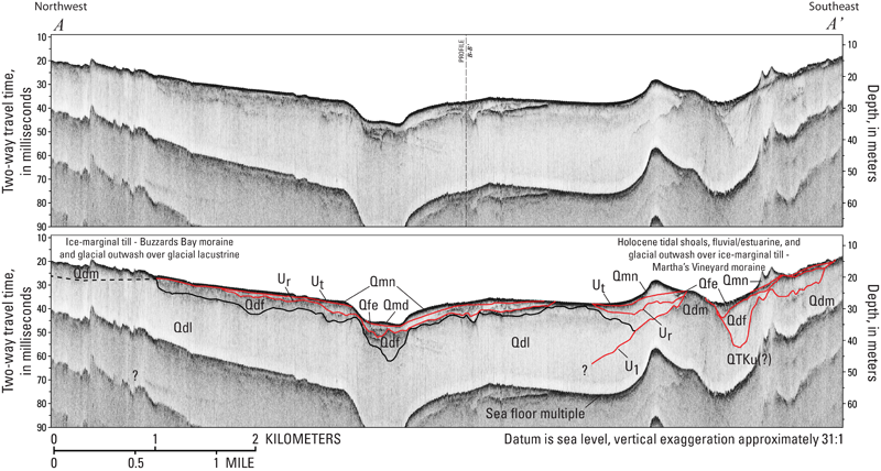
Figure 10. Chirp seismic-reflection profile A-A' with seismic stratigraphic interpretation. This profile illustrates the stratigraphy beneath western Vineyard Sound, between Cuttyhunk Island and Aquinnah on Martha's Vineyard. See figure 9 for descriptions of stratigraphic units and major unconformities (indicated by red lines). Deformed Late Cretaceous(?) to early(?) Pleistocene coastal plain units (QTKu?) underlie ice-marginal till that forms an east-west extension of the Martha's Vineyard end moraine (Qdm) across western Vineyard Sound. The deep basin north of the morainal dam is mostly filled by thick glacial lacustrine (Qdl) units, which are unconformably overlain by less extensive glaciofluvial outwash (Qdf) and Holocene fluvial, estuarine (Qfe), and nearshore and deepwater marine (Qmn and Qmd, respectively) deposits. The morphologies of meltwater drainage incised across the outwash plain through the morainal dam are apparent. To the southwest, Buzzards Bay end moraine deposits extend across previously deposited glacial drift. See figures 14 and 17 for profile location. Dashed vertical black line indicates intersection with profile B-B’. A constant sound velocity of 1,500 meters per second was used to convert two-way traveltime to depth in meters.
|
