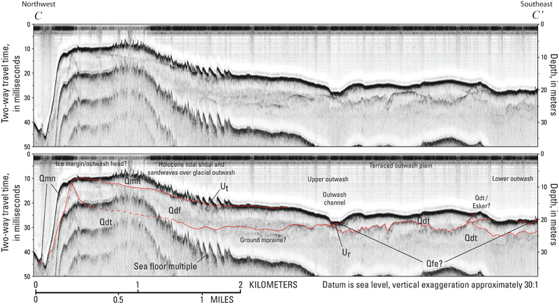
Figure 12. Chirp seismic-reflection profile C–C' with seismic stratigraphic interpretation. This profile illustrates the stratigraphy beneath northwestern Nantucket Sound in the vicinity of L'Hommedieu Shoal. See figure 9 for descriptions of stratigraphic units and major unconformities (indicated by red lines). Ice-contact material (Qdt) with a steep northern margin is covered by relatively thick, ice-proxal outwash (Qdf) that grades ice-distally and southward to terraced outwash plains (Qdf). Fluvial and estuarine fills (Qfe) are restricted to the topographic lows of outwash channels in the regressive unconformity Ur, and sandy Holocene sediments, reworked from the underlying drift, form relatively thick draping shoals and mobile sand waves (Qmn) across the ice-marginal core locally. See figures 14 and 21 for profile location. A constant sound velocity of 1,500 meters per second was used to convert two-way traveltime to depth, in meters.
|
