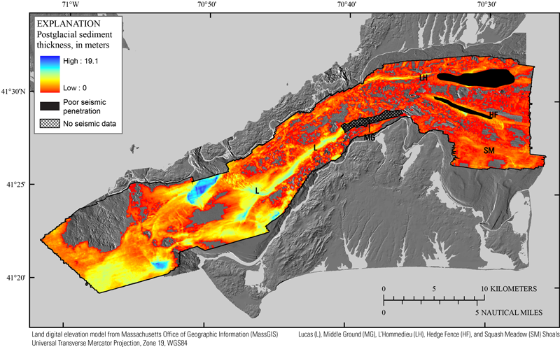
Figure 16. Map showing the thickness of postglacial fluvial and estuarine (Qfe) and Holocene nearshore and deepwater marine (Qmn and Qmd, respectively) sediments beneath Vineyard and western Nantucket Sounds. The bathymetric hillshade relief map is derived from the composite bathymetry in figure 3. The black polygon depicts the boundary of the seismic-survey area. The locations of Lucas (L), Middle Ground (MG), L’Hommedieu (LH), Hedge Fence (HF), and Squash Meadow (SM) Shoals are also indicated.
|
