Open-File Report 2017-1165
| Introduction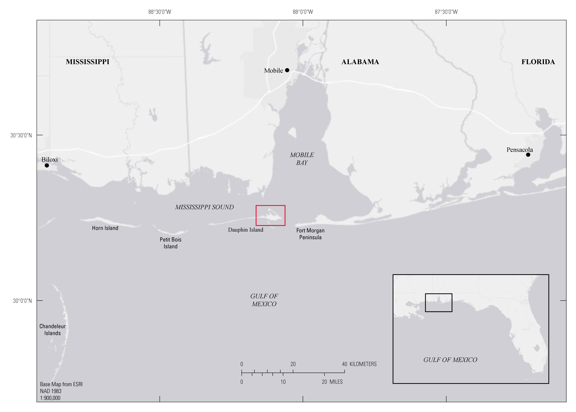 Figure 1. Regional map showing the location of Dauphin Island on Alabama's gulf coast. Study area is indicated by red box. [Click figure to enlarge.] Dauphin Island, Alabama, is a small, 16-square-kilometer (km2) barrier island that trends east-west in the northern Gulf of Mexico. It is situated between Alabama’s Gulf Highlands and Petit Bois Island, Mississippi; separates the Gulf of Mexico from Mississippi Sound; and defines the mouth of Mobile Bay with Fort Morgan Peninsula to the east (fig. 1). In addition to being a tourist attraction, the island is home to historic Fort Gaines, the United States Air Force early warning radar station, and the State’s marine education facilities. With over 200 acres of barrier island habitat—including beaches, dunes, washover fans, marshes, maritime forests, and freshwater ponds—the island is an important bird sanctuary for as many as 347 species, including solitary and colonial beach nesting birds, and trans-gulf migratory birds. Dauphin Island is also an important buffer for Alabama’s mainland coast by lessening the effects of storm events (for example, storm surge) on Alabama’s mainland shoreline. It also restricts water exchange from the gulf to help regulate the salinity in Mississippi Sound. The shelter and regulation provided by the island are critical for maintaining the health and sustainability of the oyster reefs, estuarine fisheries, shrimp, and seagrasses in Mississippi Sound, Mobile Bay, and the coastal marshes of Alabama (for example, Heron Bay Marshes). However, the island has been affected by the Deepwater Horizon oil spill in 2010 and recent extreme storm events, including Hurricanes Ivan and Katrina in 2004 and 2005, respectively, which collectively caused a major breach, commonly known as “Katrina Cut,” on the west side of the island. This study is part of a larger project between the National Fish and Wildlife Foundation (NFWF), the U.S. Geological Survey (USGS), and U.S. Army Corps of Engineers (USACE) to conduct a technical assessment of the island. A primary goal of this project is to identify trends in shoreline erosion and accretion to aid in the assessment of the feasibility and sustainability of proposed restoration efforts, which include restoring existing marsh-wetland areas and potentially expanding marsh environments east and west of Katrina Cut. The data presented in this publication correspond to task 3.2 of the Alabama Barrier Island Restoration Assessment. This information can provide a basis for assessing organic and inorganic sediment accumulation rates and temporal changes in accumulation rates over multiple decades along transects from different regions of the island. Assessing multiple marshes, which vary in elevation, vegetation type and coverage, land gradient, sediment type, shoreface direction, and exposure, is necessary as physical, biological, and chemical components all affect marsh health and its propensity to maintain, increase and (or) expand, or degrade. |

![]() U.S. Department of the Interior |
U.S. Geological Survey
U.S. Department of the Interior |
U.S. Geological Survey
URL: http://pubsdata.usgs.gov/pubs/of/2017/1165/ofr2017-1165_intro.html
Page Contact Information: GS Pubs Web Contact
Page Last Modified: Tuesday, 20-Mar-2018 14:17:54 EDT
