World Wildlife Fund Ecoregions — Index Maps
(Click on an index map to view the graphical display for that ecoregion.)
TROPICAL BROADLEAF FORESTS
Moist Forest
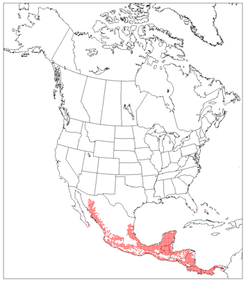
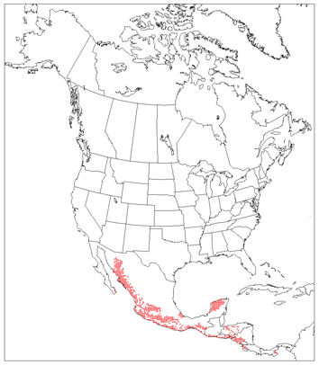
Central American Atlantic Moist Forest

Central American Montane Forest

Chiapas Montane Forest

Chimalapas Montane Forest
Costa Rican Seasonal Moist Forest

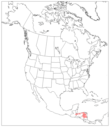
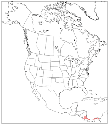
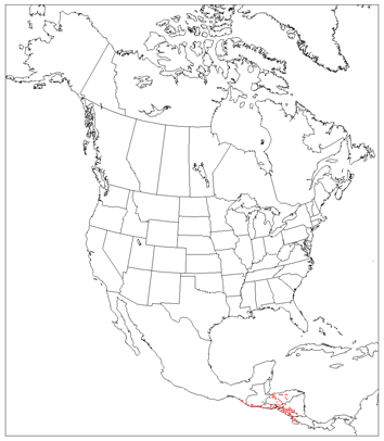
Eastern Panamanian Montane Forest
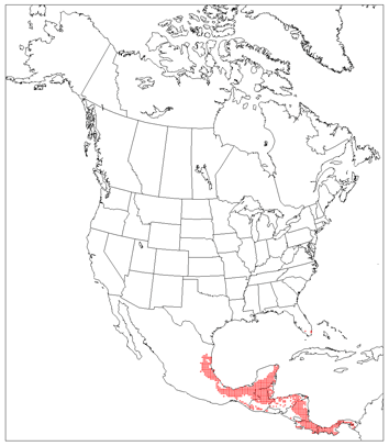
Isthmian-Atlantic Moist Forest

Isthmian-Pacific Moist Forest

Oaxacan Montane Forest
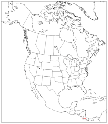
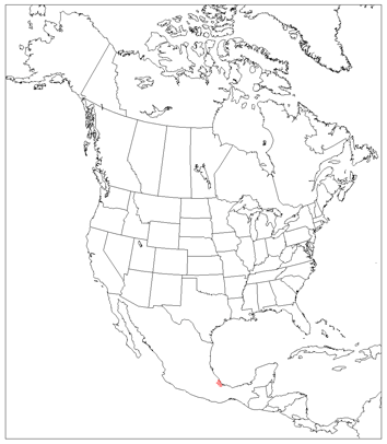
Pantanos de Centla

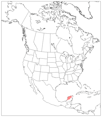
Peten-Veracruz Moist Forest

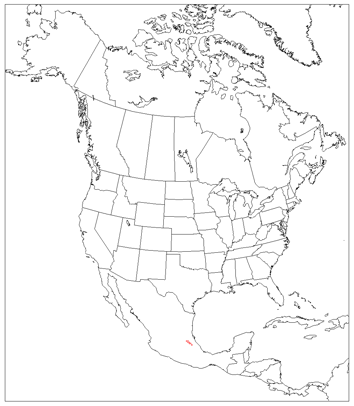
Sierra de los Tuxtlas
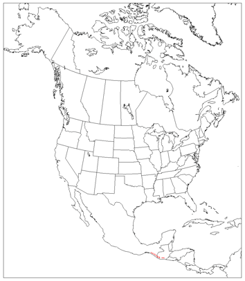
Sierra Madre de Chiapas Moist Forest
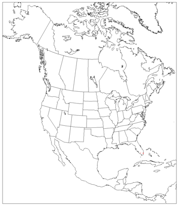
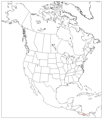
South Florida Rocklands
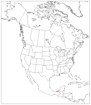
Talamancan Montane Forest
Veracruz Moist Forest
Veracruz Montane Forest
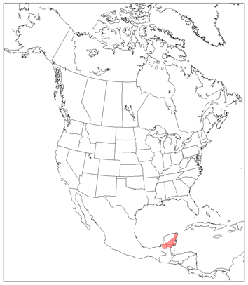
Yucatan Moist Forest
Dry Forest
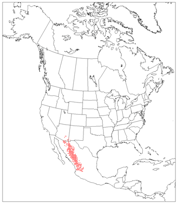
Sonoran/Sinaloan Transition Dry Forests
Bajio Dry Forest
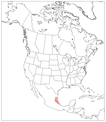
Balsas Dry Forest
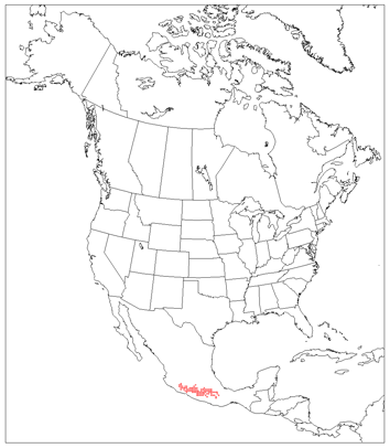
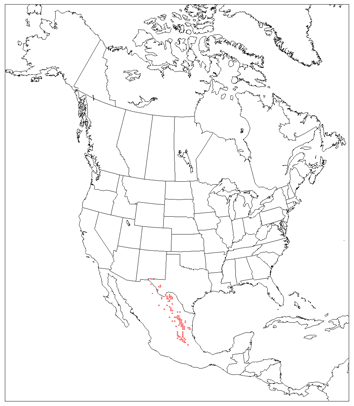
Central American Dry Forest

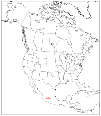
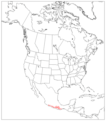
Chiapas Depression Dry Forest

Jalisco Dry Forest
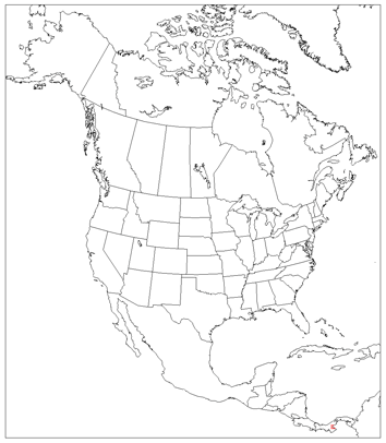
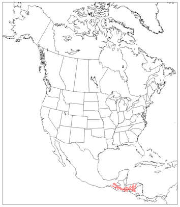
Panamanian Dry Forest

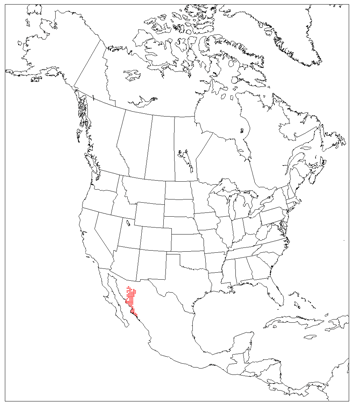
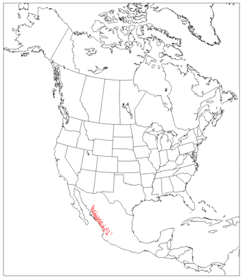
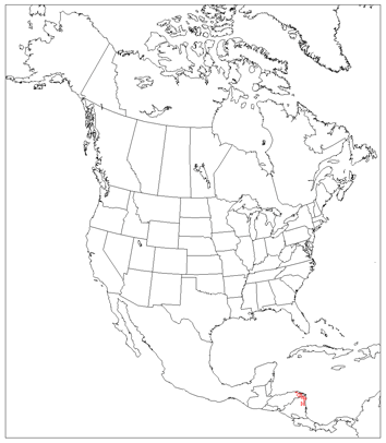
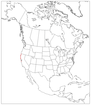
Sierra de la Laguna Dry Forest
Sinaloan Dry Forest
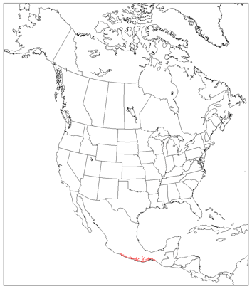
Southern Pacific Dry Forest
Veracruz Dry Forest
Yucatan Dry Forest
TEMPERATE CONIFER, BROADLEAF AND MIXED FORESTS
Broadleaf and Mixed Forests
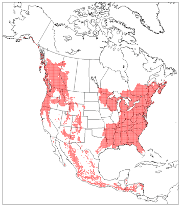
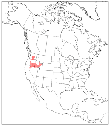
Sierra Madre Occidental Pine-Oak Forests
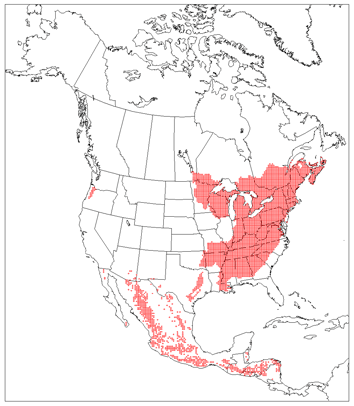
Sierra Madre Oriental Oak-Pine Forests

Sierra Juarez & San Pedro Martir Pine-Oak Forest

Belizian Pine Forest
Central American Pine-Oak Forest
Miskito Pine Forest

Sierra de la Laguna Pine-Oak Forest

Sierra Madre de Oaxaca Pine-Oak Forest
Sierra Madre del Sur Pine-Oak Forest
Trans-Mexican Volcanic Belt Pine-Oak Forest
Willamette Valley Forest
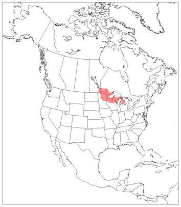
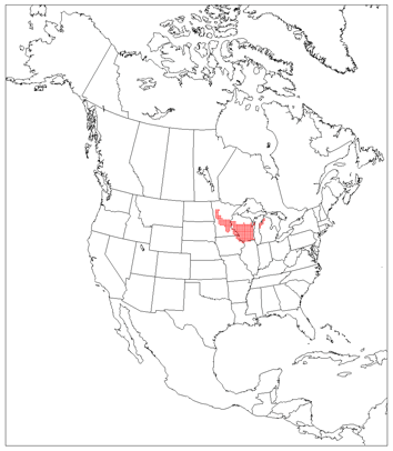
Western Great Lakes Forest
Eastern Forest/Boreal Transition
Upper Midwest Forest/Savanna Transition Zone
Southern Great Lakes Forest
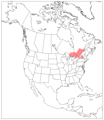
Eastern Great Lakes Lowland Forest
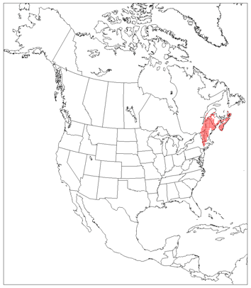
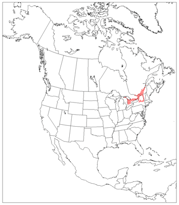
New England/Acadian Forest
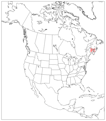
Gulf of St. Lawrence Lowland Forest
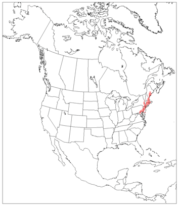
Northeastern Coastal Forest
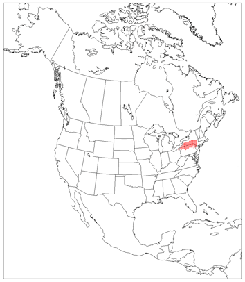
Allegheny Highlands Forest
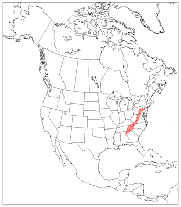
Appalachian/Blue Ridge Forest
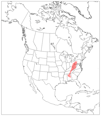
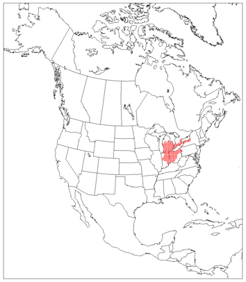
Appalachian Mixed Mesophytic Forest
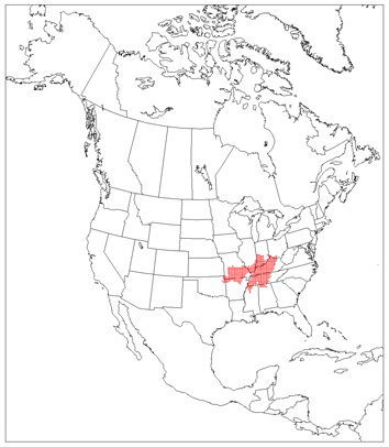
Central U.S. Hardwood Forest

Ozark Mountain Forest
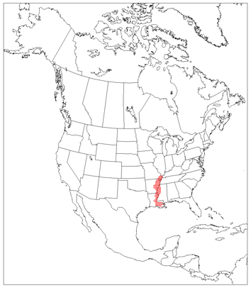
Mississippi Lowland Forest
East Central Texas Forest
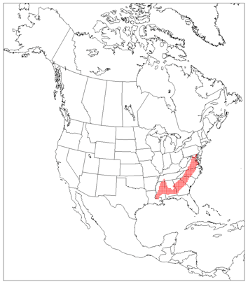
Southeastern Mixed Forest
Coniferous Forests
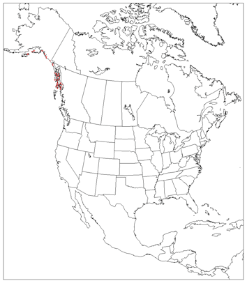
Northern Pacific Coastal Forest
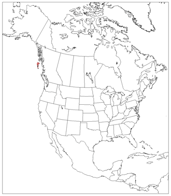
Queen Charlotte Islands

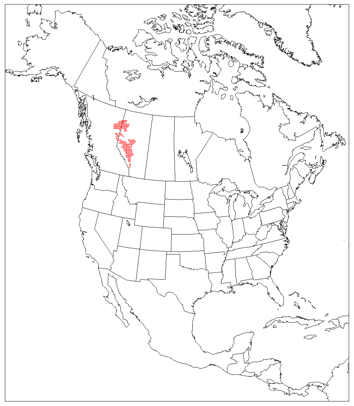
Central British Columbia Mountain Forest

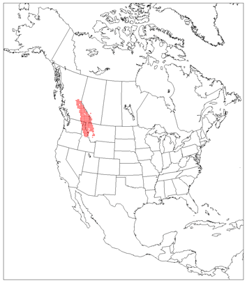
Alberta Mountain Forest

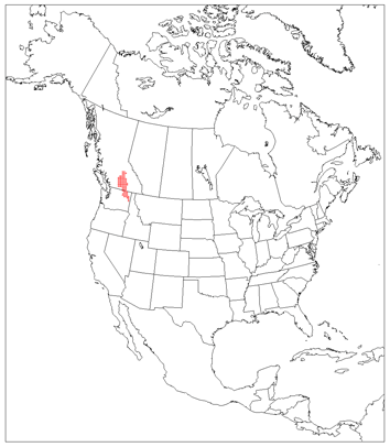
Fraser Plateau and Basin Complex
Alberta/British Columbia Foothills Forest

Northern Transitional Alpine Forest
North Central Rockies Forest
Okanogan Dry Forest

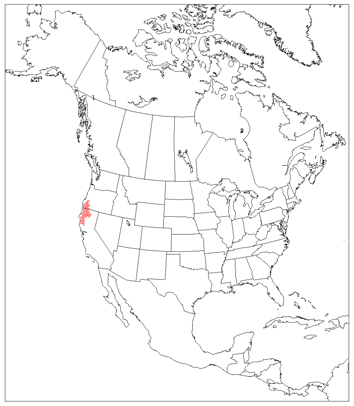
Cascade Mountains Leeward Forest

British Columbia Mainland Coastal Forest
Central Pacific Coastal Forest

Puget Lowland Forest

Central and Southern Cascades Forest
Eastern Cascades Forest
Blue Mountains Forest
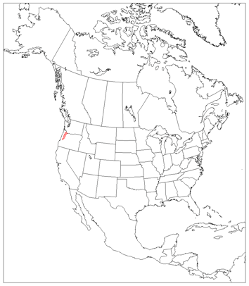
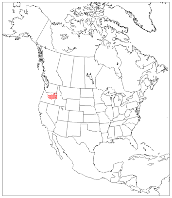
Klamath-Siskiyou Forest
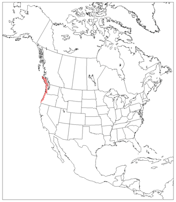
Northern California Coastal Forest

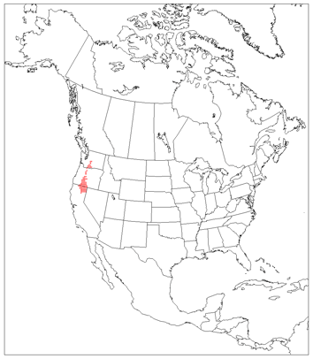
Sierra Nevada Forest
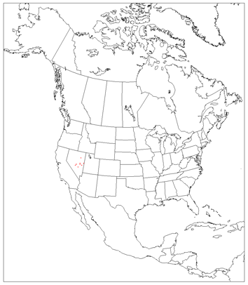
Great Basin Montane Forest

South Central Rockies Forest
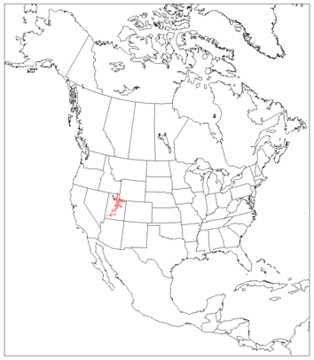
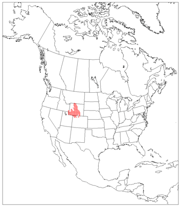
Wasatch and Uinta Montane Forest
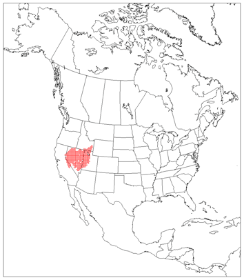
Colorado Rockies Forest
Arizona Mountains Forest

Piney Woods Forest
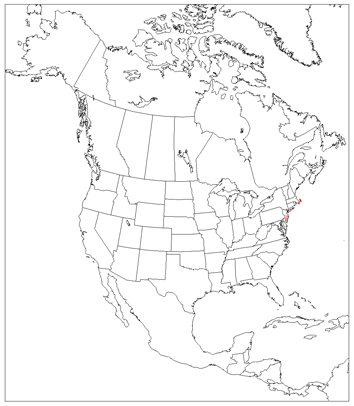
Atlantic Coastal Pine Barrens
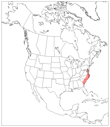
Middle Atlantic Coastal Forest
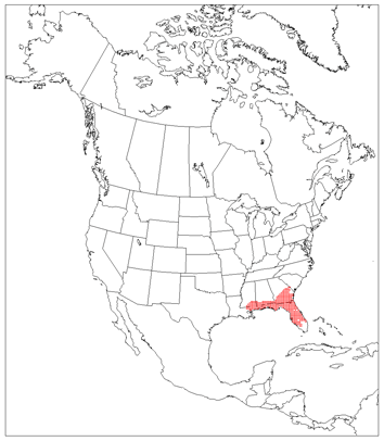
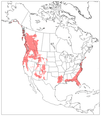
Southeastern Conifer Forest
Florida Sand Pine Scrub

GRASSLANDS, SAVANNAS, SHRUBLANDS
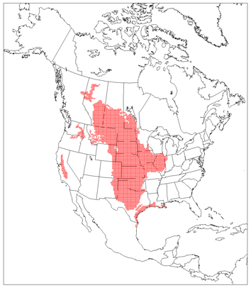
Grasslands/Savanna/Shrub
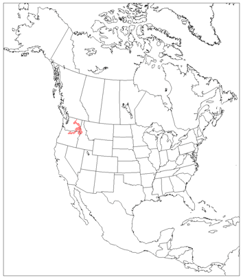
Palouse Grassland

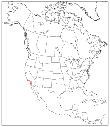
California Central Valley Grassland
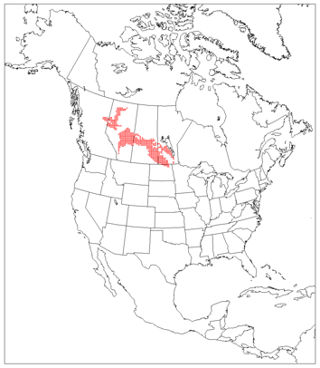
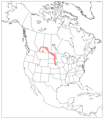
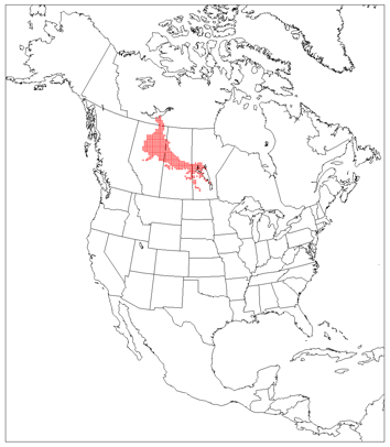
Canadian Aspen Forest and Parkland
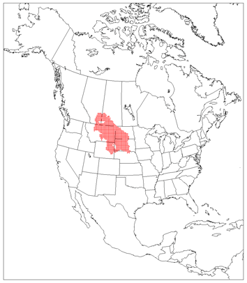
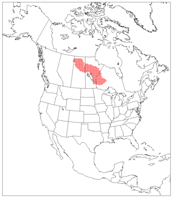
Northern Mixed Grassland
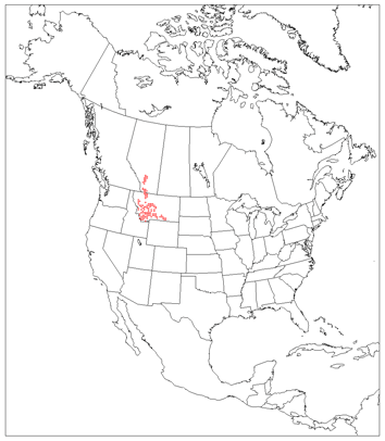
Montana Valley and Foothill Grassland
Northwestern Mixed Grasslands
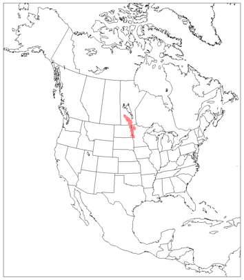
Northern Tall Grassland
Central Tall Grassland

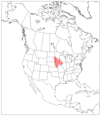
Flint Hills Tall Grassland
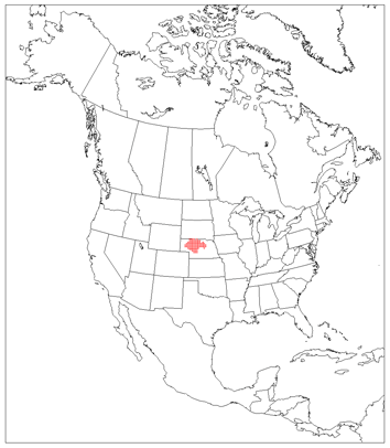
Nebraska Sand Hills Mixed Grassland
Western Short Grassland

Central and Southern Mixed Grassland
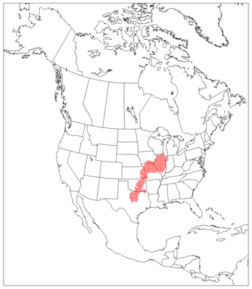
Central Forest/Grassland Transition Zone

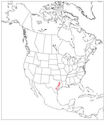
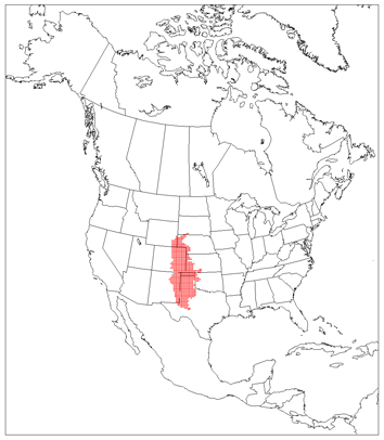
Edwards Plateau Savanna
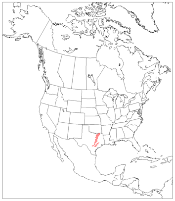
Texas Blackland Prairies
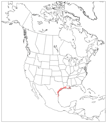
Western Gulf Coastal Grassland

Flooded Grasslands
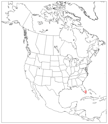
Everglades

Montane Grasslands
Zacatonal
MEDITERRANEAN AND XERIC FORMATIONS
Mediterranean Scrub and Savanna
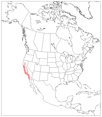
California Coastal Sage and Chaparral
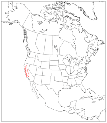
California Interior Chaparral and Woodland

California Montane Chaparral and Woodland
Xeric Shrublands/Scrublands/Deserts
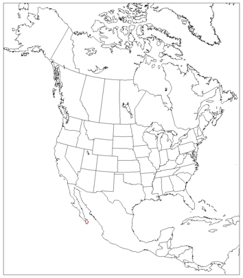
San Lucan Xeric Scrub
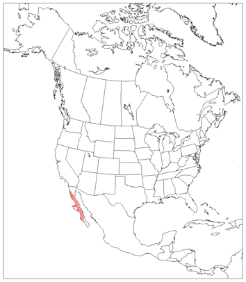
Baja California Desert
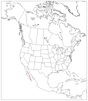
Gulf of California Xeric Scrub
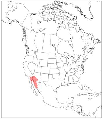
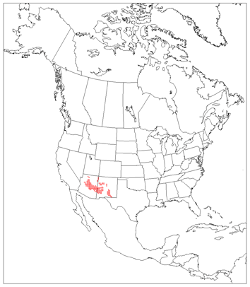
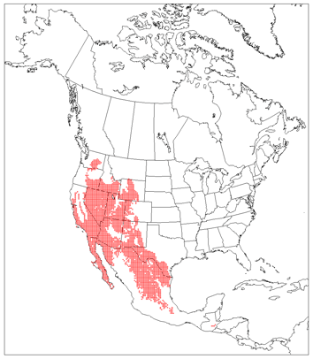
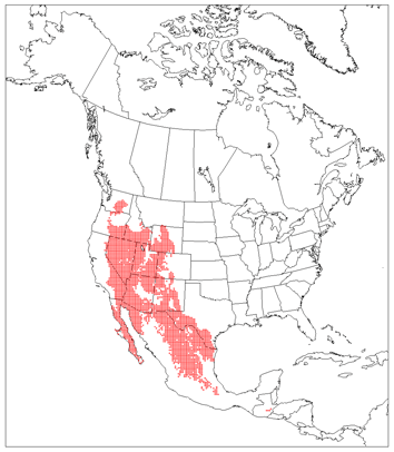
Sonoran Desert
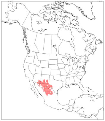
Chihuahuan Desert

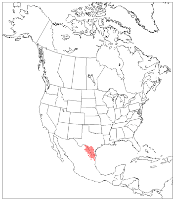
Meseta Central Matorral
Tamaulipan Matorral
Tamaulipan Mezquital
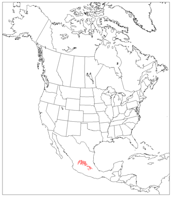
Central Mexican Matorral

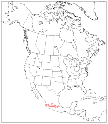
Tehuacan Valley Matorral
Snake/Columbia Shrub Steppe
Great Basin Shrub Steppe
Wyoming Basin Shrub Steppe
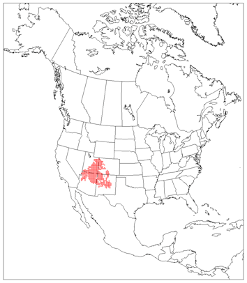
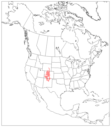
Colorado Plateau Shrubland

Mojave Desert
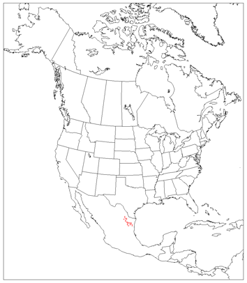
Motagua Valley Thornscrub

MANGROVES

Mangroves

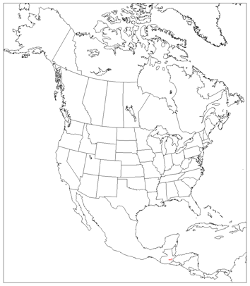
Mangroves
BOREAL FOREST, TAIGA AND TUNDRA
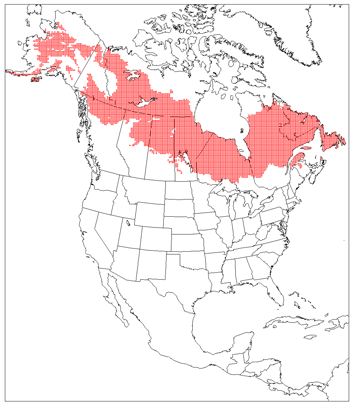
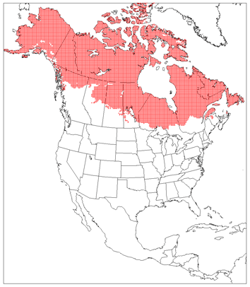
Boreal Forest/Taiga
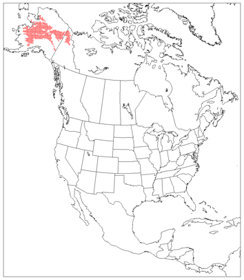
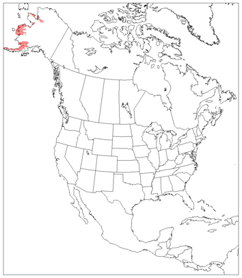
Interior Alaska/Yukon Lowland Taiga
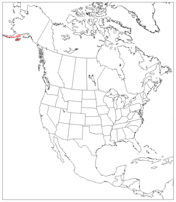
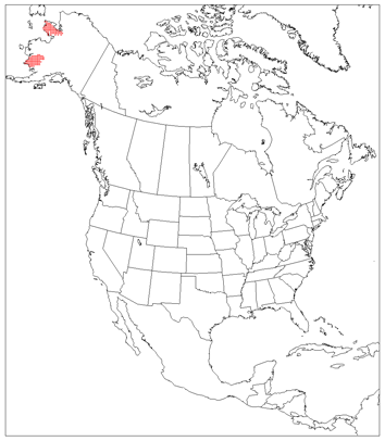
Alaska Peninsula Montane Taiga
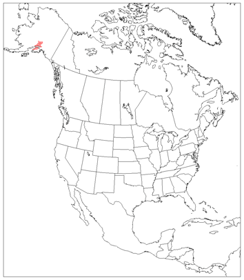
Cook Inlet Taiga

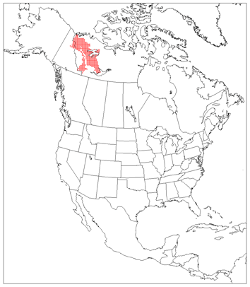
Copper Plateau Taiga
Northwest Territories Taiga
Yukon Interior Dry Forest
Northern Cordillera Forest
Muskwa/Slave Lake Forest
Northern Canadian Shield Taiga
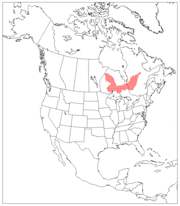
Mid-Continental Canadian Forest
Midwestern Canadian Shield Forest
Central Canadian Shield Forest
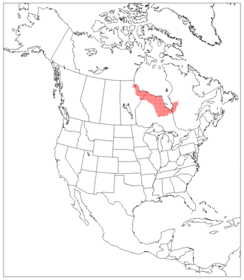
Southern Hudson Bay Taiga
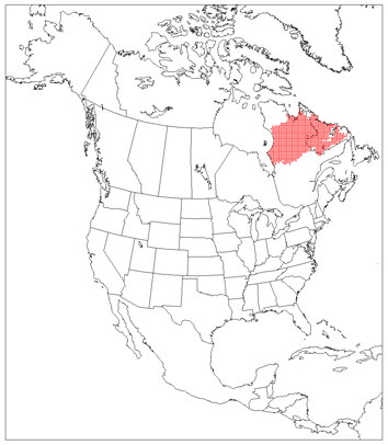
Eastern Canadian Shield Taiga
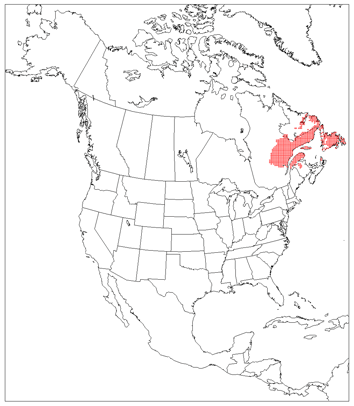
Eastern Canadian Forest
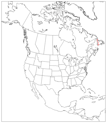
Newfoundland Highland Forest

South Avalon-Burin Oceanic Barrens
Tundra
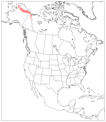
Beringia Lowland Tundra
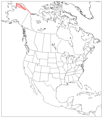
Beringia Upland Tundra
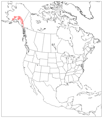
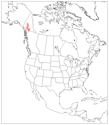
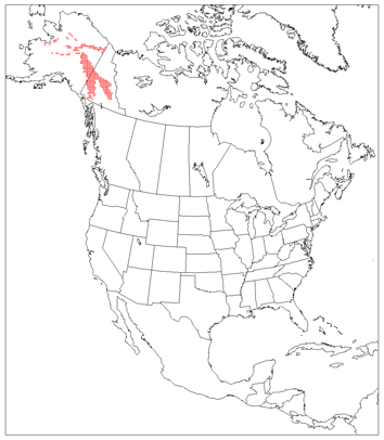
Alaska/St. Elias Range Tundra
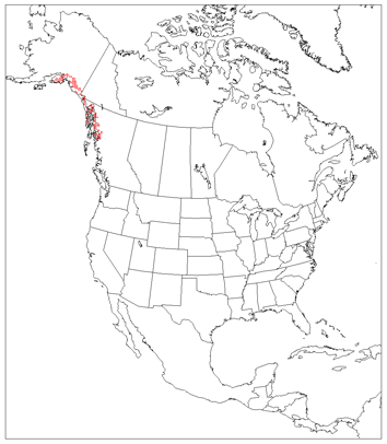
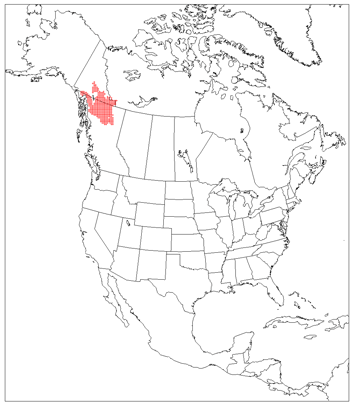
Pacific Coastal Mountain Tundra and Ice Fields
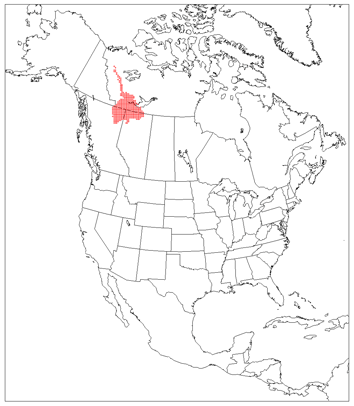
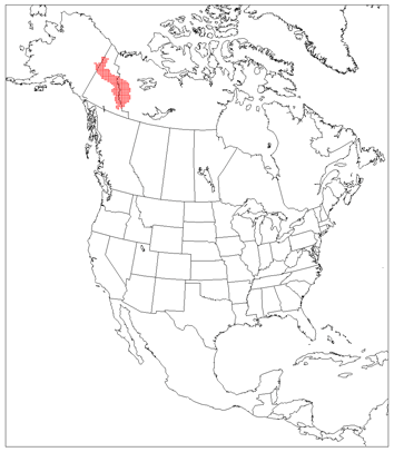
Interior Yukon/Alaska Alpine Tundra
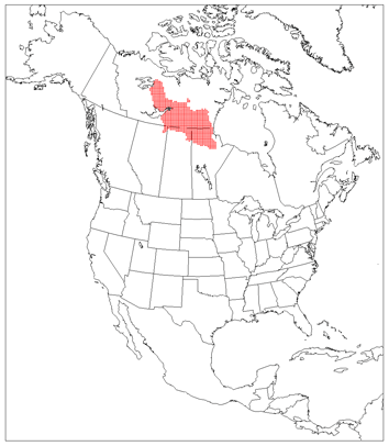
Ogilvie/MacKenzie Alpine Tundra
Brooks/British Range Tundra
Arctic Foothills Tundra
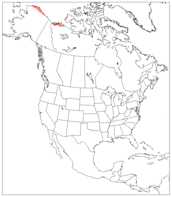
Arctic Coastal Tundra
Low Arctic Tundra
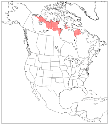
Middle Arctic Tundra
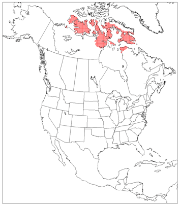
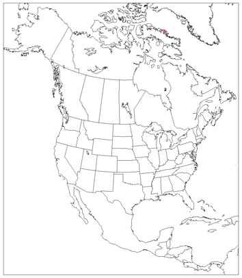
High Arctic Tundra
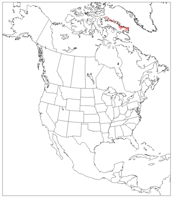
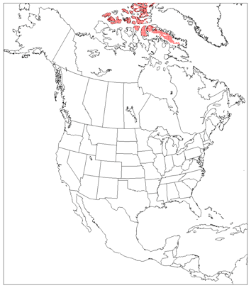
Davis Highlands Tundra
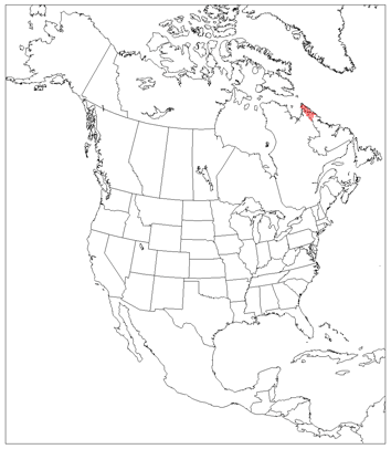
Baffin Coastal Tundra
Torngat Mountain Tundra

