Table of contents | Glossary | Geology | Depositional model | Heterogeneity | Diagenetic history | Petroleum geology | 1) East-West porosity slices | 2) North-South porosity slices | 3) Onion views of 3-D images | Horizontal slices of porosity | 5) Horizontal and East-West permeability and porosity slices
GIF files are stored in the hslice (horizontal slice) directory and can be displayed as slides using an external viewer, such as JPEGView or LView. GIF files are named and numbered such that external viewers can correctly sequence files in the folders.
Images are animated by the hporosf.MOV stand-alone movie located in the movies folder. Movies are called up much quicker directly from the folder than from the following text hook, although the animation speed of 1 frame/second is analogous. Technical information on the movies, data sources, and research methodology is located in techinfo.htm.
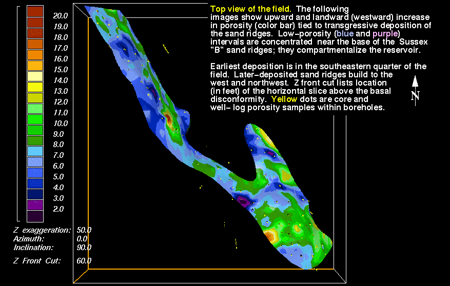
Top view of field area; north is top of map. Access the movie by clicking Plan-view distribution of porosity (hporosf.MOV). Before the movies can be opened you may need to copy to your hard drive a movie-viewing program; information on how to acquire this freeware and software is listed in the readme for movies file. Due to differences in processing speeds we recommend accessing the stand-alone movie from the movies folder.
1) 60 ft - hslic10a.gif - The upper disconformity surface of the Sussex "B" sandstone
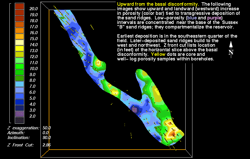
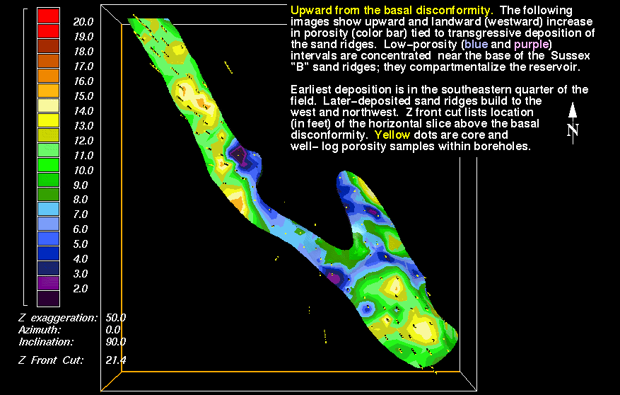
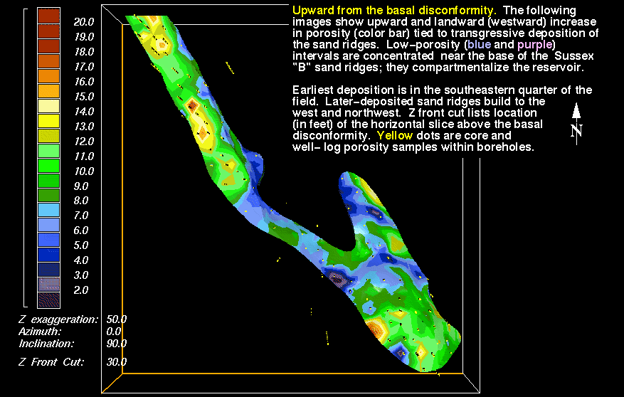
2) Basal view of field - hslic10k.gif - Porosity distribution on the basal disconformity surface (basal sand ridges 1 and 3) of the Sussex "B" sandstone
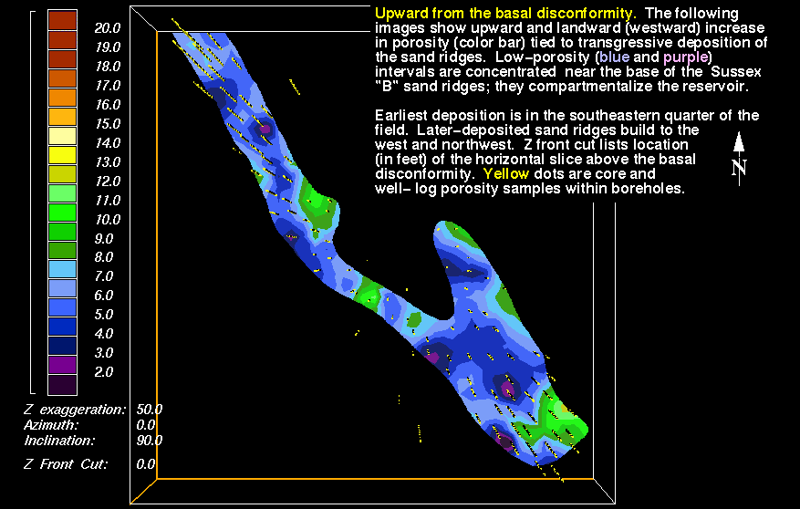
3) 1.4 ft above disconformity - hslic10l.gif Patches of reservoir-grade (green through red) porosity are present, mainly along seaward (eastern and southeastern) margins of sand ridges
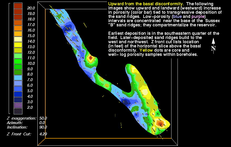
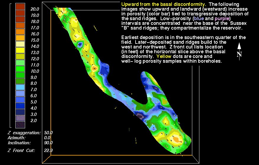
4) 2.9 ft - hslic10m.gif - Patches begin to coalesce
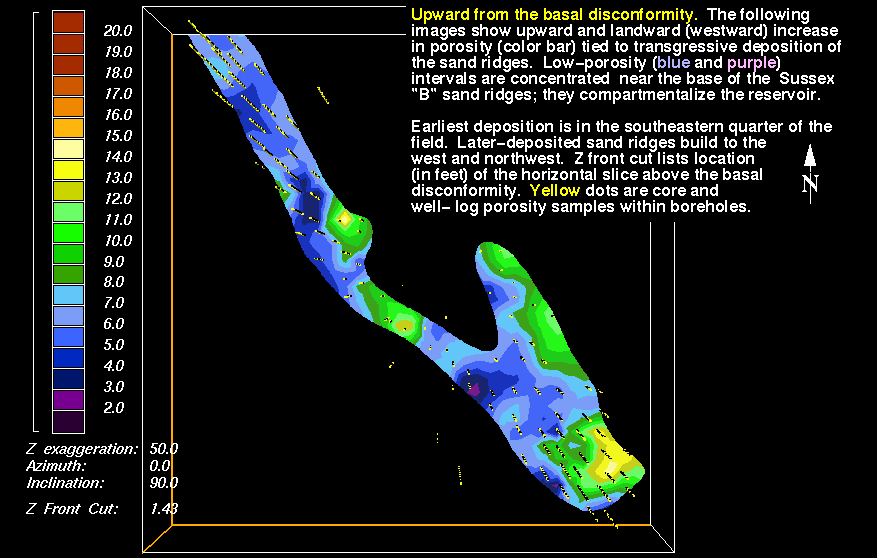
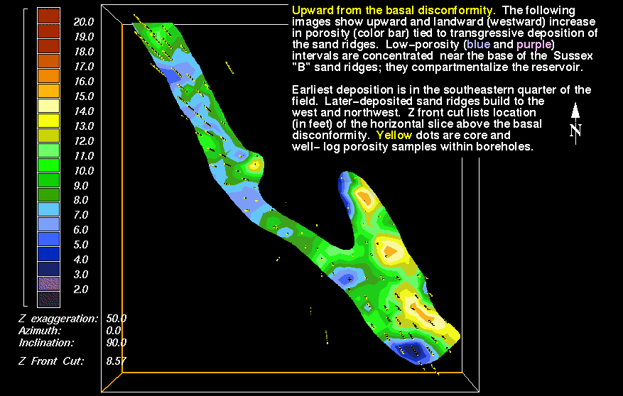
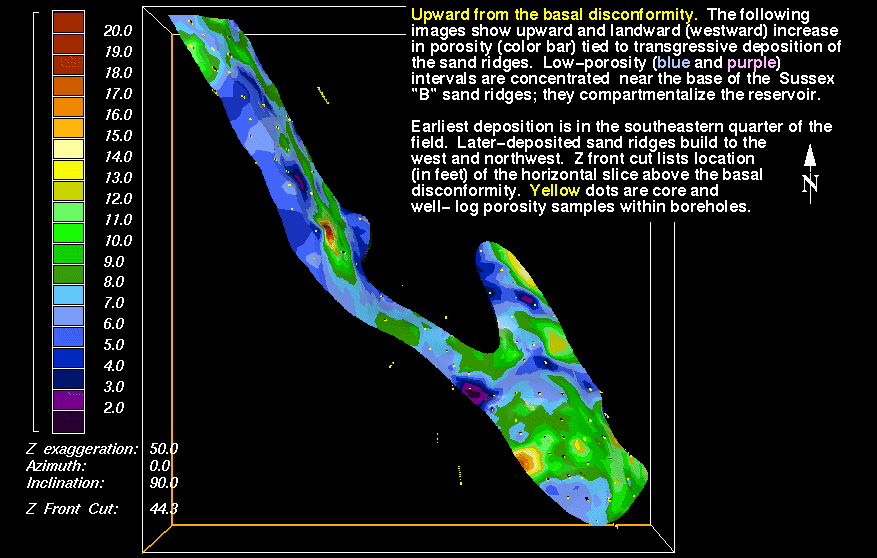
5) 4.3 ft - hslic10n.gif - Region of reservoir-grade porosity increases in area, although it is still concentrated along the seaward margin of the earliest-deposited sand ridge (number 1), located in the southeastern half of the field.
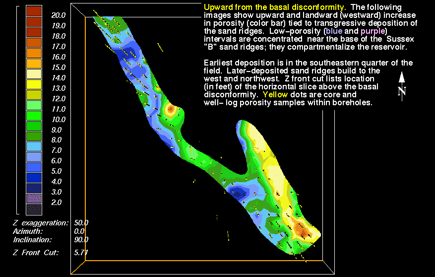
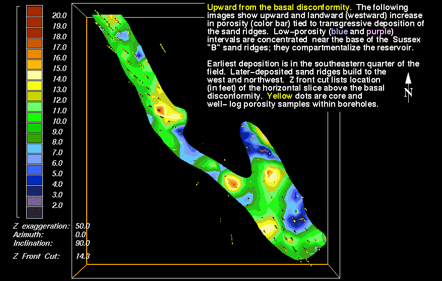
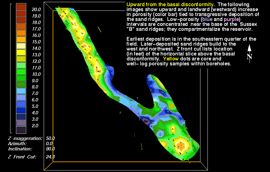
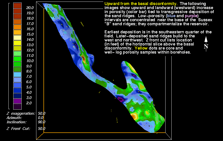
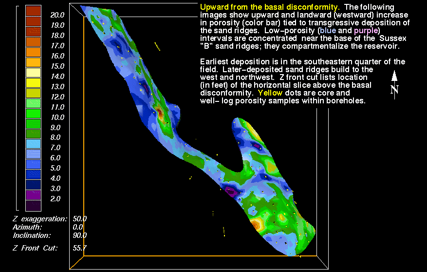
6) 5.7 ft - hslic10o.gif - Areas of reservoir-grade porosity (8 percent and greater) transgress to the southwest, parallel to field and sand-ridge boundaries.
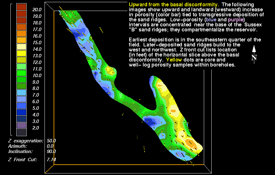
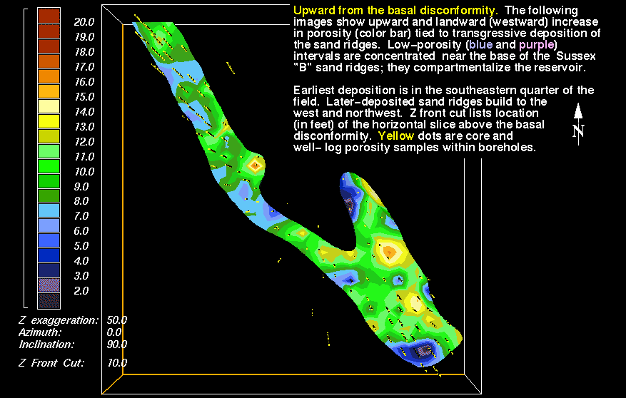
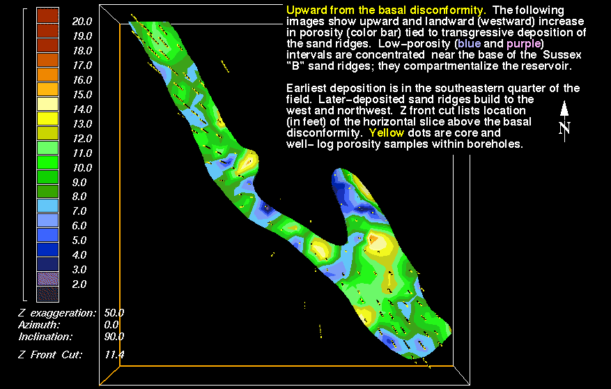
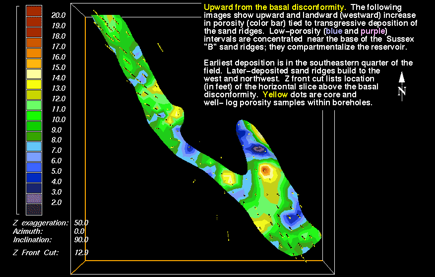
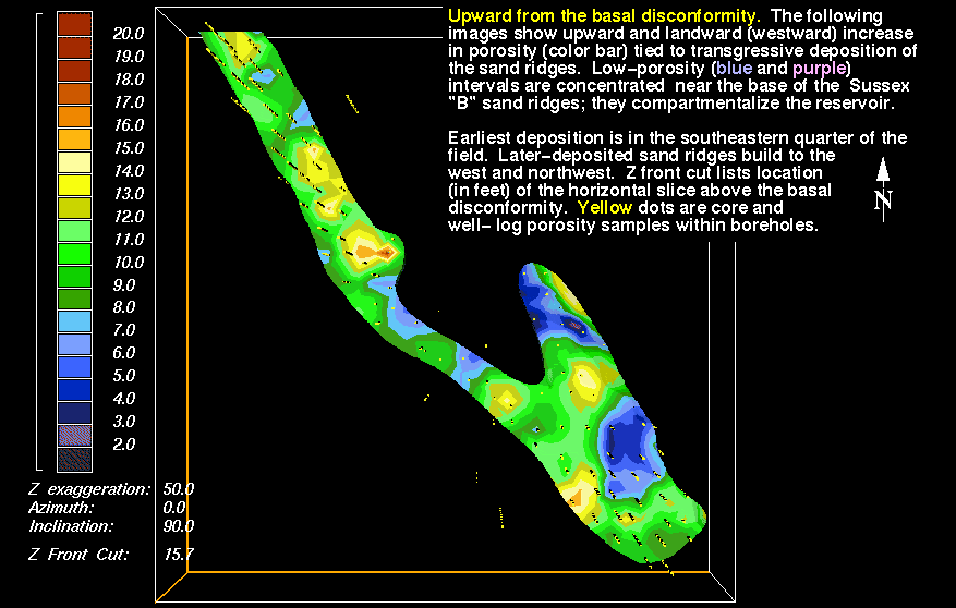
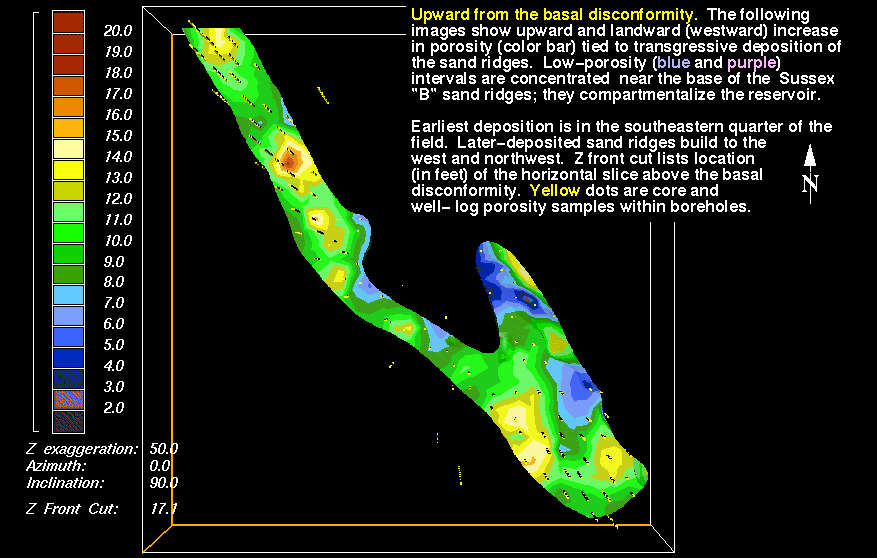
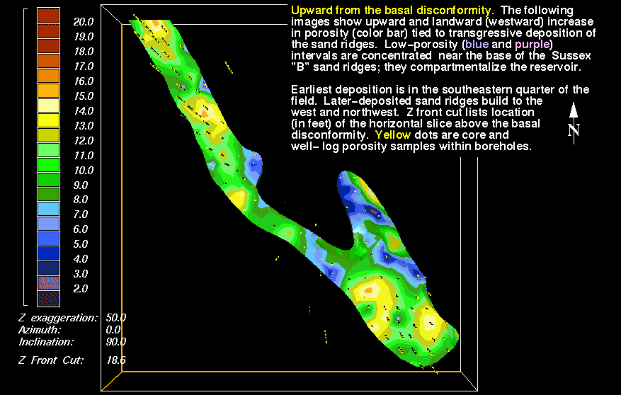
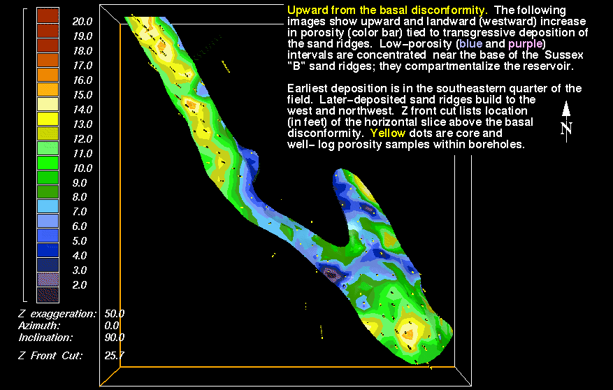
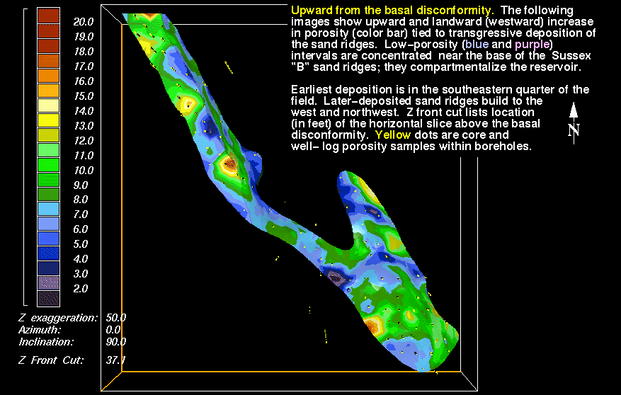
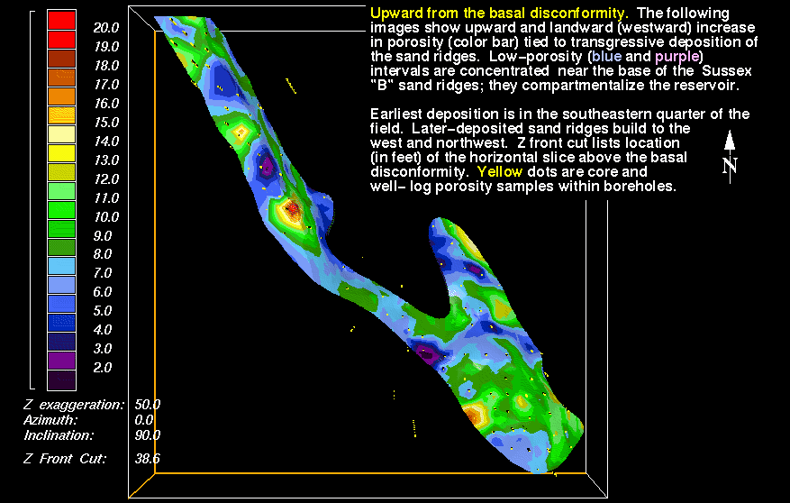
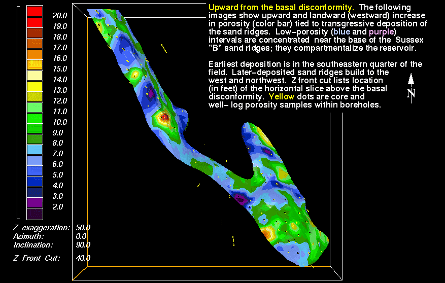
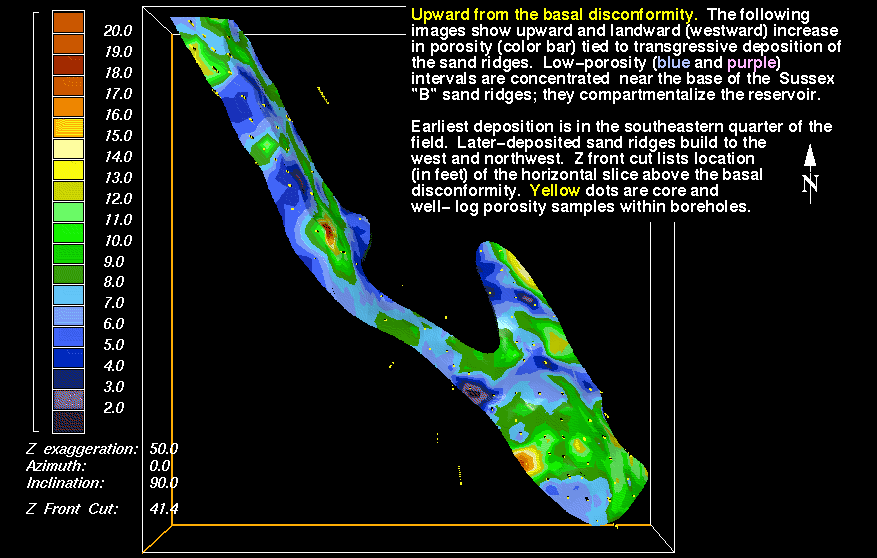
7) 7.1 ft - hslic10p.gif - This and the following images show areal distribution of porosity at each Z-axis increment. Included are 1) the continued transgressive deposition of sand ridges, as shown by porosity distribution, 2) limited distribution of high porosity intervals (12 percent and greater), and 3) compartmentalization of sand ridges resulting from deposition of low-porosity intervals of overlying sand ridges.
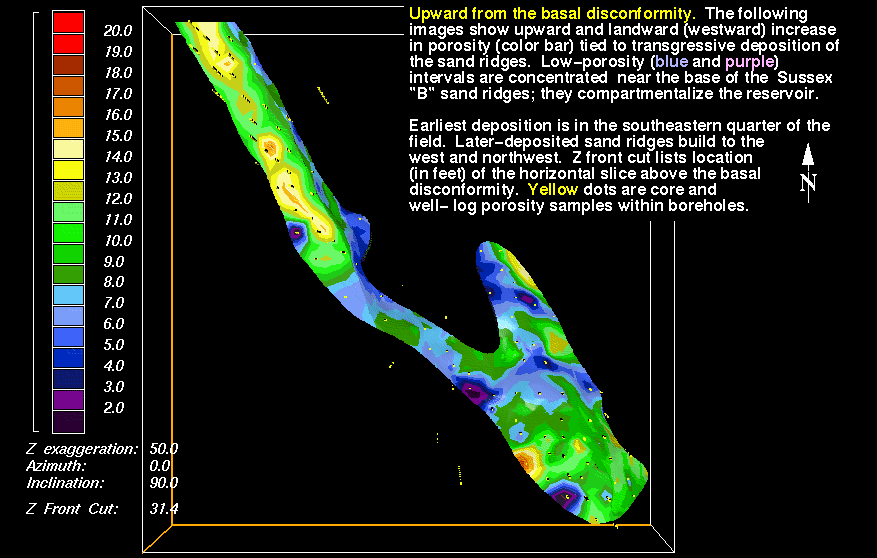
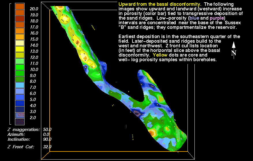
25) 32.9 ft - hslic18.gif - This marks the upper surface of sand ridges 1 and 2, in the southeastern half of the field area.
30) 40.0 ft - hslic23.gif - This marks the approximate upper limit of reservoir-grade sandstones of the uppermost sand ridge.
32) 42.9 ft - hslic25.gif - The small area of reservoir-grade porosity in the northwestern tip of the field area may represent the eastern border of a new sand ridge, based also on examination and mapping of geophysical borehole logs. Thickness and areal distribution of this sandstone bed are not documented due to limited drilling west of the field.