Table of contents | Glossary | Geology | Depositional model | Heterogeneity | Diagenetic history | Petroleum geology | 1) East-West porosity slices | 2) North-South porosity slices | 3) Onion views of 3-D images | 4) Horizontal slices of porosity | Horizontal and East-West permeability and porosity slices |
The two sets of image files included in this section are named:
The following two sets of GIF file lists are stored in the 3dvk (3-D vertical slices of permeability) and hporper (horizontal slices of porosity and permeability) directories. GIF files are named and numbered such that external viewers can correctly sequence files in the folders. Images can be displayed as slide shows using an external viewer, such as JPEGView or LView, or can be accessed as movies; links follow the below figures.
Before the movies can be opened, you may need to copy to your hard drive a movie-viewing program; information on how to acquire this freeware and software is listed in the readme for movies file. Due to differences in processing speeds we recommend accessing the stand-alone movie from the movies folder.
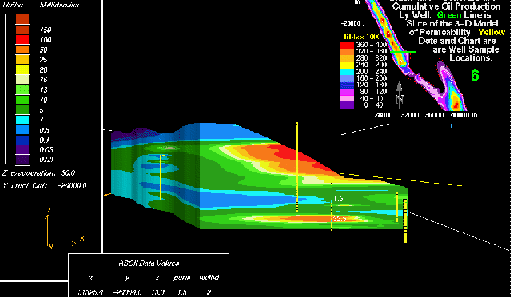
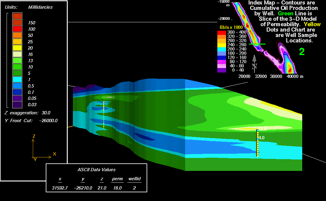
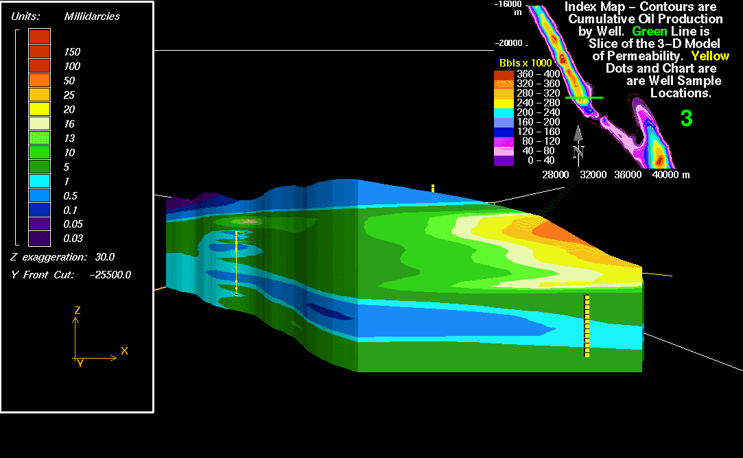
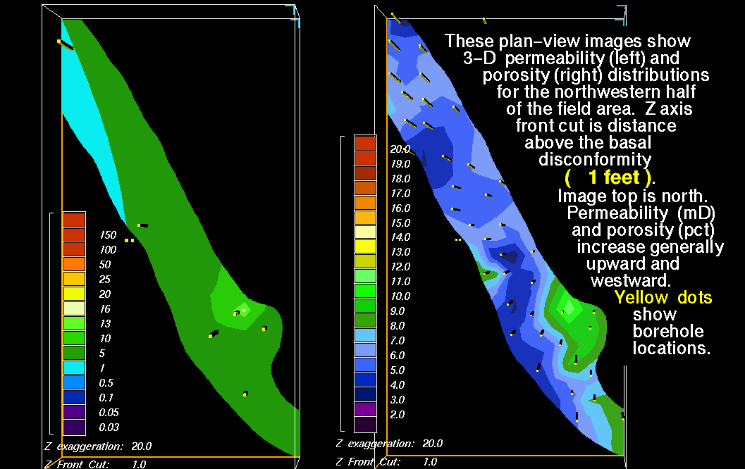
3-D permeability images are "smoother" than the 3-D porosity models due to fewer data points; core permeability and porosity data from 10 boreholes are augmented by well-log porosity data from an additional 110 boreholes.
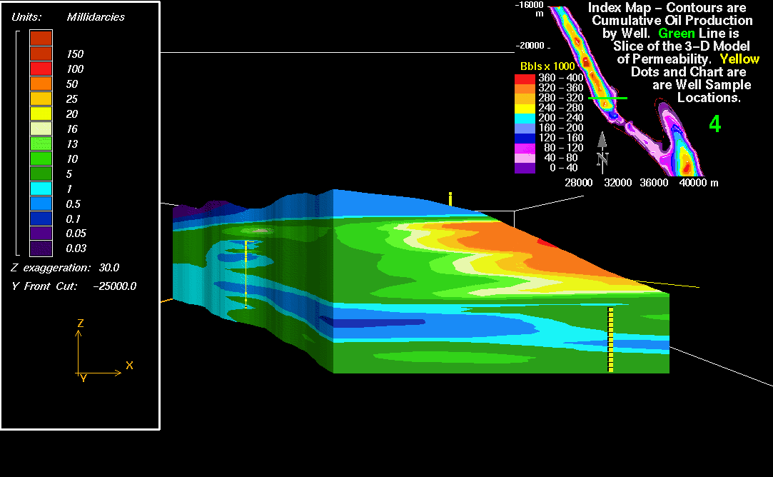
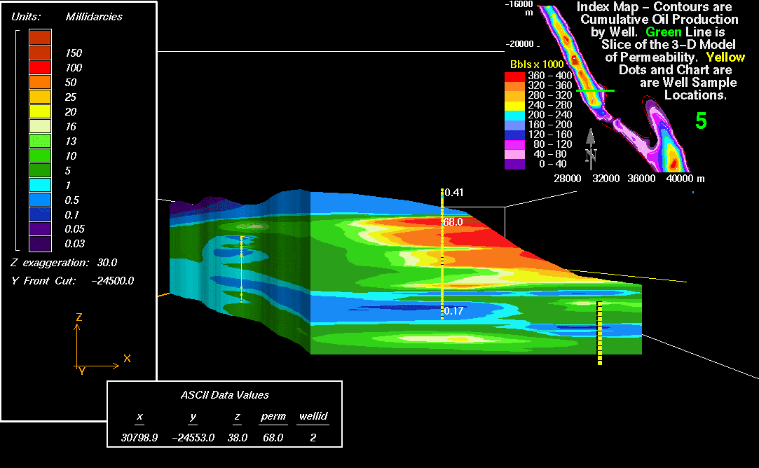
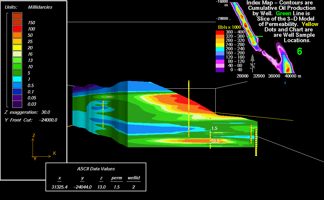
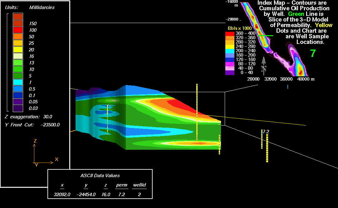
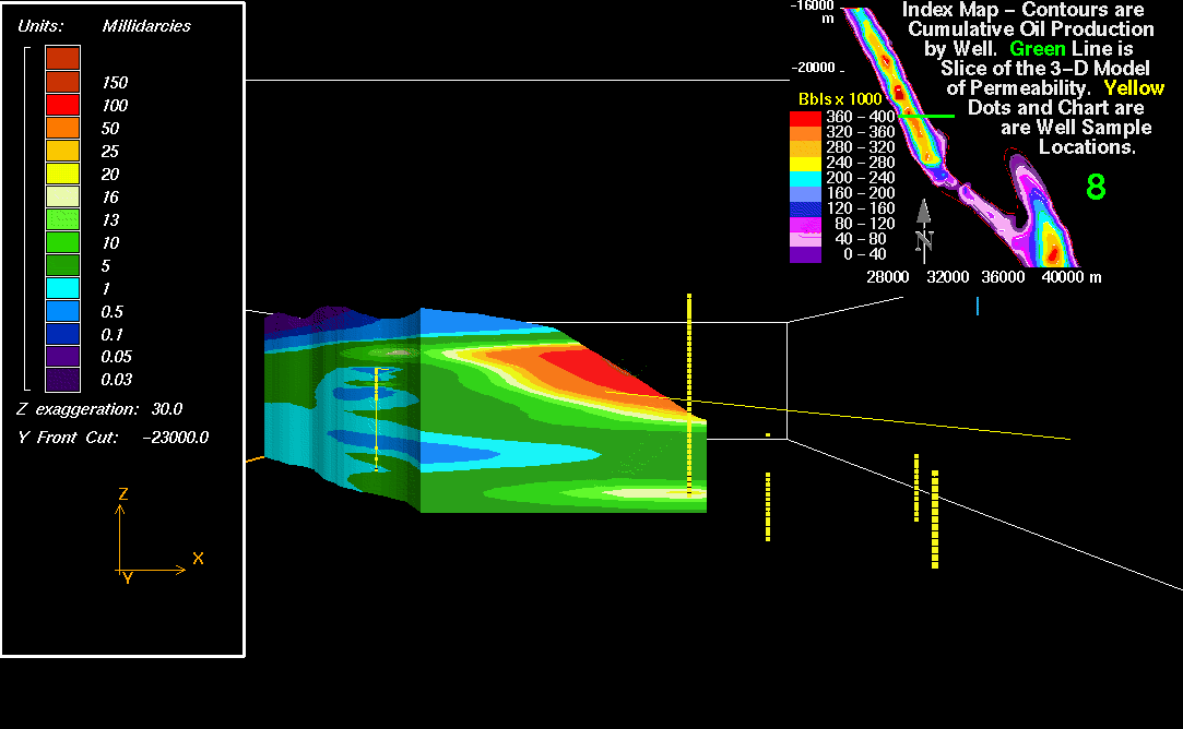
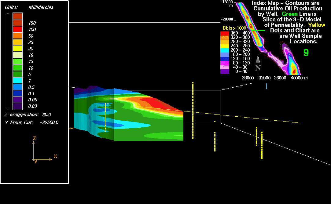
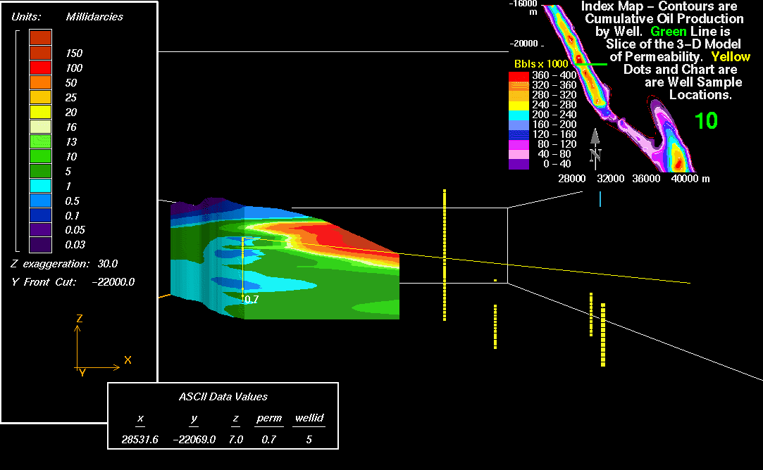
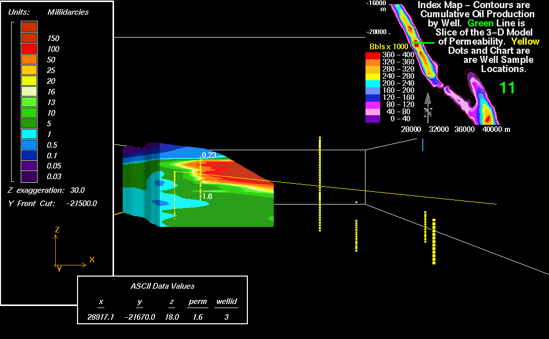
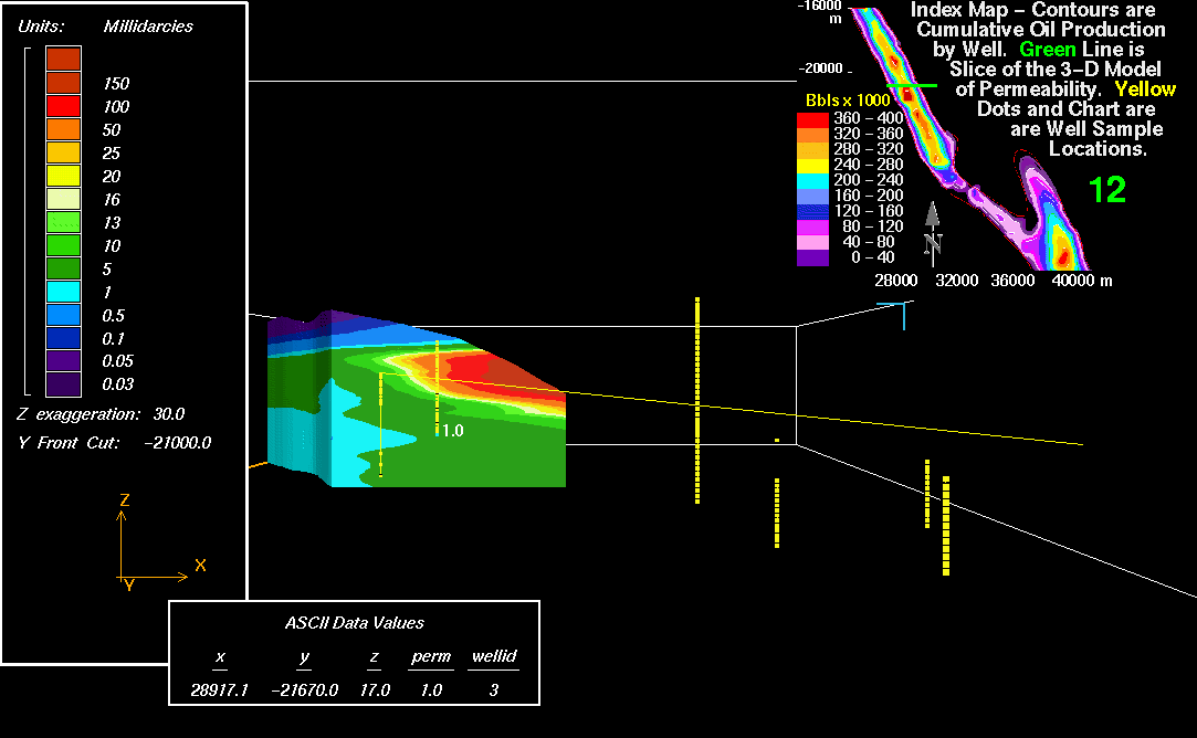
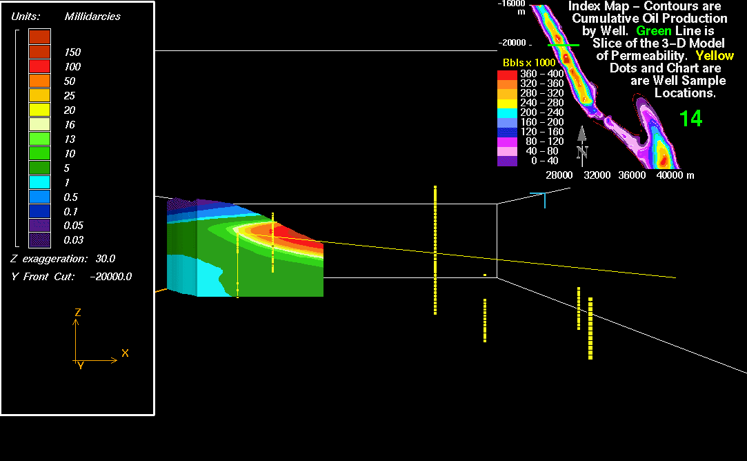
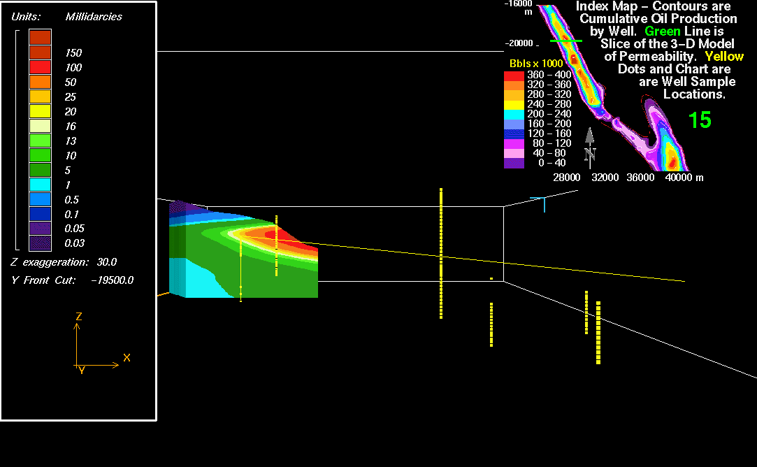
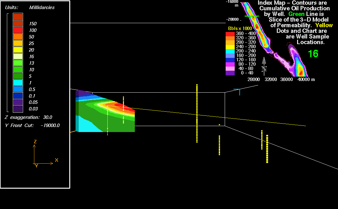
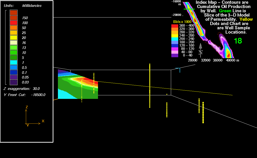
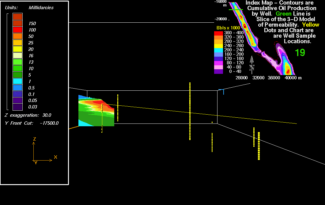
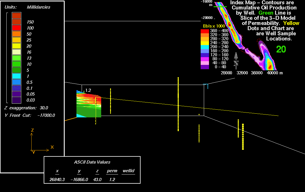
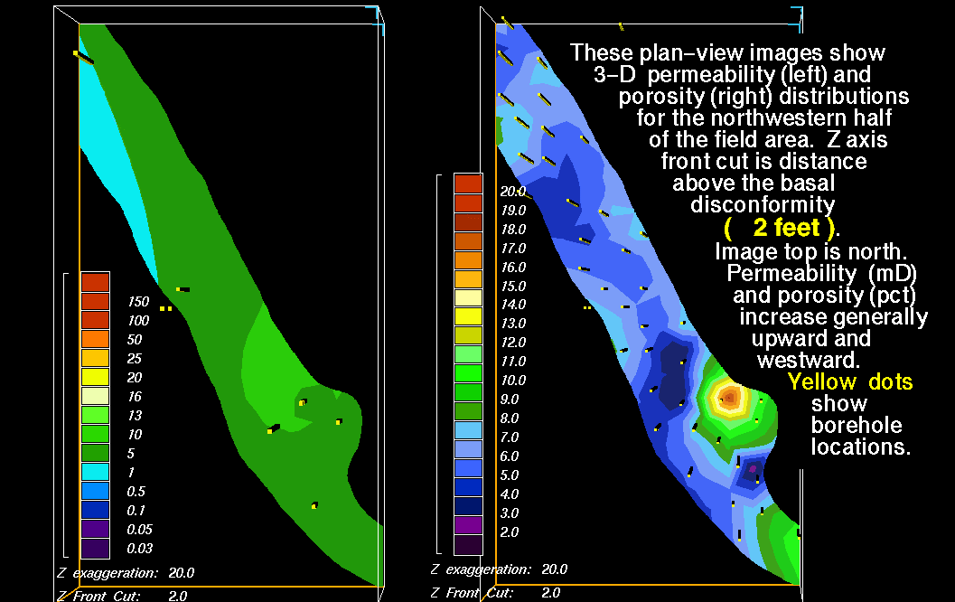
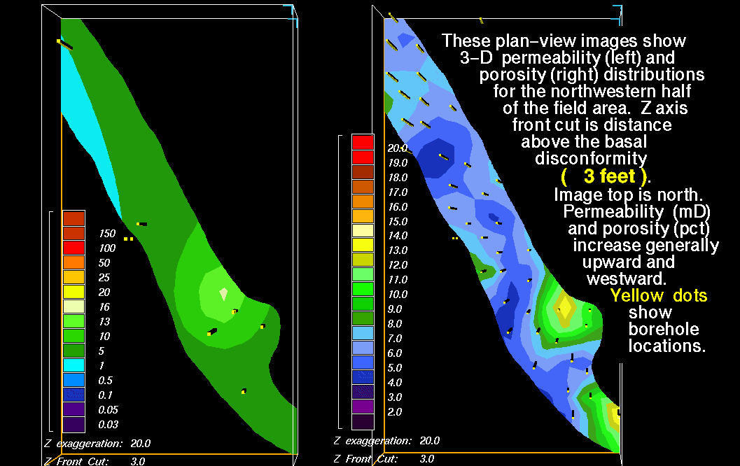
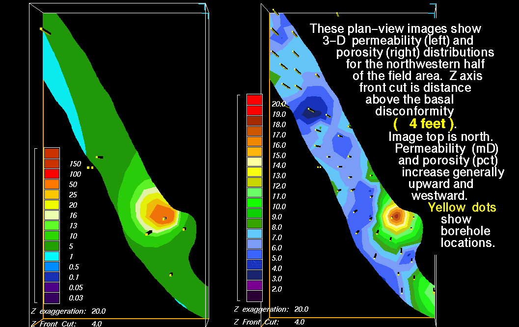
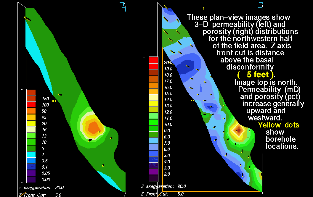
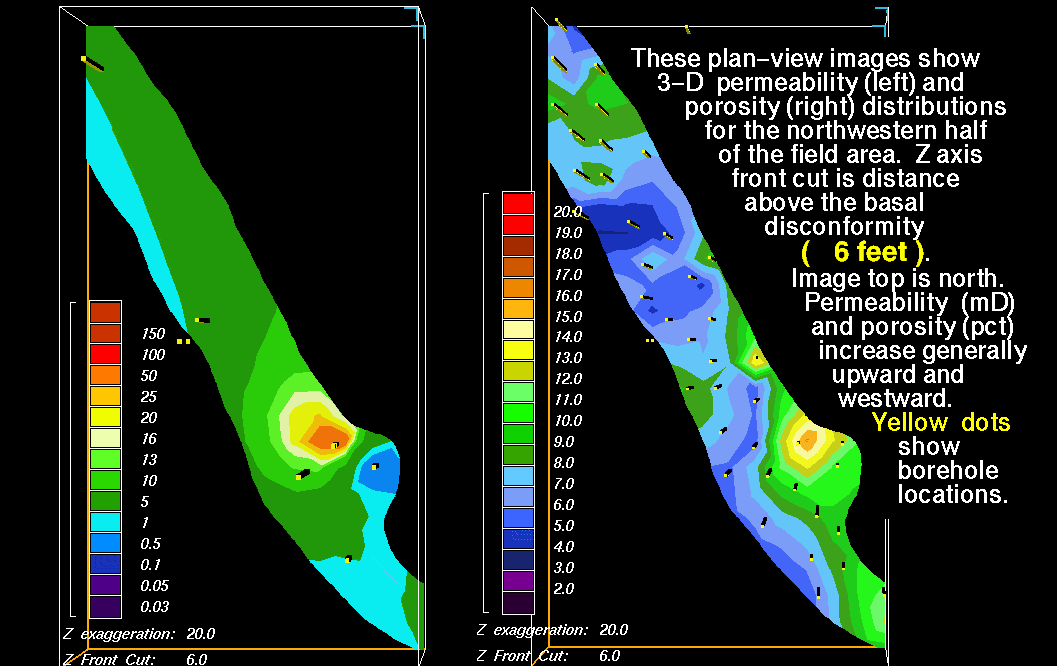
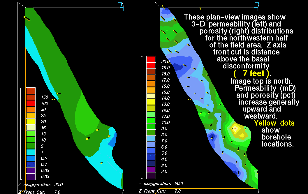
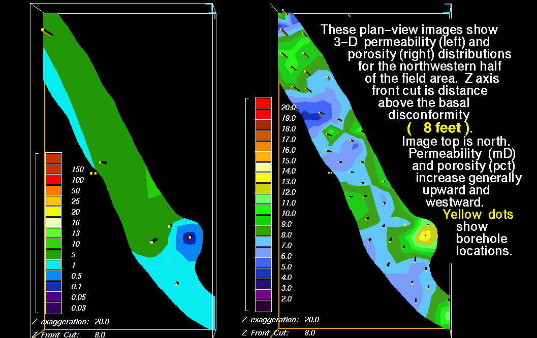
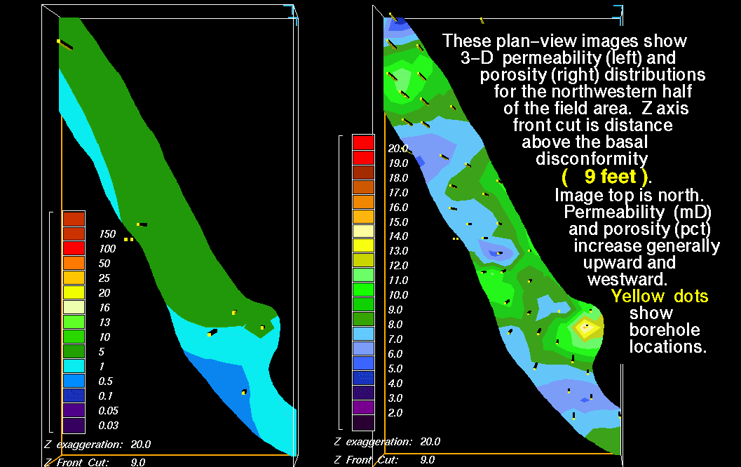
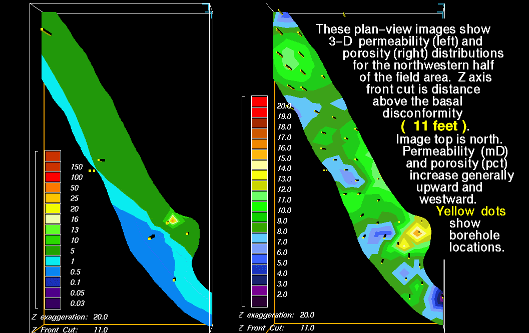
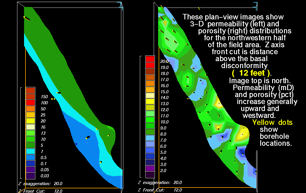
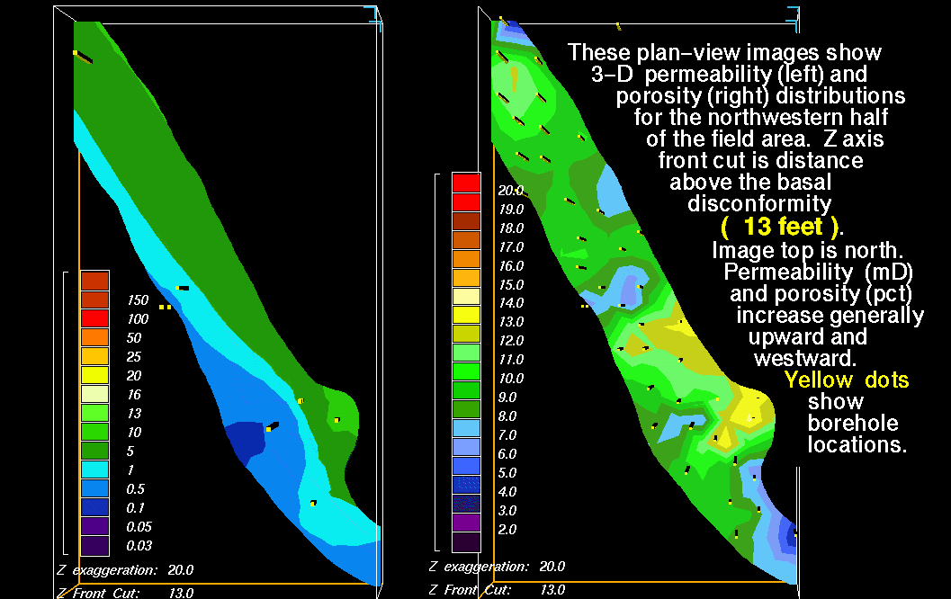
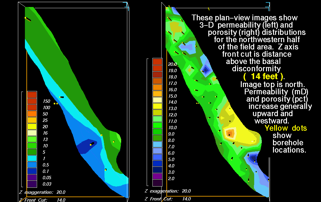
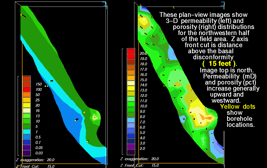
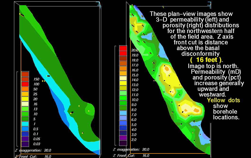
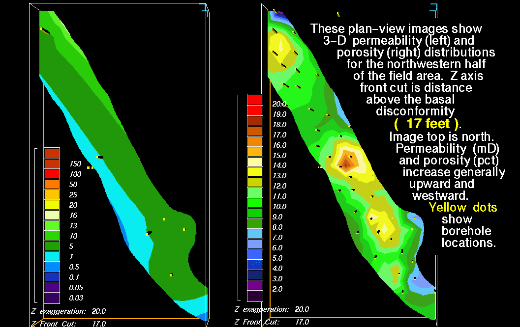
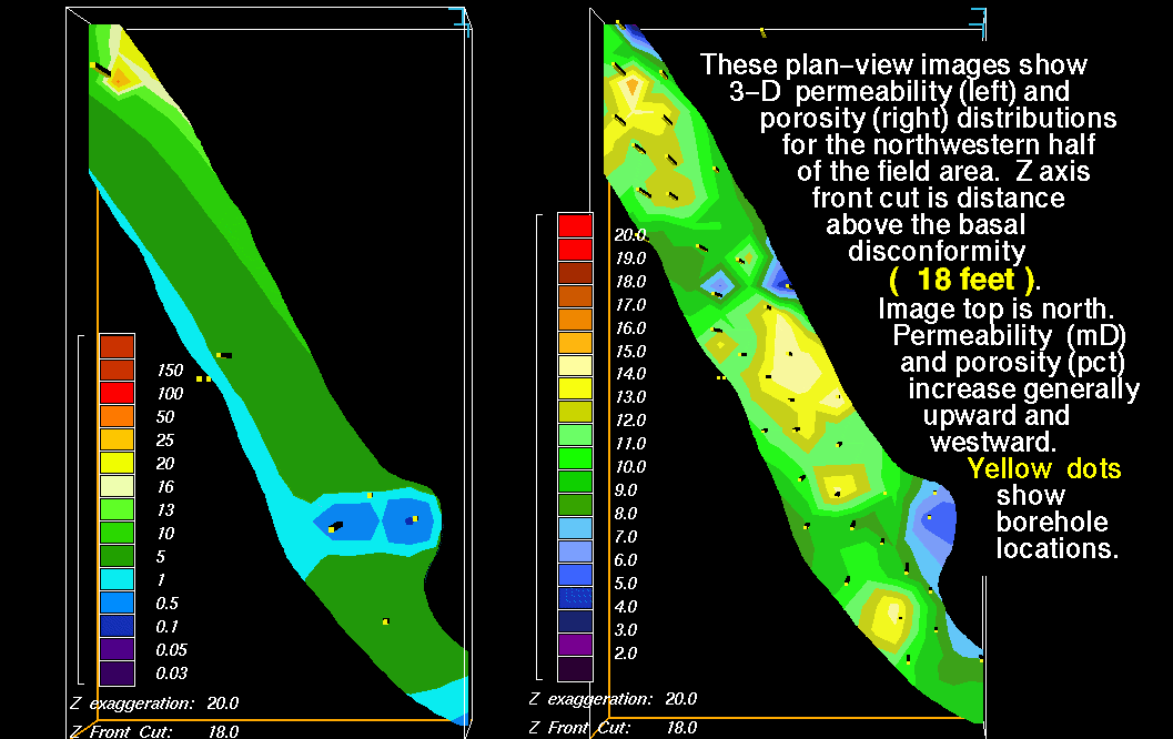
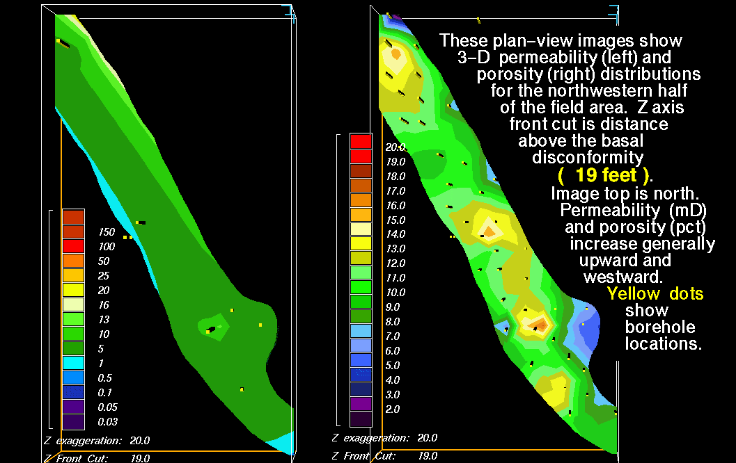
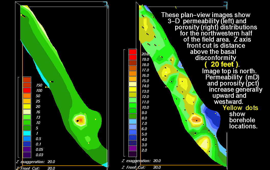
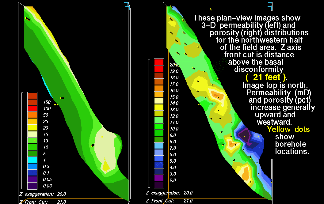
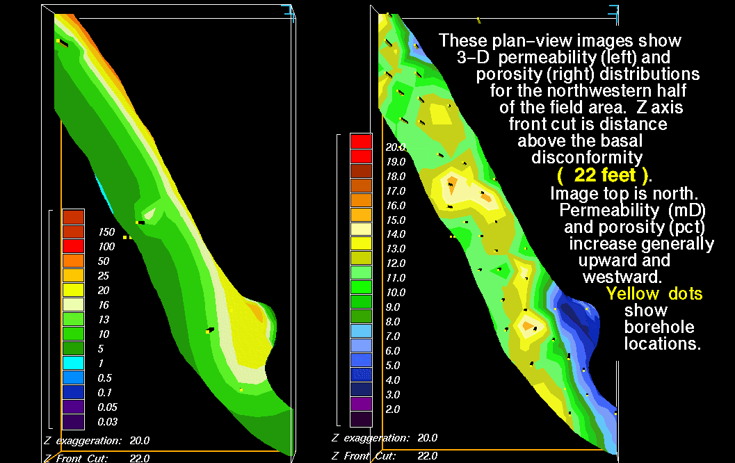
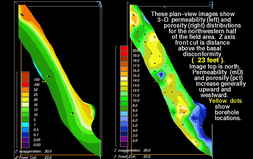
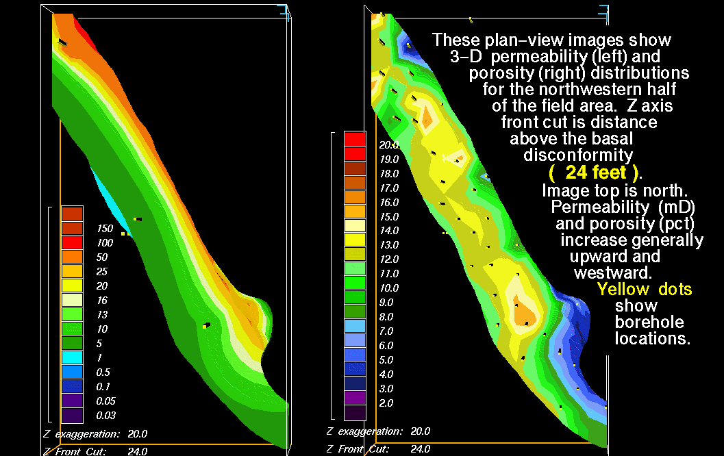
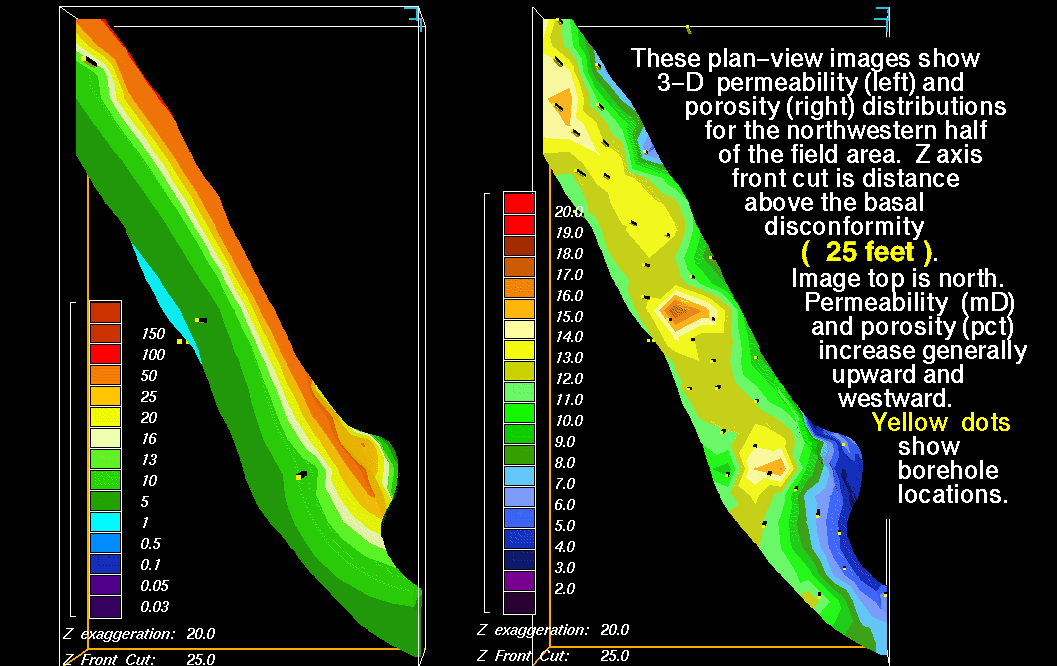
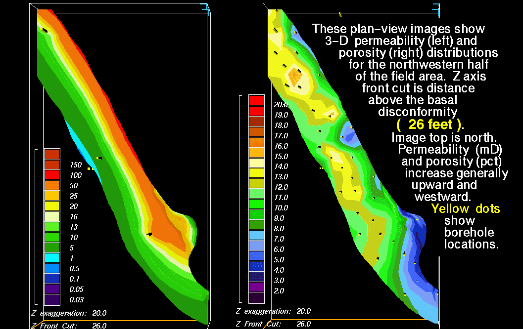
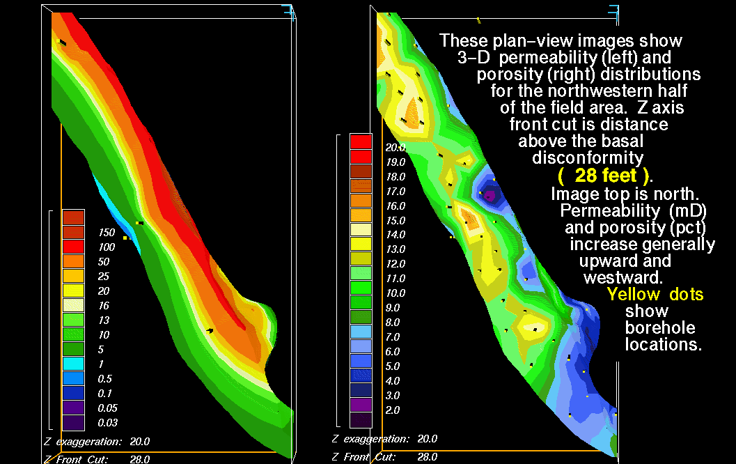
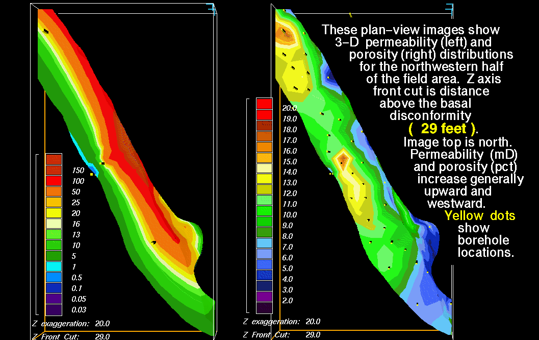
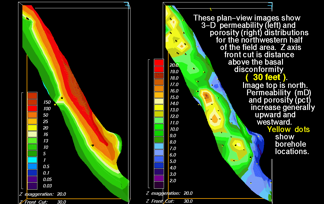
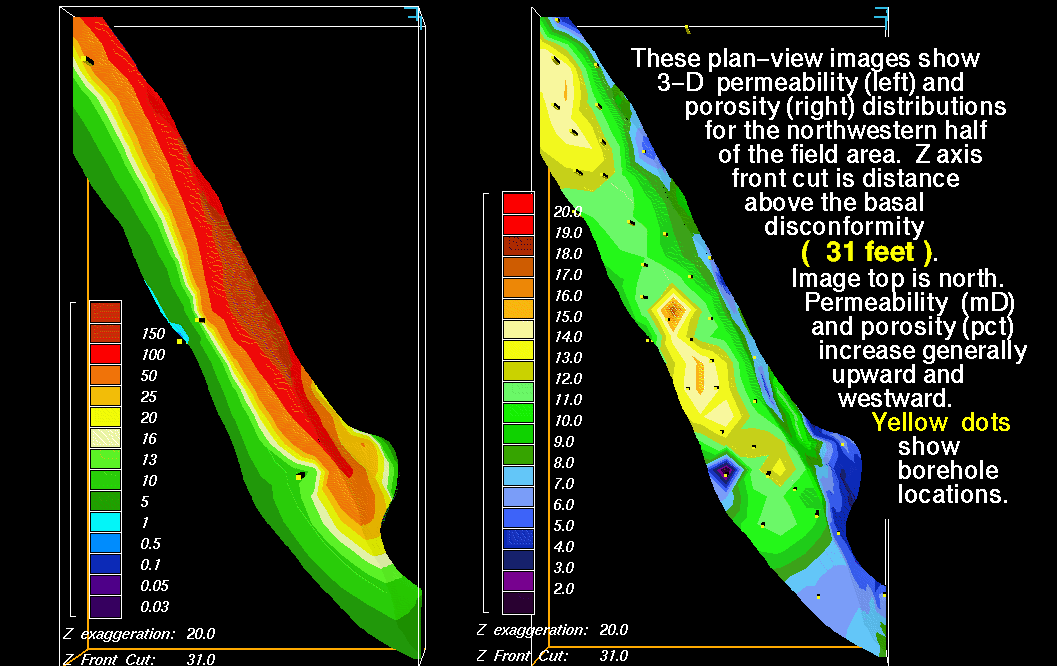
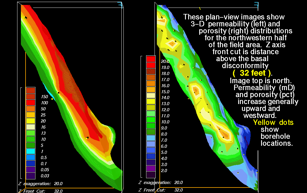
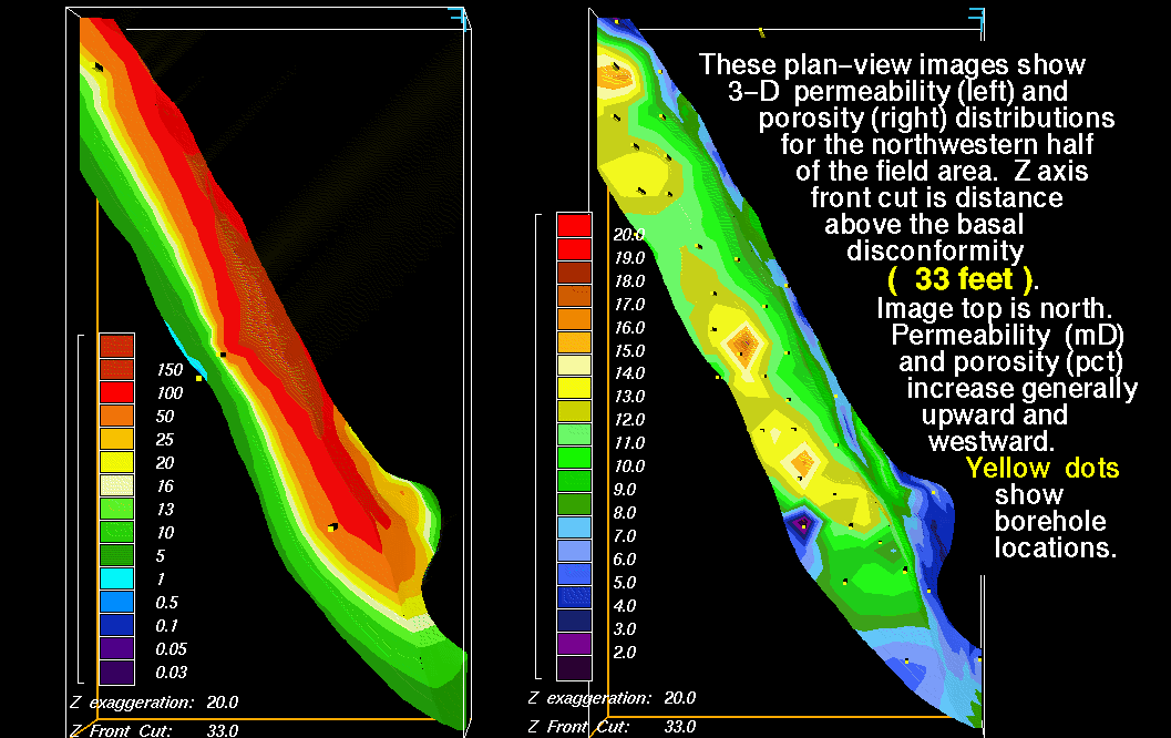
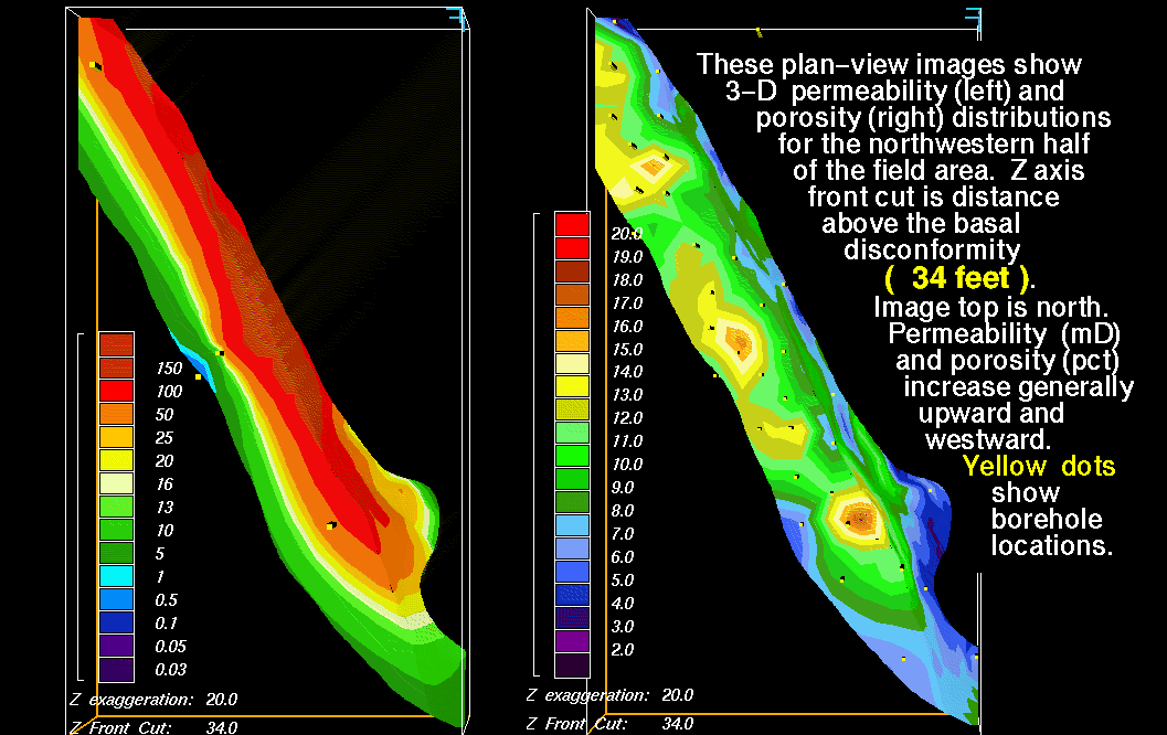
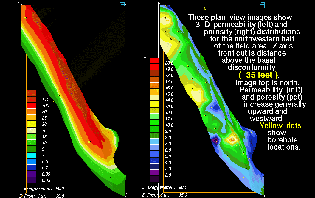
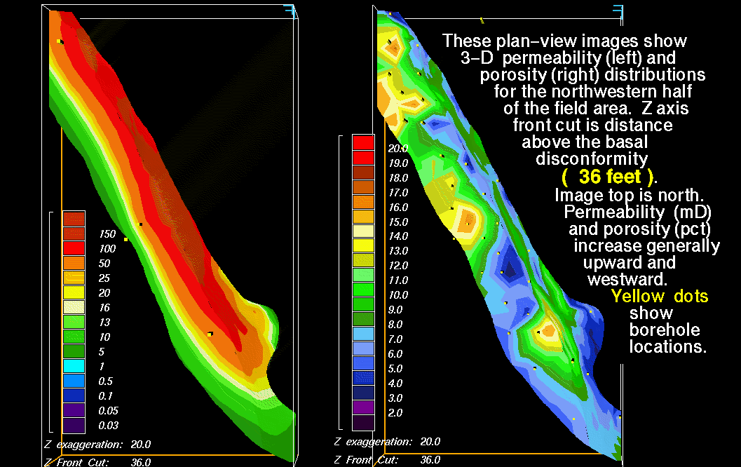
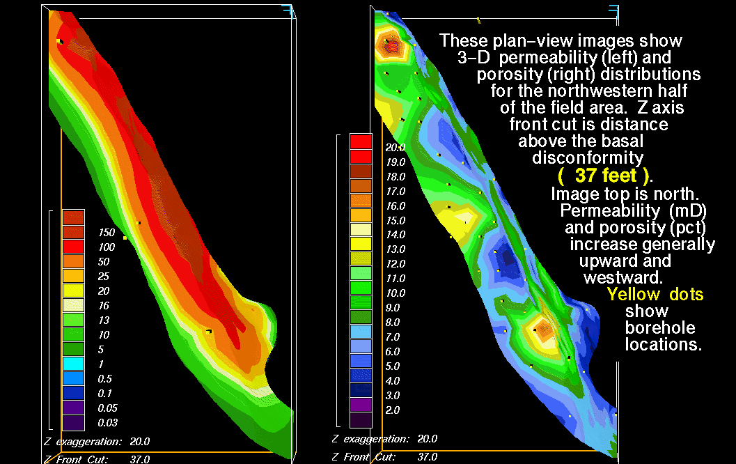
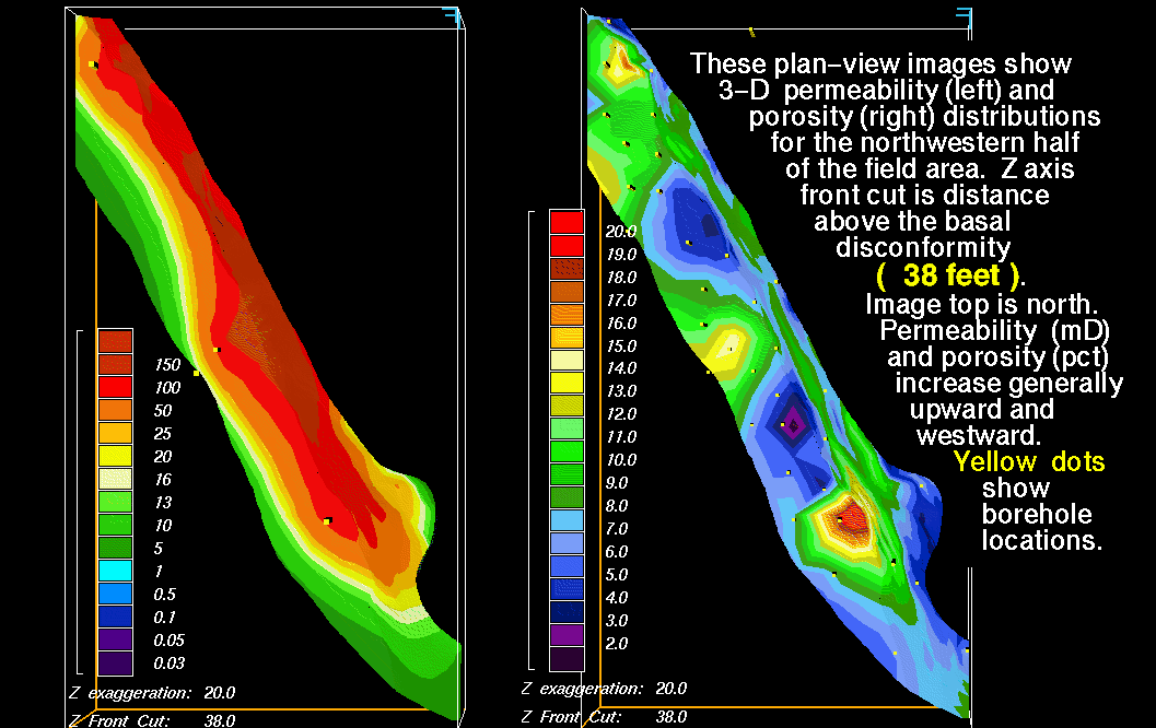
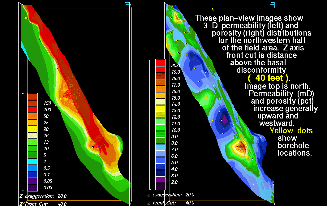
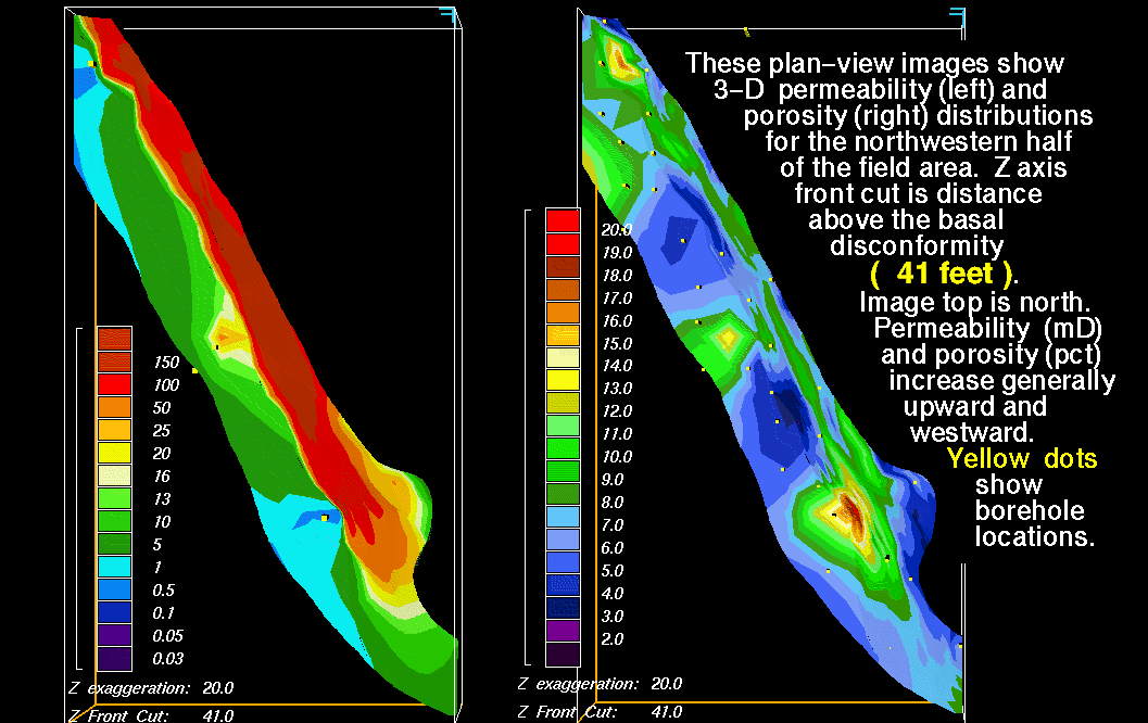
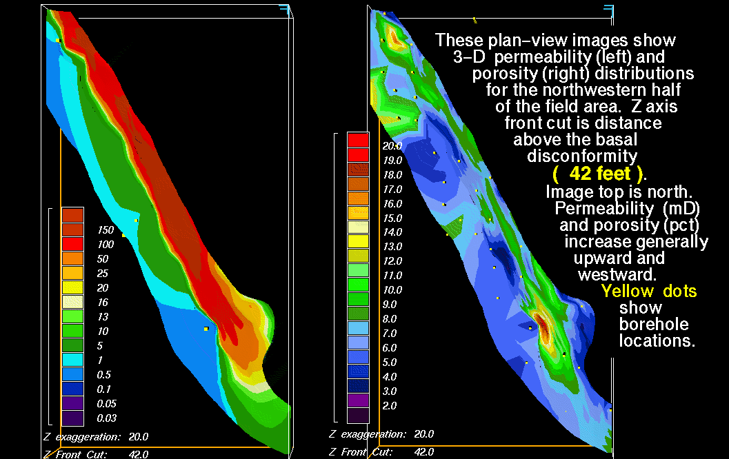
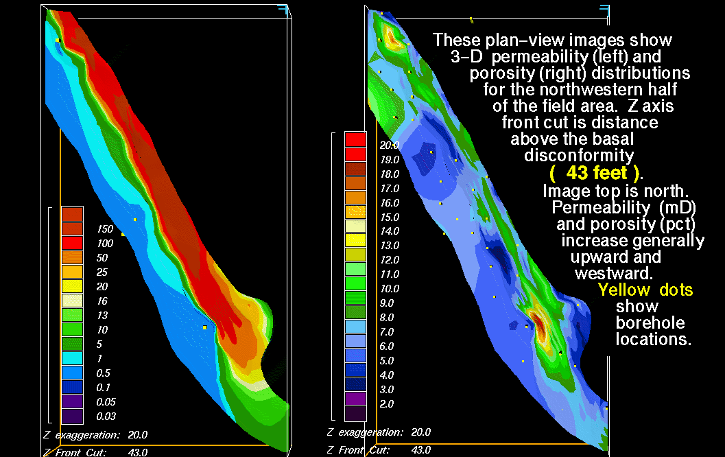
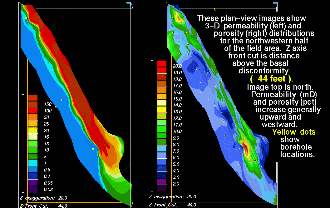
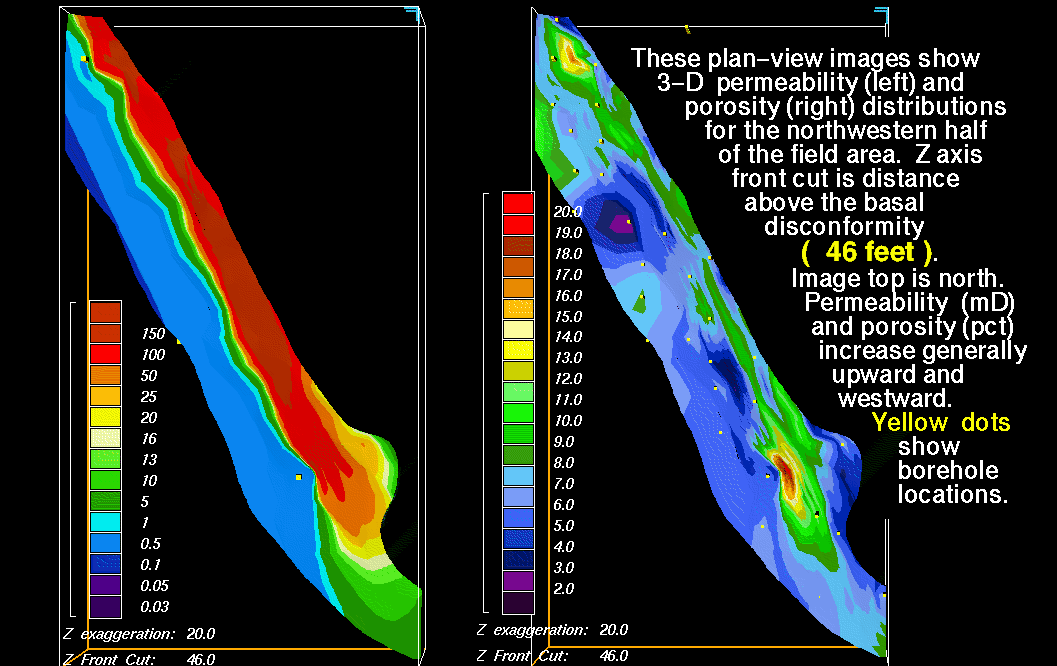
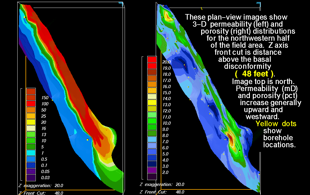
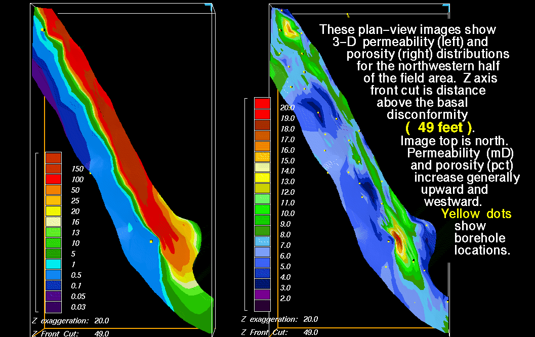
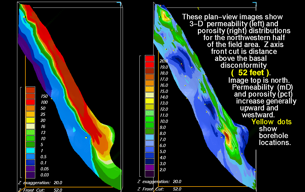
North-South-Oriented Vertical Slices are spaced at 500-m (1,524 ft) intervals and numbered from south to north. Plan-view images are numbered in 1-ft (0.3 m) increments from the basal disconformity datum. Explanation and index map are shown on most images. Each slice has two color bars. They are 1) variation in permeability in millidarcies (mD), and 2) porosity in 1-percent increments. Vertical exaggeration of the 3-D models is listed on images. Yellow dots are sample locations in boreholes.
Most vertical slices show two sand ridges separated by zones of lower porosity and permeability. Horizontal slices illustrate;
1) the highly variable distribution of porosity and permeability in three dimensions,
2) concentration of lowest porosity/permeability zones proximal to the basal disconformity and the western field margins,
3) general upward and seaward increase in porosity and permeability within individual sand ridges, with
4) stacking of greatest porosity/permeability along field axes that resulted from transgressive deposition (westward) of later sand ridges.
Small-scale example of an east-west-oriented vertical slice of permeability across the field. The movie shows east-west vertical slices of permeability distribution. ewpermvf.MOV
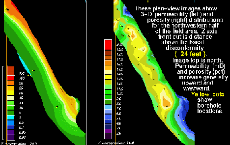
Small-scale plan-view images of permeability and porosity across the northwestern half of the field area. The movie shows plan-view distribution of permeability and porosity. hporperf.MOV .
VERTICAL SLICES OF 3-D PERMEABILITY
Slice 2) Y Axis at -26,000 m - permv12.gif
Slice 3) Y Axis at -25,500 m - permv13.gif
Slice 4) Y Axis at -25,000 m - permv14.gif
Slice 5) Y Axis at -24,500 m - permv15.gif
Slice 6) Y Axis at -24,000 m - permv16.gif
Slice 7) Y Axis at -23,500 m - permv17.gif
Slice 8) Y Axis at -23,000 m - permv18.gif
Slice 9) Y Axis at -22,500 m - permv19.gif
Slice 10) Y Axis at -22,000 m - permv20.gif
Slice 11) Y Axis at -21,500 m - permv21.gif
Slice 12) Y Axis at -21,000 m - permv22.gif
Slice 13) Y Axis at -20,500 m - permv23.gif
Slice 14) Y Axis at -20,000 m - permv24.gif
Slice 15) Y Axis at -19,500 m - permv25.gif
Slice 16) Y Axis at -19,000 m - permv26.gif
Slice 17) Y Axis at -18,500 m - permv27.gif
Slice 18) Y Axis at -18,000 m - permv28.gif
Slice 19) Y Axis at -17,500 m - permv29.gif
PLAN VIEW SLICES OF 3-D PERMEABILITY AND POROSITY
. 2) 1 ft above basal disconformity - porper12.gif
. 3) 2 ft above basal disconformity - porper13.gif
. 4) 3 ft above basal disconformity - porper14.gif
. 5) 4 ft above basal disconformity - porper15.gif
. 6) 5 ft above basal disconformity - porper16.gif
. 7) 6 ft above basal disconformity - porper17.gif
. 8) 7 ft above basal disconformity - porper18.gif
. 9) 8 ft above basal disconformity - porper19.gif
10) 9 ft above basal disconformity - porper20.gif
11) 10 ft above basal disconformity - porper21.gif
12) 11 ft above basal disconformity - porper22.gif
13) 12 ft above basal disconformity - porper23.gif
14) 13 ft above basal disconformity - porper24.gif
15) 14 ft above basal disconformity - porper25.gif
16) 15 ft above basal disconformity - porper26.gif
17) 16 ft above basal disconformity - porper27.gif
18) 17 ft above basal disconformity - porper28.gif
19) 18 ft above basal disconformity - porper29.gif
20) 19 ft above basal disconformity - porper30.gif
21) 20 ft above basal disconformity - porper31.gif
22) 21 ft above basal disconformity - porper32.gif
23) 22 ft above basal disconformity - porper33.gif
24) 23 ft above basal disconformity - porper34.gif
25) 24 ft above basal disconformity - porper35.gif
26) 25 ft above basal disconformity - porper36.gif
27) 26 ft above basal disconformity - porper37.gif
28) 27 ft above basal disconformity - porper38.gif
29) 28 ft above basal disconformity - porper39.gif
30) 29 ft above basal disconformity - porper40.gif
31) 30 ft above basal disconformity - porper41.gif
32) 31 ft above basal disconformity - porper42.gif
33) 32 ft above basal disconformity - porper43.gif
34) 33 ft above basal disconformity - porper44.gif
35) 34 ft above basal disconformity - porper45.gif
36) 35 ft above basal disconformity - porper46.gif
37) 36 ft above basal disconformity - porper47.gif
38) 37 ft above basal disconformity - porper48.gif
39) 38 ft above basal disconformity - porper49.gif
40) 39 ft above basal disconformity - porper50.gif
41) 40 ft above basal disconformity - porper51.gif
42) 41 ft above basal disconformity - porper52.gif
43) 42 ft above basal disconformity - porper53.gif
44) 43 ft above basal disconformity - porper54.gif
45) 44 ft above basal disconformity - porper55.gif
46) 45 ft above basal disconformity - porper56.gif
47) 46 ft above basal disconformity - porper57.gif
48) 47 ft above basal disconformity - porper58.gif
49) 48 ft above basal disconformity - porper59.gif
50) 49 ft above basal disconformity - porper60.gif
51) 50 ft above basal disconformity - porper61.gif
52) 51 ft above basal disconformity - porper62.gif
53) 52 ft above basal disconformity - porper63.gif
54) 53 ft above basal disconformity - porper64.gif