Data Series 917
|
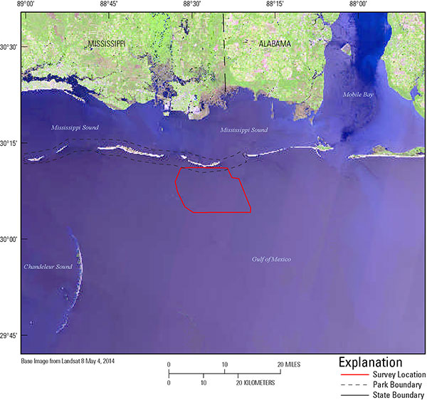
Introduction Figure 1. Study area and location map of the Gulf side of Petit Bois Island, Gulf Islands National Seashore, Mississippi. [Click to enlarge.] The Gulf Islands National Seashore (GUIS) is composed of a series of barrier islands along the Mississippi–Alabama coastline (fig. 1). Historically these islands have undergone long-term shoreline change, erosion, and storm-induced breaching. During the early 1900s, Ship Island was a single island. In 1969, Hurricane Camille breached Ship Island, widening the cut and splitting it into what is now known as West Ship Island and East Ship Island. In 2005, Hurricane Katrina flooded the islands with a 4-m high storm surge, and put into question the stability of the barrier islands and their potential response to future storm impacts. The National Park Service (NPS) is responsible for the protection and preservation of historical Fort Massachusetts, located on Ship Island. Restoration options require sound scientific background to ensure successful implementation and survivability. To scientifically assist the NPS with island restoration an understanding of the surficial and underlying geologic framework, the island morphology, and the sediment exchange within the system, a collaborative effort between the U.S. Geological Survey (USGS), the NPS, and the U.S. Army Corps of Engineers (USACE) was developed under the ongoing regional USGS Northern Gulf of Mexico (NGOM) Ecosystems Change and Hazard Susceptibility Project and the USACE Mississippi Coastal Improvements Program (MsCIP) in collecting geophysical data, and providing interpretations and guidance. The project design and efforts for this study included establishing the role the underlying framework geology has played in the development of these islands; characterizing the morphology of the inner shelf to define sediment transport pathways and sediment exchange with the islands; and providing a state-of-the-art baseline dataset (including bathymetry and topography) for future monitoring and modeling studies (James Flocks, USGS, unpub. data, 2014). The data collected included DGPS navigation, high-resolution chirp seismic-reflection profiles (shallow stratigraphy), interferometric swath bathymetry (seafloor morphology), and sidescan sonar imagery (seafloor geology). This data series includes the bathymetric and interferometric backscatter data collected in August, 2013 (USGS Field Activity Number, 13CCT04), while the seismic-reflection data for the same cruise is reported by Forde and others (20xx). Other USGS geophysical publications relevant to this study area include: Morton and Rogers, 2009; Smith and others, 2009; Twichell and others, 2009, 2011a; DeWitt and others, 2010, 2012a, 2012b 2012c; Flocks and others, 2011; Forde and others, 2011a, 2011b, 2011c, 2011d, 2012; Pendleton and others, 2011; Pfeiffer and others, 2011; Buster and others, 2012. Processed data, maps, and imagery products are downloadable in a geographic information system (GIS) format located in data downloads. Also see Related Works.
|