Data Series 1049
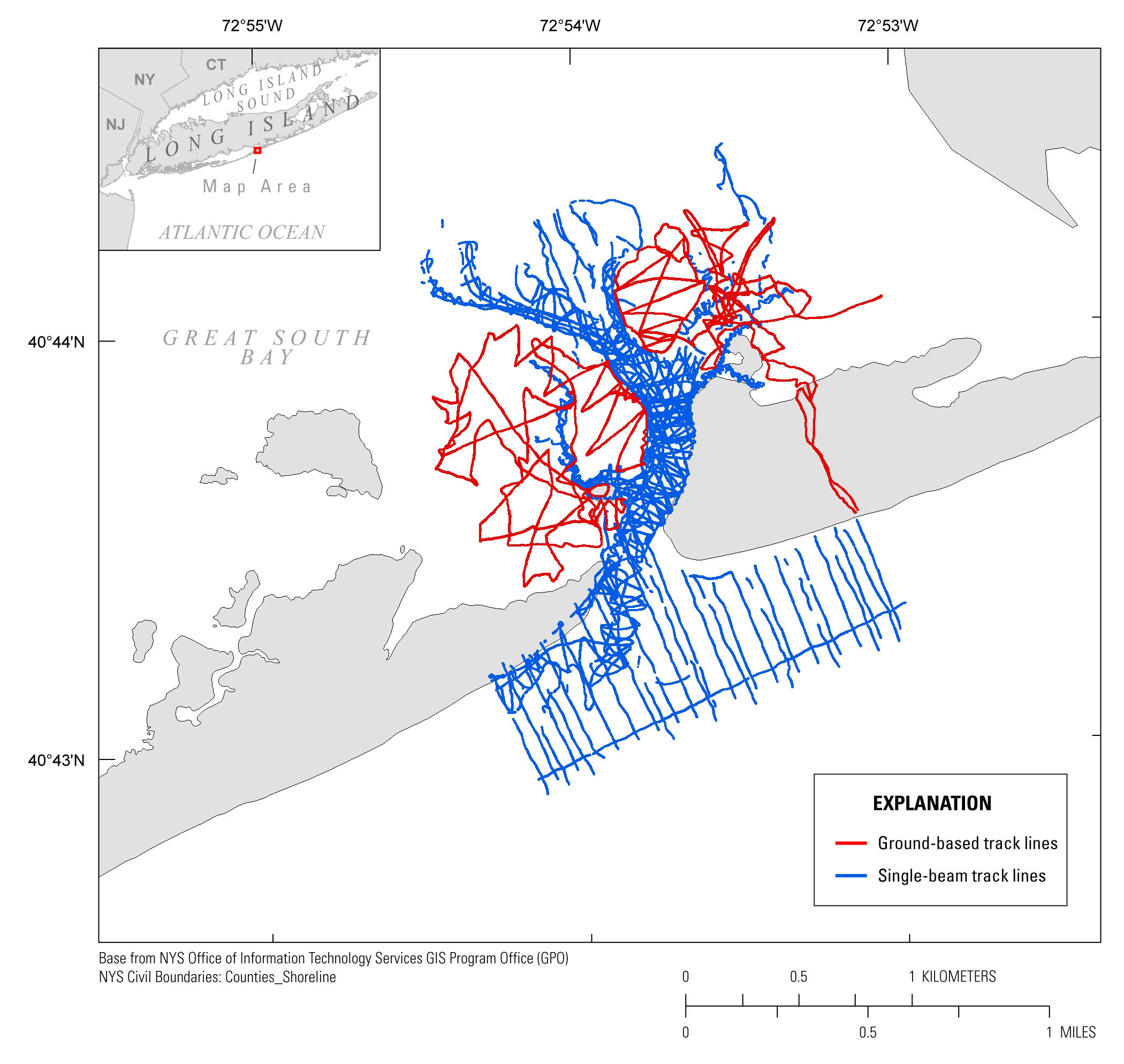
| Survey OverviewShore-perpendicular transects were surveyed within the wilderness breach and on the shoreface using single-beam echosounders and Global Positioning Systems (GPS) mounted on two personal watercraft (PWC). Overall, shore-normal transects were collected every 200 meters (m) along Fire Island, which extends eastward 31.8 kilometers (km) from the eastern boundary of Robert Moses State Park—Long Island to the Otis Pike Fire Island High Dune Wilderness, eastward of the wilderness breach (fig. 3). Each transect extended from the shallowest obtainable surf zone depth to approximately 2 km offshore. Two shore-parallel lines were collected along most of the length of Fire Island, with three of these tracklines collected near the wilderness breach, and additional shore-normal survey lines having a varied trackline spacing between 50 and 100 m were collected within the wilderness breach ebb-delta, extending from the breach to approximately 500 m shoreward of the pre-Hurricane Sandy shoreline (figs. 3, 4). Trackline spacing was increased from every 200 m to every 100 m along central Fire Island and along a 4-km stretch extending to the east from the wilderness breach western bank. The denser trackline spacing of 100 m was used to capture characteristics of the wilderness breach ebb-tidal delta fully. The 100 m spaced lines in central Fire Island were added to capture nearshore bars, which were missed at low tide during the first survey attempt. Within the wilderness breach, bathymetric surveying was limited to collection within flood channels due to extremely shallow flood shoals preventing navigation. To collect the elevation data for these shallow, subaerial flood shoals, surveyors collected GPS elevation data on foot, using a backpack system, in locations near the wilderness breach where the PWCs were unable to survey (fig. 4).
|

![]() U.S. Department of the Interior |
U.S. Geological Survey
U.S. Department of the Interior |
U.S. Geological Survey
URL: http://pubsdata.usgs.gov/pubs/ds/1049/ds1049_overview.html
Page Contact Information: GS Pubs Web Contact
Page Last Modified: Thursday, 11-May-2017 10:24:57 EDT