Data Series 1049
| Project Summary
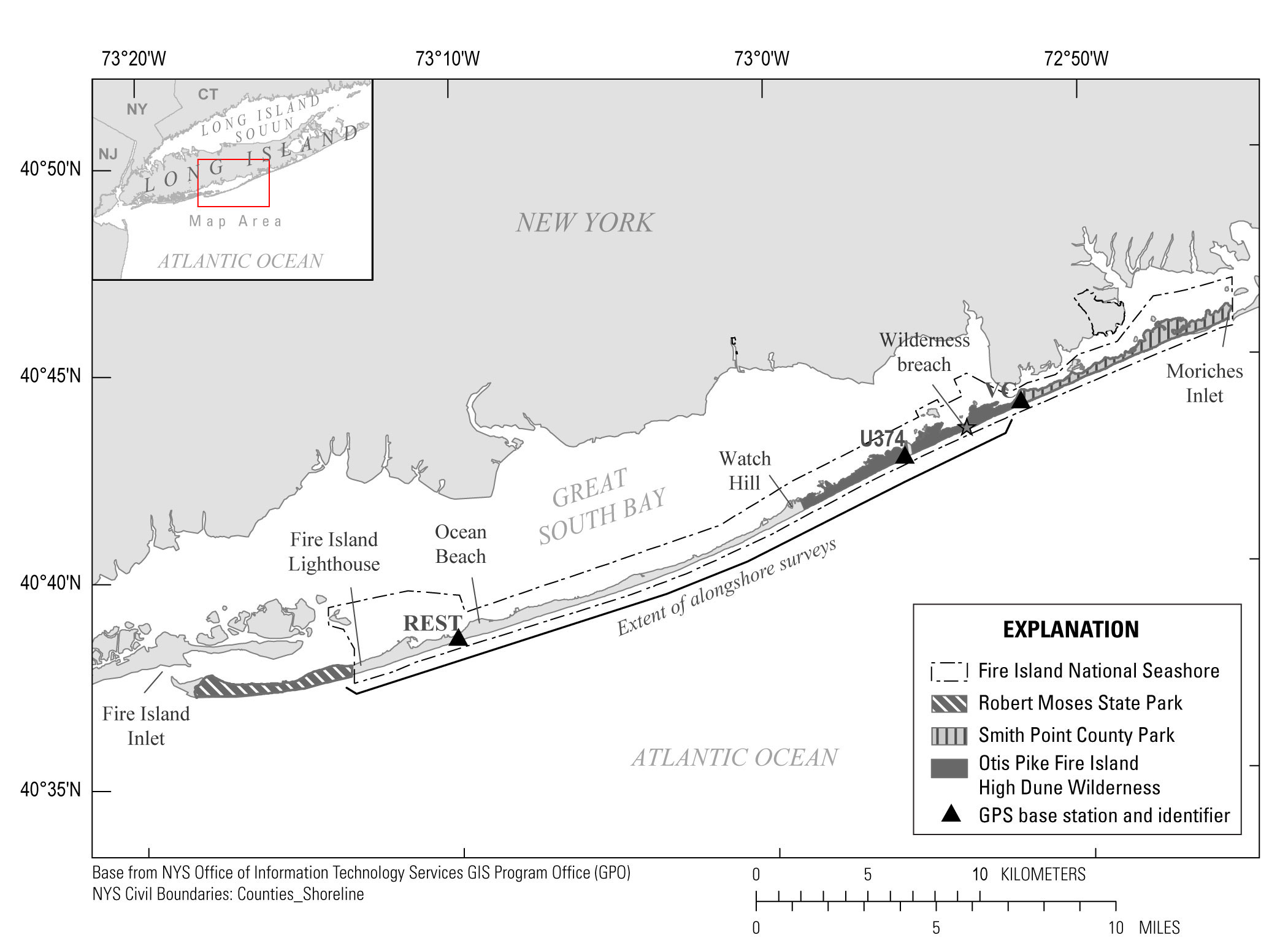
In October 2012, Hurricane Sandy impacted Fire Island, New York (N.Y.), part of a barrier island chain along the south shore of Long Island, N.Y. The storm caused substantial changes to the subaerial beach, altered the shoreface morphology (Hapke and others, 2013), and breached the barrier island within the Otis Pike Fire Island High Dune Wilderness area (figs. 1, 2). To characterize the morphologic evolution of the wilderness breach since Hurricane Sandy, scientists from the U.S. Geological Survey (USGS) St. Petersburg Coastal and Marine Science Center (SPCMSC) conducted surveys in June 2013 (Brownell and others, 2015), June 2014 (Nelson and others, 2016), and October 2014 (Nelson and others, 2017). The primary objective of the surveys was to map the morphology of the Fire Island shoreface and the wilderness breach as part of the USGS Hurricane Sandy Supplemental Project GS2–2B. This survey, which took place May 6-12, 2015 (USGS Field Activity Number (FAN) 2015–312–FA), includes the processed horizontal and vertical point data (x, y, z) and Digital Elevation Models (DEMs) of the Fire Island shoreface and the wilderness breach.
|

![]() U.S. Department of the Interior |
U.S. Geological Survey
U.S. Department of the Interior |
U.S. Geological Survey
URL: http://pubsdata.usgs.gov/pubs/ds/1049/ds1049_summary.html
Page Contact Information: GS Pubs Web Contact
Page Last Modified: Thursday, 11-May-2017 09:23:49 EDT