1996 Survey
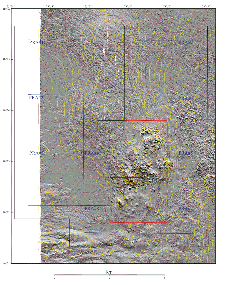
Figure 5a. Shaded Relief and Topography
Shaded relief and depth contours displayed at 1 m intervals for the 1996 survey. The boundaries of the Historic Area Remediation Site (brown), the Primary Remediation Area (divided into 9 cells outlined in blue), the Mud Dump Site (red), the no-discharge zone (black), and the western part of the Cellar Dirt Disposal Site (green) are also shown. White areas are areas of no data. See the Maps section of the text for a description of the how these images were created from the multibeam data.