1998 Survey
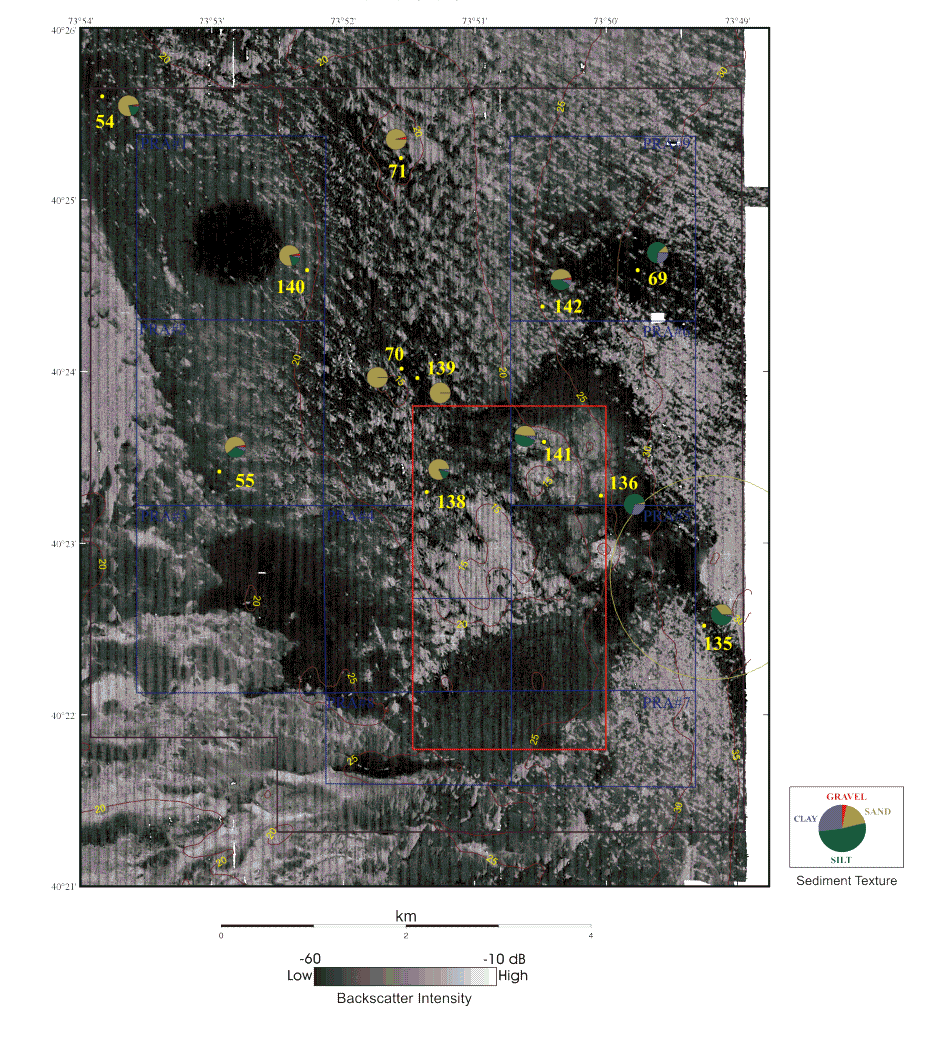
Figure 6b. Backscatter Intensity, Topography and Sediment Texture
Backscatter intensity and depth contours displayed at 5 m intervals for the 1998 survey. Pie diagrams for the sediment texture (see Table 3 [PDF}) for samples obtained in 1998 are superimposed. The boundaries of the Historic Area Remediation Site (brown), the Primary Remediation Area (divided into 9 cells outlined in blue), the Mud Dump Site (red), the no-discharge zone (black), and the Cellar Dirt Disposal Site (green) are also shown. White areas are areas of no data. Principal changes between 1996 and 1998 are the placement of new dredged material in the eastern part of the HARS, capping in the southern part (see circular feature centered near 40°22.25' N. and 73°50.45' W.), and remediation in PRA#1. The remediation in PRA#1 appears as circular area of low-backscatter intensity material. See the Maps section of the text for a description of the how these images were created from the multibeam data.
>