2000 Survey
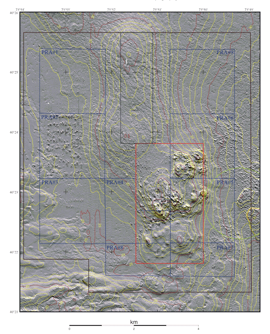
Figure 7a. Shaded Relief and Topography
Shaded relief and depth contours displayed at 1 m intervals for the 2000 survey. The boundaries of the Historic Area Remediation Site (brown), the Primary Remediation Area (divided into 9 cells outlined in blue), the Mud Dump Site (red), the no-discharge zone (black), and the western part of the Cellar Dirt Disposal Site (green) are also shown. White areas are areas of no data. Principal changes between 1998 and 2000 visible in this shaded relief map are associated with remediation in the western two-thirds of PRA#2. These placements resulted in a moderate increase in backscatter intensity (see figure 7b), and individual features that appear as craters 30 to 70 m long and of order 20 m wide, with the major axis oriented roughly north-south. The craters have elevated rims and depressions in the center and are apparently formed as the placed material impacted the soft sea floor. See the Maps section of the text for a description of the how these images were created from the multibeam data.