Bathymetry Difference
Figure 8a. 1996-1998
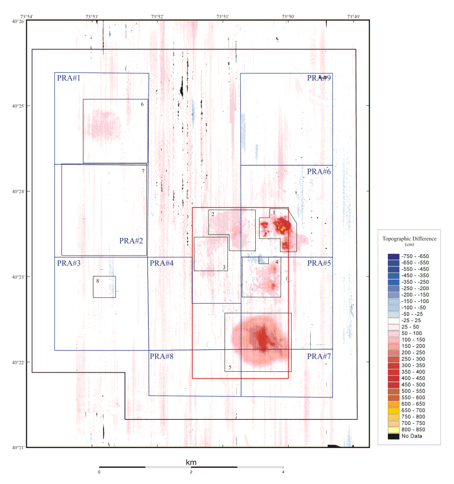
Topography observed in the 1998 survey subtracted from the 1996 survey. Positive features (red shades) indicate shallower water in 1998 compared to 1996; negative features (blue shades) indicate deepening of the water. Between 1996 and 1998, the mean difference in depth across the entire survey area was 24 cm, within the estimated system accuracy of 30 cm. Local changes in depth are observed where dredged material was placed between the 1996 and 1998. More accurate information on the amount of material placed at each site and the water content of the sediment on the seafloor is needed to determine if any of the material placed on the sea floor in the HARS has been eroded and transported from the site. However, the data suggest little net accumulation in Area 3, compared to the other areas that received similar amounts of material (Figure 6, Table 1). The material placed in Area 3 was mud and silt which spreads easily during placement and may be easily eroded. Some loss of material is more likely at this shallow site than from deeper areas. The north-south stripes, running parallel to the survey tracklines, are artifacts of environmental conditions during data collection.