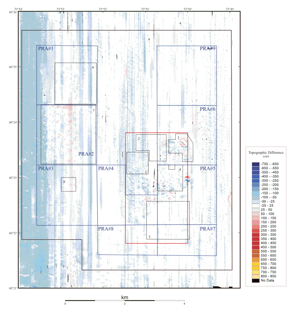
Bathymetry Difference
Figure 8b. 1998-2000
Topography observed in 2000 subtracted from 1998. Positive features (red shades) indicate shallower water in the later year as compared to the earlier year; negative features (blue shades) indicate deepening of the water. Between 1998 and 2000 the mean difference was -14 cm, within the estimated system accuracy of 30 cm. The feature centered near 40o22.97' N., 73o50' W. results from a small offset in the apparent position of the sharp mound that rises to within 12 m of the surface. The north-south stripes, running parallel to the survey tracklines, are artifacts of environmental conditions during data collection.