Deep-Towed Chirp Profiles of the Blake Ridge Collapse Structure: USGS OFR 01-123
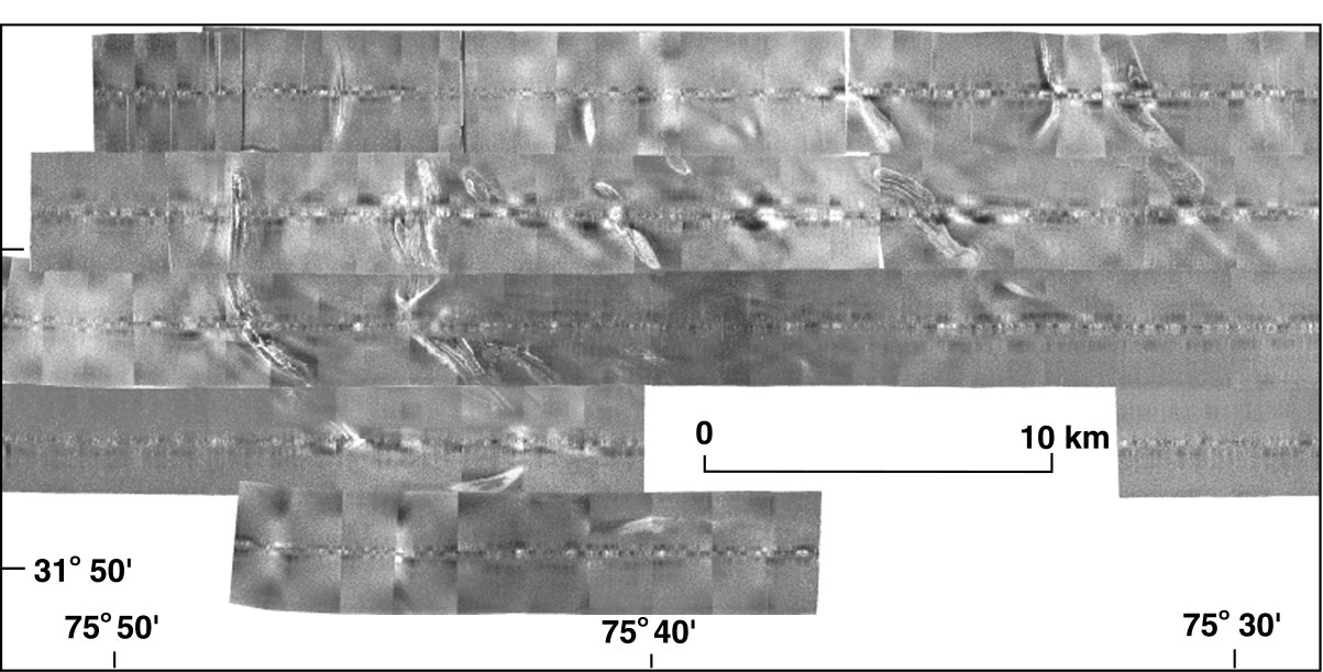
This image was created from data collected by the SIS7000 "Bob" unit concurrently with the chirp profiles on the 1995 cruise and cover the same area. The sidescan from the 1992 data could not be processed into a proper mosaic.
1995 Sidescan Sonar Mosaic.
![]() Document Homepage --
1. Introduction --
2. Cruise Reports -- 3. Track Map -- 4. Data Files and Descriptions -- 5. References -- 6. Metadata files -- 7. Help
Document Homepage --
1. Introduction --
2. Cruise Reports -- 3. Track Map -- 4. Data Files and Descriptions -- 5. References -- 6. Metadata files -- 7. Help