| |  |  | | Lake Pontchartrain Atlas: | |  | | |  | | |  | | |  | | |  | | |  | | |  | | |  | | |  | | |  | | Environmental Issues |  | |  | | |  | | |  | | |  |  | |  | |  | | |  |  |  | | | |  | Environmental Issues - Aggregate Dredge Holes Contributors: Connor, Jr., Maygarden, Penland, Kindinger - Lake Pontchartrain Dredge Pit Bathymetry
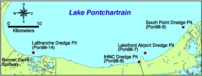
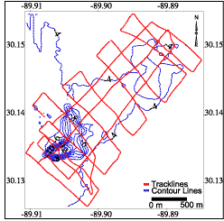
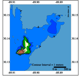
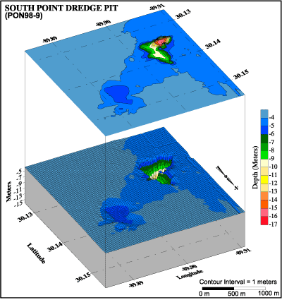
 | | Figure 38: Lake Pontchartrain dredge pit locations. | In 1998, a partnership was formed between the UNOCRL and the USGS to collect hydrographic data along the south shore of Lake Pontchartrain in order to document bathymetric change since the early 1900's. These hydrographic data were processed and computer-generated to produce bathymetric maps. Locations of dredge-pits and specific study areas are shown in Figure 38. One of four significant holes in the Lake bottom on the south shore mapped by this survey is near South Point. The bathymetric data show that this hole is approximately 17 m (55.8 ft) deep. The hole was created when sand was pumped from the Lake bottom to fill the Little Woods Canal, which ran parallel to the shoreline. Information from Orleans Levee District suggests that the sand was used to fill the canal prior to building the hurricane protection levee. Records show that clay from a borrow area near Howze Beach on the north shore was transported to the same site to cap the sand layer. This work took place in the 1970's.  | | Figure 39: Trackline map with contour lines: South Point Dredge Pit. |  | | Figure 40: Filled contour map: South Point Dredge Pit. |  | | Figure 41: 3D bathymetric profile including filled contour map: South Point dredge pit. | « Previous | Next » |

