Coastal & Marine Geology Program
>
Center for Coastal & Regional Marine Studies
> Environmental Atlas of Lake Pontchartrain
Environmental Atlas of the Lake Pontchartrain Basin
Lake Pontchartrain Atlas Home
Lake Pontchartrain Atlas:
Preface
Table of Contents
Introduction
Environmental Overview
Environmental Status & Trends
Restoration
Physical Environments
Basin Geology
Biological Resources
Environmental Issues
Bibliography
Resources
Contributors
Acronyms
Contact:
Jack Kindinger
Physical Environments:
Climate
|
Hurricane History
|
Circulation
|
Wave Climate
|
Relative Sea Level
|
Relative Sea Level Rise
Physical Environments - Climate
Contributors: Peters, Beall
Introduction
New Orleans Climate History 1954-2000
Baton Rouge Climate History 1960-2000
Covington Climate History 1930-2000
Slidell Climate History 1960-2000
Plaquemines Climate History 1960-2000
Buras Climate History 1948-2000
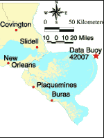
National Data Buoy Climate History 1981-1993
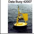
Figure 21:
Photograph of Data Buoy 42007 and a map showing its location.
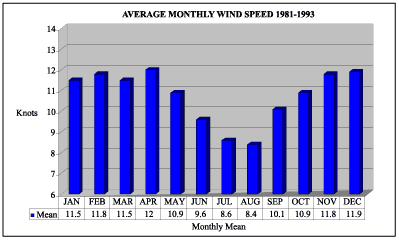
Figure 22:
Average monthly wind speed at Data Buoy 42007 for 1981-1993.
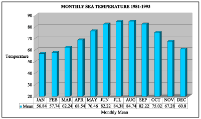
Figure 23:
Monthly sea temperature at Data Buoy 42007 for 1981-1993.
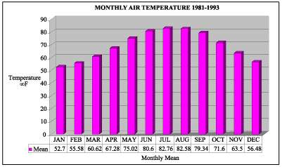
Figure 24:
Monthly air temperature at Data Buoy 42007 for 1981-1993.
Source and acknowledgement:
NOAA National Data Buoy Center.
«
Previous
|
Next
»
Coastal & Marine Geology Program
>
Center for Coastal & Regional Marine Studies
> Environmental Atlas of Lake Pontchartrain
email
Feedback
[an error occurred while processing this directive]