U.S. Geological Survey Open-File Report 2009-1137
Quaternary Geologic Framework of the St. Clair River between Michigan and Ontario, Canada
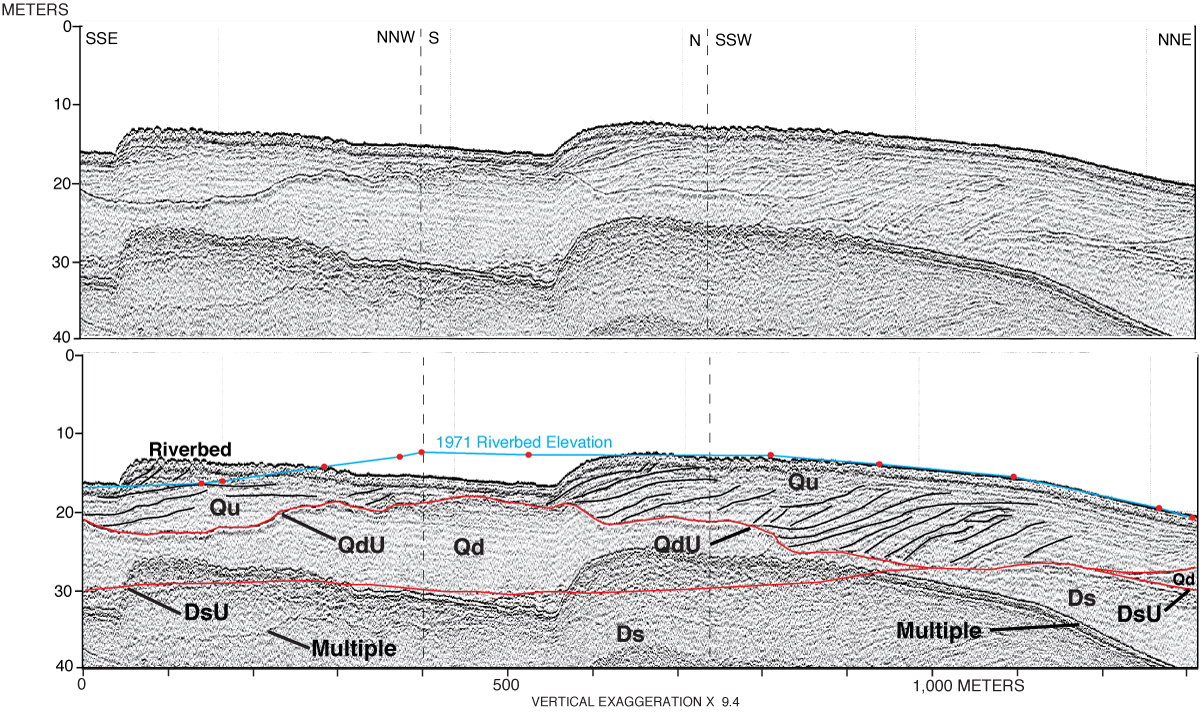
Figure 19. Boomer sub-bottom profile showing the seismic stratigraphy beneath two linguoid bars in the northernmost St. Clair River area. The blue line represents the elevation of the riverbed in 1971 as derived from individual sounding points (red dots). Vertical scale is depth in meters (zero depth is 175.9 m IGLD 1985 based on water level, at the time of data acquisition, at the NOAA gage at Dunn Paper), using a sound velocity of 1,450 m/s in water and 1,650 m/s in sediment. (See table 1 for explanation of stratigraphic units and unconformities; see fig. 10 for profile location.) Click on figure for larger image. |
 |

![]() U.S. Department of the Interior |
U.S. Geological Survey
U.S. Department of the Interior |
U.S. Geological Survey
URL: https://pubsdata.usgs.gov/pubs/of/2009/1137/html/figure19.html
Page Contact Information: Contact USGS
Page Last Modified: Wednesday, 07-Dec-2016 21:58:21 EST
