U.S. Geological Survey Open-File Report 2009-1137
Quaternary Geologic Framework of the St. Clair River between Michigan and Ontario, Canada
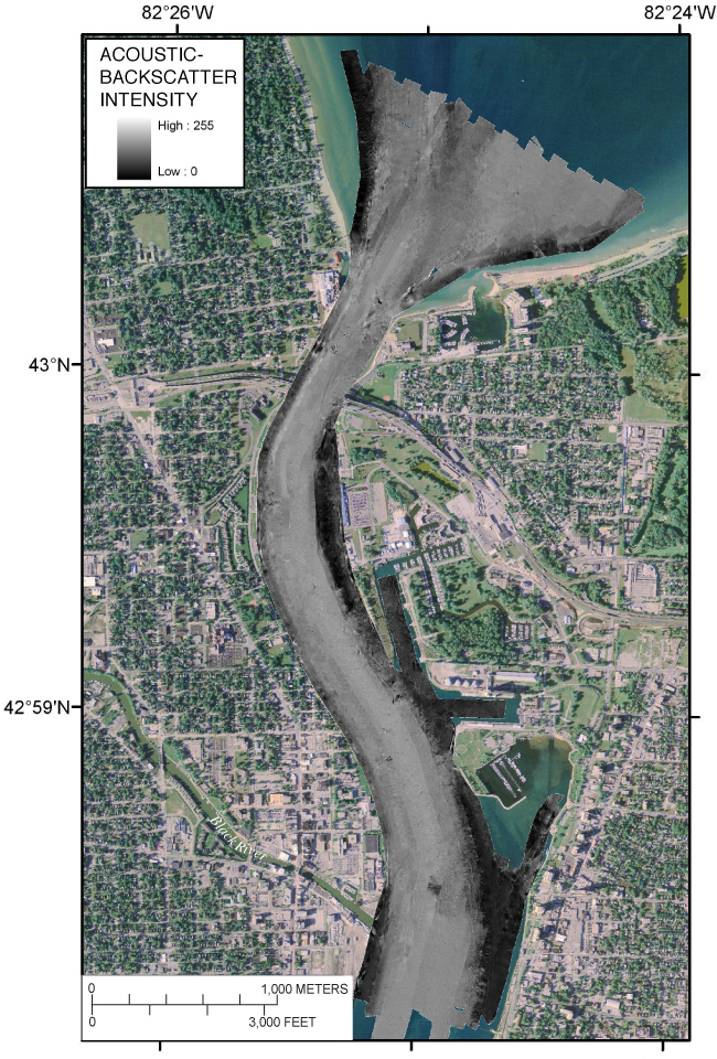
Figure 21. Map showing SWATHplus®-processed acoustic backscatter intensity in the northernmost St. Clair River area. Dark areas are lower backscatter and light are higher backscatter. (2005 orthophoto base from Michigan State University, Remote Sensing & GIS Research and Outreach Services, USDA-FSA Aerial Photography Field Office.) Click on figure for full-sized image in PDF format, 7 MB. |
 |
To view files in PDF format, download a free copy of Adobe Reader.

![]() U.S. Department of the Interior |
U.S. Geological Survey
U.S. Department of the Interior |
U.S. Geological Survey
URL: https://pubsdata.usgs.gov/pubs/of/2009/1137/html/figure21.html
Page Contact Information: Contact USGS
Page Last Modified: Wednesday, 07-Dec-2016 21:58:23 EST
