Skip past header information
USGS - science for a changing world

U.S. Geological Survey Open-File Report 2011-1113

Summary of Oceanographic and Water-Quality Measurements in West Falmouth Harbor and Buzzards Bay, Massachusetts, 2009-2010


Skip past contents information/ Title Page / List of Figures / Conversion Factors / Abstract / Introduction / Instruments / Site Description / Mooring Log / Results / Acknowledgments / References Cited / Appendix


Figure 10. Photograph of  Aanderaa and YSI deployed on pedestal mount.


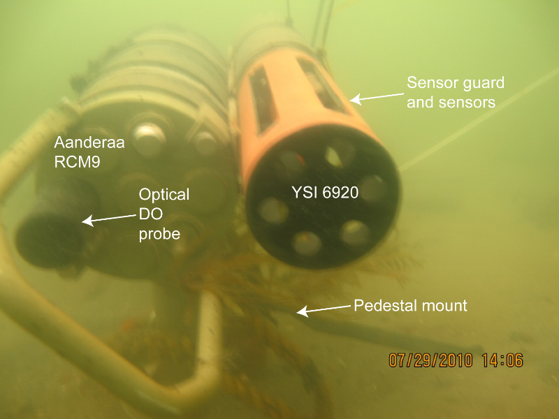
Figure 10. Aanderaa RCM9 with optical dissolved oxygen (DO) probe and YSI 6920 multiparameter sonde, deployed on the seabed using a pedestal mount (mooring 886) 0.3 meters above bottom. Mooring 888 used a similar mount, with only a YSI multiparameter sonde.

Download the full size image in PDF format.


To view files in PDF format, download a free copy of Adobe Reader.


Skip USGS links group

Accessibility FOIA Privacy Policies and Notices

Take Pride in America logo USAGov logo U.S. Department of the Interior | U.S. Geological Survey
End of USGS links group