Skip past header information
USGS - science for a changing world

U.S. Geological Survey Open-File Report 2011-1113

Summary of Oceanographic and Water-Quality Measurements in West Falmouth Harbor and Buzzards Bay, Massachusetts, 2009-2010


Skip past contents information/ Title Page / List of Figures / Conversion Factors / Abstract / Introduction / Instruments / Site Description / Mooring Log / Results / Acknowledgments / References Cited / Appendix


Figure 13. Data from mooring 860.


Figure 13. Time series of pressure, east velocity, north velocity, water temperature, and salinity from mooring 860, Buzzards Bay South. Abbreviations: db, decibars; cm/s, centimeters per second; oC, degrees Celsius; psu, practical salinity units.

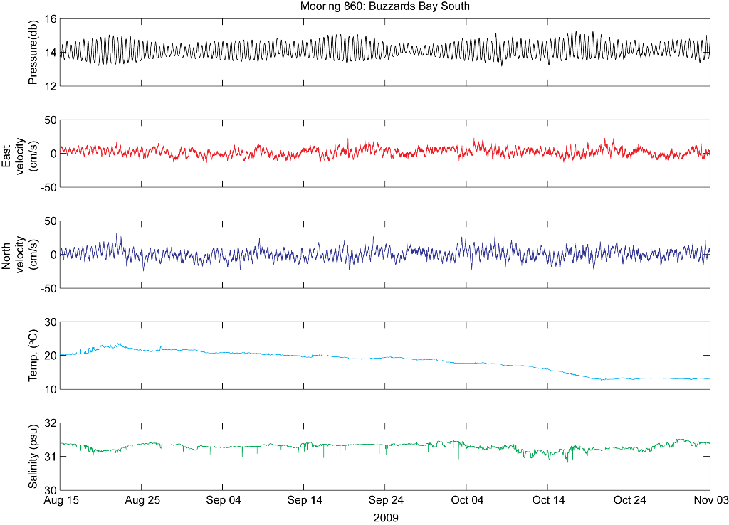
Download the full size image in PDF format.


To view files in PDF format, download a free copy of Adobe Reader.


Skip USGS links group

Accessibility FOIA Privacy Policies and Notices

Take Pride in America logo USAGov logo U.S. Department of the Interior | U.S. Geological Survey
End of USGS links group