Skip past header information
USGS - science for a changing world

U.S. Geological Survey Open-File Report 2011-1113

Summary of Oceanographic and Water-Quality Measurements in West Falmouth Harbor and Buzzards Bay, Massachusetts, 2009-2010


Skip past contents information/ Title Page / List of Figures / Conversion Factors / Abstract / Introduction / Instruments / Site Description / Mooring Log / Results / Acknowledgments / References Cited / Appendix


Figure 14. Data from moorings 861 and 862.


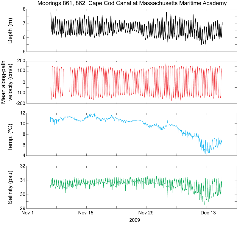
Figure 14. Time series of water level, mean along-path channel velocity (ebb/southwest positive), water temperature, and salinity from moorings 861 and 862, Cape Cod Canal at Massachusetts Maritime Academy. Abbreviations: m, meters; cm/s, centimeters per second; oC, degrees Celsius; psu, practical salinity units.

Download the full size image in PDF format.


To view files in PDF format, download a free copy of Adobe Reader.


Skip USGS links group

Accessibility FOIA Privacy Policies and Notices

Take Pride in America logo USAGov logo U.S. Department of the Interior | U.S. Geological Survey
End of USGS links group