U.S. Geological Survey Open-File Report 2011-1113
Summary of Oceanographic and Water-Quality Measurements in West Falmouth Harbor and Buzzards Bay, Massachusetts, 2009-2010
/ Title Page / List of Figures / Conversion Factors / Abstract / Introduction / Instruments / Site Description / Mooring Log / Results / Acknowledgments / References Cited / Appendix
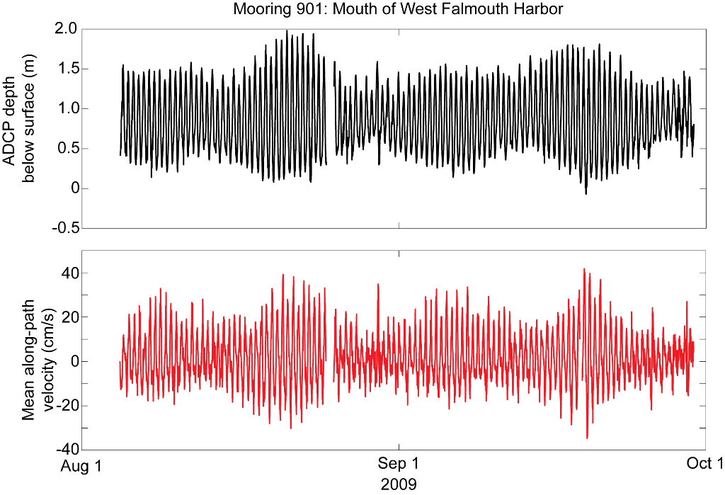
Figure 15. Time series of ADCP depth below surface and mean along-path channel velocity (ebb/west positive) from mooring 901, Mouth of West Falmouth Harbor. Abbreviations: m, meters; cm/s, centimeters per second.
Download the full size image in PDF format.
To view files in PDF format, download a free copy of Adobe Reader.