Skip past header information
USGS - science for a changing world

U.S. Geological Survey Open-File Report 2011-1113

Summary of Oceanographic and Water-Quality Measurements in West Falmouth Harbor and Buzzards Bay, Massachusetts, 2009-2010


Skip past contents information/ Title Page / List of Figures / Conversion Factors / Abstract / Introduction / Instruments / Site Description / Mooring Log / Results / Acknowledgments / References Cited / Appendix


Figure 2. Map of Buzzards Bay and mooring locations.


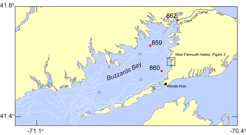
Figure 2.  Map of portions of southeastern Massachusetts, Cape Cod, and Buzzards Bay. Moorings in Buzzards Bay and Cape Cod Canal are indicated with a red circle and mooring number (859, 860, and 862). Bathymetric contours are in meters, referenced to mean low water. Box indicates inset for figure 3.

Download the full size image in PDF format. 


To view files in PDF format, download a free copy of Adobe Reader.


Skip USGS links group

Accessibility FOIA Privacy Policies and Notices

Take Pride in America logo USAGov logo U.S. Department of the Interior | U.S. Geological Survey
End of USGS links group