Skip past header information
USGS - science for a changing world

U.S. Geological Survey Open-File Report 2011-1113

Summary of Oceanographic and Water-Quality Measurements in West Falmouth Harbor and Buzzards Bay, Massachusetts, 2009-2010


Skip past contents information/ Title Page / List of Figures / Conversion Factors / Abstract / Introduction / Instruments / Site Description / Mooring Log / Results / Acknowledgments / References Cited / Appendix


Figure 6. Photograph of side-looking ADCP deployed on pier.


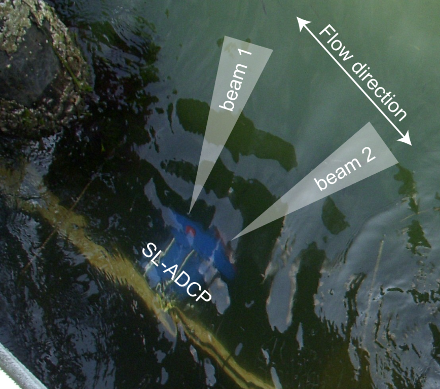
Figure 6.  Position and schematic of beam spread for the SL-ADCP deployed on pier, facing entrance channel to West Falmouth Harbor (mooring 901). Actual beams traveled over 20 meters into the channel before interference with the channel bed and water surface (due to beam vertical spreading).

Download the full size image in PDF format (106 KB).


To view files in PDF format, download a free copy of Adobe Reader.


Skip USGS links group

Accessibility FOIA Privacy Policies and Notices

Take Pride in America logo USAGov logo U.S. Department of the Interior | U.S. Geological Survey
End of USGS links group