Skip past header information
USGS - science for a changing world

U.S. Geological Survey Open-File Report 2011-1156

Carolinas Coastal Change Processes Project Data Report for Observations near Diamond Shoals, North Carolina, January-May 2009


Supporting Observations

Skip past contents information

Supporting data (meteorological conditions and stream flows) as determined by other sources are provided below. These data offer an assessment of the environmental conditions during the study period. Sensor locations for these ancillary data are shown in fig. 43. Links to data sources are given below:

National Oceanic and Atmospheric Administration (NOAA) National Data Buoy Center (NDBC), station 41025
U.S. Army Corps of Engineers Filed Research Facility (FRF) station in Duck, N.C.
National Centers for Environmental Protection (NCEP) North American Regional Model analysis (NAR)
USGS 0208436195 Tranters Creek at SR1403 near Washington, N.C.
USGS 02084557 Van Swamp near Hoke, N.C.

Meteorological Observations

Meteorological observations of wind speed and direction, wave height, surface wave period, air temperature, sea-surface temperature, and barometric pressure were recorded by instruments maintained offshore of Cape Hatteras by the sources listed above.

Station Location Latitude Longitude
41025 Diamond Shoals, N.C. 35° 0' 22" N 75° 24' 07" W
FRF Duck, N.C. 36° 11' 1" N 75° 44' 42" W
NAM Duck, N.C. 36° 11' 1" N 75° 44' 42" W

Streamflow Observations

Daily streamflow observations from January 1, 2009 to May 10, 2009 were obtained from two streamgages operated by the USGS.

Station Location Latitude Longitude
0208436195 Tranters Creek
near Washington, N.C.
35° 33' 47" N 77° 05' 10" W
02084557 Van Swamp
near Hoke, N.C.
35° 43' 51" N 76° 44' 46" W


Click on the following figures for larger images in PDF format.

Figure 43. Locations of supporting observations.
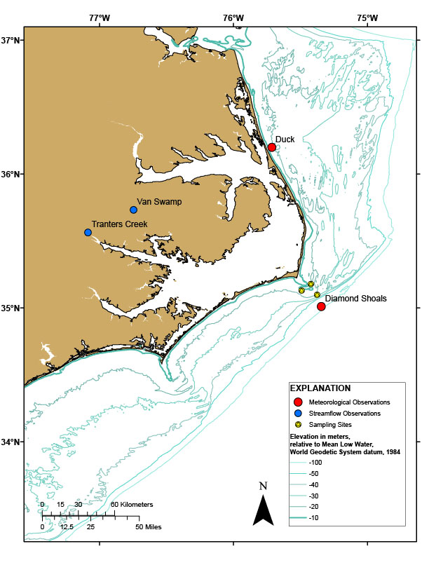
Figure 43. Map showing locations of supporting observations.

Skip USGS links group

Accessibility FOIA Privacy Policies and Notices

Take Pride in America logo USAGov logo U.S. Department of the Interior | U.S. Geological Survey
End of USGS links group