U.S. Geological Survey Open-File Report 2012–1004
Sea-Floor Geology in Central Rhode Island Sound South of Sakonnet Point, Rhode Island
![]() Title |
List of Figures |
Conversion Factors |
Abstract |
Introduction |
Setting |
Methods |
Bathymetry |
Sediments |
Bottom Photography |
GIS Data Catalog |
Summary |
Acknowledgments |
References |
Contacts
Title |
List of Figures |
Conversion Factors |
Abstract |
Introduction |
Setting |
Methods |
Bathymetry |
Sediments |
Bottom Photography |
GIS Data Catalog |
Summary |
Acknowledgments |
References |
Contacts
 |
||
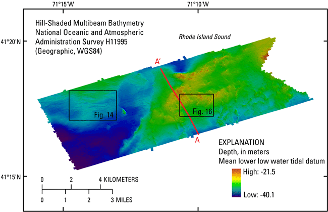
Figure 12. Hill-shaded multibeam bathymetric image of National Oceanic and Atmospheric Administration survey H11995 in Rhode Island Sound. Warmer colors (reds) represent shallower areas and cooler colors (blues) represent deeper areas. Locations of figures 14 and 16 and seismic-reflection profile A-A' in figure 15 are also shown. WGS84, World Geodetic System 1984. |
||


