U.S. Geological Survey Open-File Report 2012-1099
Summary of Oceanographic and Water-Quality Measurements near the Blackwater National Wildlife Refuge, Maryland, 2011
/ Title Page / List of Figures / Conversion Factors / Abstract / Introduction / Instruments / Site Description / Mooring Log / Results / Acknowledgments / References Cited / Appendix
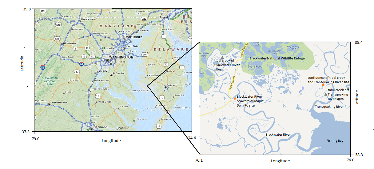
Figure 1. Map of the region (left) with an inset showing the experimental area with study sites on the Blackwater and Transquaking Rivers marked. © 2012 Mapquest, © 2012 Google
Download the full size image in PDF format.
To view files in PDF format, download a free copy of Adobe Reader.