Open-File Report 2014-1160
![]() Title | List of Figures | Conversion Factors | Abstract | Introduction | Setting | Methods | Bathymetry | Sediments | Bottom Photography | GIS Data Catalog | Summary | Acknowledgments | References Cited | Contacts |
Index
Title | List of Figures | Conversion Factors | Abstract | Introduction | Setting | Methods | Bathymetry | Sediments | Bottom Photography | GIS Data Catalog | Summary | Acknowledgments | References Cited | Contacts |
Index
 |
||
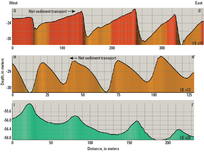
Figure 19. Profiles of barchanoid sand waves (G-G’ and H-H’) and transverse megaripples near the current-scoured bathymetric depression (I-I’). Barchanoid sand waves along the western border of the study area indicate eastward net sediment transport (G-G’), whereas those to the southwest of Cerberus Shoal have profiles that indicate westward net sediment transport (H-H’). Transverse megaripples in the bathymetric depression have symmetrical profiles that indicate no dominant net sediment-transport direction. Location of profile H-H’ is shown in figure 20, location of I-I’ is shown in figure 18, and locations of all of the profiles are shown in figure 12. VE, vertical exaggeration. |
||