Skip past header information
USGS - science for a changing world

Open-File Report 2014-1220


Shallow Geology, Sea-Floor Texture, and Physiographic Zones of Buzzards Bay, Massachusetts 


Skip past contents information/ Title Page / List of Figures / Conversion Factors / Abbreviations / Abstract / Introduction / Methods / Results / Discussion / Summary / Acknowledgments / References Cited / Appendix — Geospatial Data / Index /


Map showing the elevation (referenced to the North American Vertical Datum of 1988) of the late Wisconsinan regressive unconformity Ur, which identifies the eroded surface of Pleistocene glacial drift beneath Buzzards Bay.


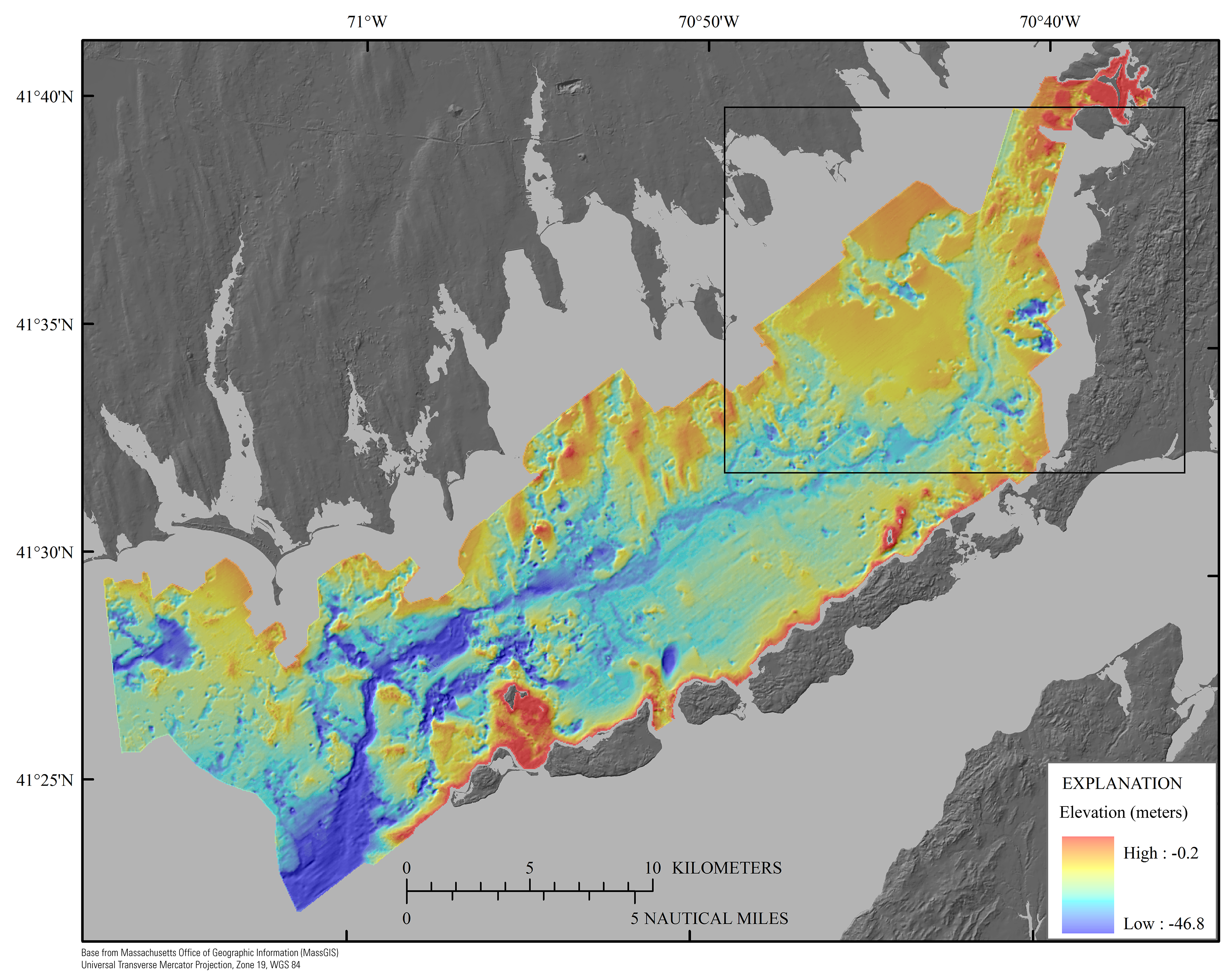
Figure 14. Map showing the elevation (referenced to the North American Vertical Datum of 1988) of the late Wisconsinan regressive unconformity Ur, which identifies the eroded surface of Pleistocene glacial drift beneath Buzzards Bay. Ur represents a composite unconformity where it locally merges with the Holocene transgressive unconformity (Ut) where wave-base erosion during the Holocene transgression truncated the lower unconformity, Ur. Black rectangle shows the location of figure 21.