
Open-File Report 2014-1220
>> Pubs Warehouse > OF 2014-1220
Shallow Geology, Sea-Floor Texture, and Physiographic Zones of Buzzards Bay, Massachusetts
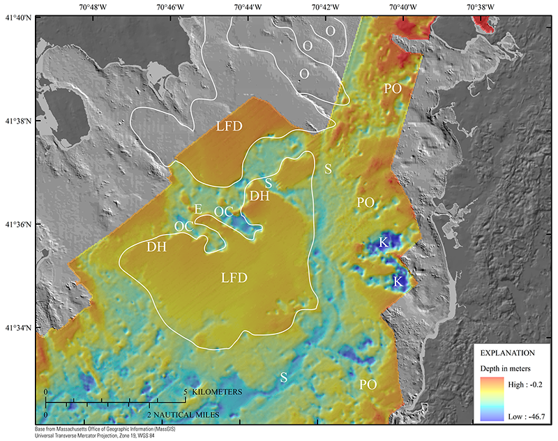 |
Figure 21. Map showing detailed area of depth to the top of glacial deposits (fig. 14). The gray bathymetry hillshade relief is modified from the composite bathymetry of Buzzards Bay (fig. 3). These surfaces show the morphology of glacial outwash and associated features. Lacustrine fan deltas (LFD) and coalescing outwash lobes (O) are outlined in white. Outwash channels (OC) and the delta head (DH) are labeled on the well-preserved LFD in the center of the basin. This feature is considered to be a single ice-contact lacustrine delta morphosequence on the basis of the interpretation of the chirp profiles (fig. 12). An esker (E) separates the outwash channels. Spillways (S) indicate where proglacial lakes drained. Pitted outwash (PO) and large kettles (K) are along the eastern shore. See figure 14 for map location.
|

