
Open-File Report 2014-1220
>> Pubs Warehouse > OF 2014-1220
Shallow Geology, Sea-Floor Texture, and Physiographic Zones of Buzzards Bay, Massachusetts
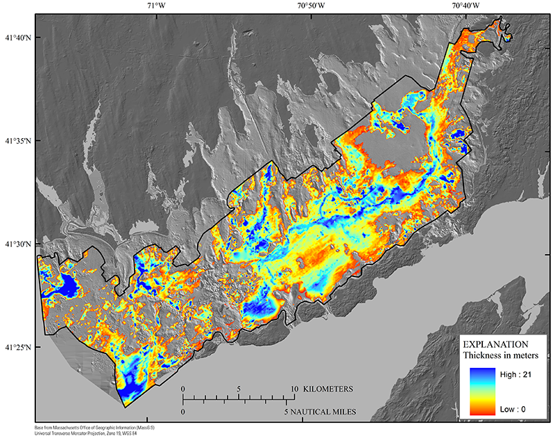 |
Figure 15. Map showing the thickness of postglacial fluvial and estuarine (Qfe) and nearshore marine (Qmn) sediments beneath Buzzards Bay. The black polygon depicts the boundary of the seismic-survey area. The bathymetry hillshade relief map is modified from the composite bathymetry of Buzzards Bay (fig. 3).
|

