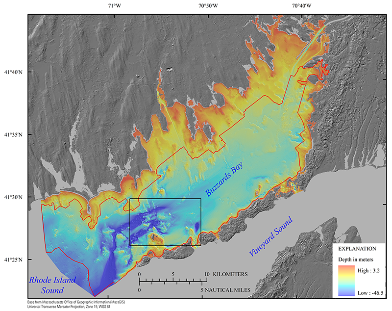
Figure 3. A digital elevation model (DEM) produced from swath interferometric, multibeam, and single-beam bathymetry at 10-meter horizontal resolution (table 1). Swath bathymetry data were collected in the area inside the red polygon. High rugosity and high relief are most often associated with rocky areas, whereas smooth, low-relief regions tend to be blanketed by fine-grained sediment deposits (fig. 17). The black rectangle indicates the location of figure 22. Depth is referenced to the North American Vertical Datum of 1988.
|
