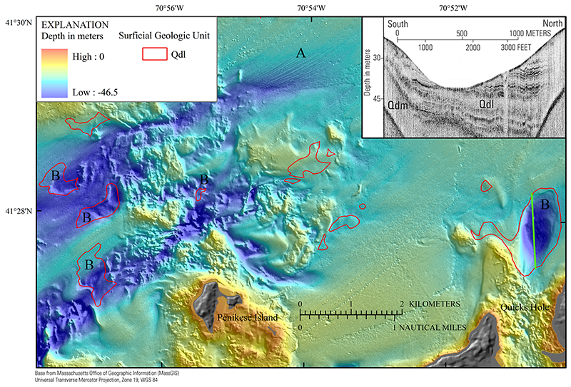
Figure 22. Map showing bathymetry and areas of erosion. The hillshade relief map underlying the bathymetry layer is modified from the composite bathymetry of Buzzards Bay (fig. 3). A, striations on the sea floor are truncated estuarine and marine sediment. B, scour depressions where glaciolacustrine deposits (Qdl) are exposed at the sea floor. See figure 3 for location of this map. Inset is a chirp seismic-reflection profile that shows truncation and exposure of glaciolacustrine (Qdl) deposits in a scour depression north of Quicks Hole (green line).
|
