Open-File Report 2014-1224
![]() Title |
List of Figures |
Conversion Factors |
Abstract |
Introduction |
Setting |
Methods |
Bathymetry |
Sidescan Sonar |
Sediments |
Bottom Photography |
Interpretation |
GIS Data Catalog |
Summary |
Acknowledgments |
References |
Contacts |
Index
Title |
List of Figures |
Conversion Factors |
Abstract |
Introduction |
Setting |
Methods |
Bathymetry |
Sidescan Sonar |
Sediments |
Bottom Photography |
Interpretation |
GIS Data Catalog |
Summary |
Acknowledgments |
References |
Contacts |
Index
 |
||
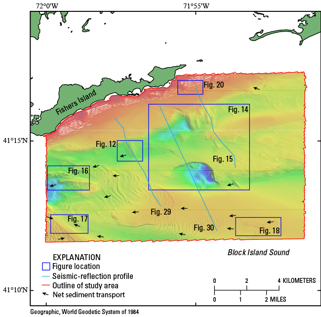
Figure 13. Map of the study area showing locations of the detailed multibeam figures (dark blue rectangles), seismic profiles (light blue lines), and interpreted directions of net sediment transport based on sand-wave and obstacle-mark asymmetry (black arrows). Fig., figure. |
||

![]() U.S. Department of the Interior |
U.S. Geological Survey
U.S. Department of the Interior |
U.S. Geological Survey
URL: http://pubsdata.usgs.gov/pubs/of/2014/1224/html/ofr2014-1224-fig13.html
Page Contact Information: GS Pubs Web Contact
Page Last Modified: Wednesday, 07-Dec-2016 20:06:42 EST
