Open-File Report 2014-1224
![]() Title |
List of Figures |
Conversion Factors |
Abstract |
Introduction |
Setting |
Methods |
Bathymetry |
Sidescan Sonar |
Sediments |
Bottom Photography |
Interpretation |
GIS Data Catalog |
Summary |
Acknowledgments |
References |
Contacts |
Index
Title |
List of Figures |
Conversion Factors |
Abstract |
Introduction |
Setting |
Methods |
Bathymetry |
Sidescan Sonar |
Sediments |
Bottom Photography |
Interpretation |
GIS Data Catalog |
Summary |
Acknowledgments |
References |
Contacts |
Index
 |
||
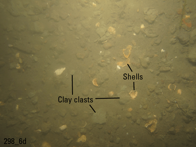
Figure 31. Photograph of clay clasts and scattered shells on the sea floor at station 298_6, located to the east of a bathymetric depression with walls composed of silty clay glaciolacustrine sediment. The clasts at station 298_6 are likely derived from the depression and carried downcurrent where they are deposited on the sea floor. Photograph location is shown in figure 25. |
||

![]() U.S. Department of the Interior |
U.S. Geological Survey
U.S. Department of the Interior |
U.S. Geological Survey
URL: http://pubsdata.usgs.gov/pubs/of/2014/1224/html/ofr2014-1224-fig31.html
Page Contact Information: GS Pubs Web Contact
Page Last Modified: Wednesday, 07-Dec-2016 20:06:54 EST
