Open-File Report 2014-1224
![]() Title |
List of Figures |
Conversion Factors |
Abstract |
Introduction |
Setting |
Methods |
Bathymetry |
Sidescan Sonar |
Sediments |
Bottom Photography |
Interpretation |
GIS Data Catalog |
Summary |
Acknowledgments |
References |
Contacts |
Index
Title |
List of Figures |
Conversion Factors |
Abstract |
Introduction |
Setting |
Methods |
Bathymetry |
Sidescan Sonar |
Sediments |
Bottom Photography |
Interpretation |
GIS Data Catalog |
Summary |
Acknowledgments |
References |
Contacts |
Index
 |
||
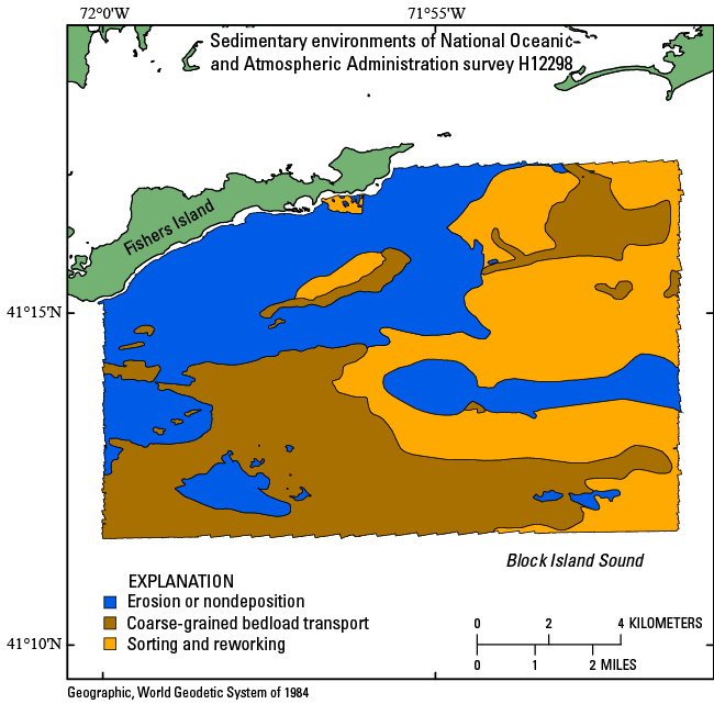
Figure 32. Map of sedimentary environments in the National Oceanic and Atmospheric Administration survey H12298 study area, interpreted from multibeam-bathymetric, sidescan-sonar, sediment samples, and bottom photography data. Sedimentary environments in the study area include those characterized by processes of erosion or nondepostion, coarse-grained bedload transport, and sorting and reworking. |
||