Open-File Report 2015-1149
|
|
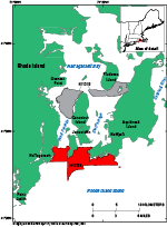
SettingNarragansett Bay is a north-south trending estuary in eastern Rhode Island and southeastern Massachusetts (fig. 1). The study area, which lies primarily in the southernmost parts of East Passage and West Passage of Narragansett Bay, is bordered on the south by Rhode Island Sound, on the west by the town of Narragansett, Rhode Island, and on the north by Conanicut and Aquidneck Islands, R.I. Most of the bay is relatively shallow, averaging about 7 to 10 meters (m) in depth. The greatest depths are in East Passage; this is also where the largest volume of water flows south out of the bay during ebb tide (Kincaid and others, 2003). Most of the bedrock surrounding southern Narragansett Bay consists of meta-sandstone, meta-conglomerate, schist, carbonaceous schist, and graphite of the Pennsylvanian-age Narragansett Bay Group; whereas the shore surrounding the study area is dominated by granite, sandstone, conglomerate, slate, and phyllite of the Newport and Conanicut Groups, ranging in age from the late Proterozoic to Ordovician, which were variably metamorphosed during the Avalonian and Alleghanian orogenies (Hermes and others, 1994; U.S. Geological Survey, 2014). A southward drainage pattern was established in the Narragansett Bay area during the Tertiary, and episodes of erosion and deposition took place in the Pleistocene and Holocene, as glacial deposits from the Laurentide Ice Sheet filled valleys and a transgressing shoreline reworked and deposited sediments (McMaster, 1984). Presently, the southern part of the bay is open to the ocean, and waves and tidal currents erode and rework sediments, preventing deposition (McMaster, 1984). |

![]() U.S. Department of the Interior |
U.S. Geological Survey
U.S. Department of the Interior |
U.S. Geological Survey
URL: http://pubsdata.usgs.gov/pubs/of/2015/1149/html/ofr20151149_setting.html
Page Contact Information: GS Pubs Web Contact
Page Last Modified: Wednesday, 07-Dec-2016 21:44:13 EST