U.S. Geological Survey Open-File Report 2015-1153
![]() / Title Page / List of Figures / Conversion Factors / Abbreviations / Abstract / Introduction / Methods / Results / Discussion / Summary / Acknowledgments / References Cited / Appendix — Geospatial Data / Citation Page /
/ Title Page / List of Figures / Conversion Factors / Abbreviations / Abstract / Introduction / Methods / Results / Discussion / Summary / Acknowledgments / References Cited / Appendix — Geospatial Data / Citation Page /

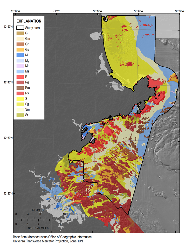
Figure 11. The distribution of sediment textures within the study area from Nahant, Massachusetts, to New Hampshire. The bottom-type classification is from Barnhardt and others (1998) and is based on 16 sediment classes. The classification is based on four sediment units that include gravel (G), mud (M), rock (R), and sand (S) (fig. 8). If the texture is greater than 90 percent, it is labeled with a single letter. If the composition of one component is less than 90 percent, it is labeled with two letters, where the first letter is the primary sediment unit (more than 50 percent) and the second letter is the secondary sediment unit (less than 50 percent).