U.S. Geological Survey Open-File Report 2015-1153
![]() / Title Page / List of Figures / Conversion Factors / Abbreviations / Abstract / Introduction / Methods / Results / Discussion / Summary / Acknowledgments / References Cited / Appendix — Geospatial Data / Citation Page /
/ Title Page / List of Figures / Conversion Factors / Abbreviations / Abstract / Introduction / Methods / Results / Discussion / Summary / Acknowledgments / References Cited / Appendix — Geospatial Data / Citation Page /
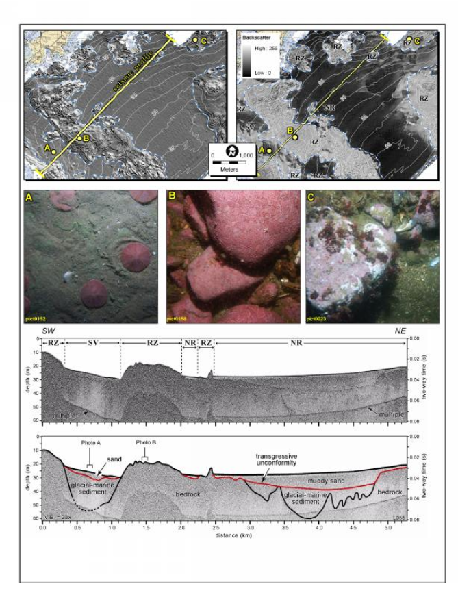
Figure 18. Figure showing bathymetry (upper left), backscatter (upper right) with physiographic zone boundaries, and bottom photographs (center) along a seismic reflection profile (bottom two panels). Yellow line on bathymetry panel is the location of the seismic profile (also shown in fig. 13). Shelf valleys formed often between bedrock highs during the lowstand and unconformably overlie glacial-marine deposits. RZ, rocky zone; SV, shelf valley; NR, nearshore ramp; SW, southwest; NE, northeast; m, meters; s, seconds; km, kilometers. From Barnhardt and others (2006).

![]() U.S. Department of the Interior |
U.S. Geological Survey
U.S. Department of the Interior |
U.S. Geological Survey
URL: http://pubsdata.usgs.gov/pubs/of/2015/1153/figurepages/ofr20151153_fig18.html
Page Contact Information: GS Pubs Web Contact
Page Last Modified: Wednesday, 07-Dec-2016 21:45:11 EST
