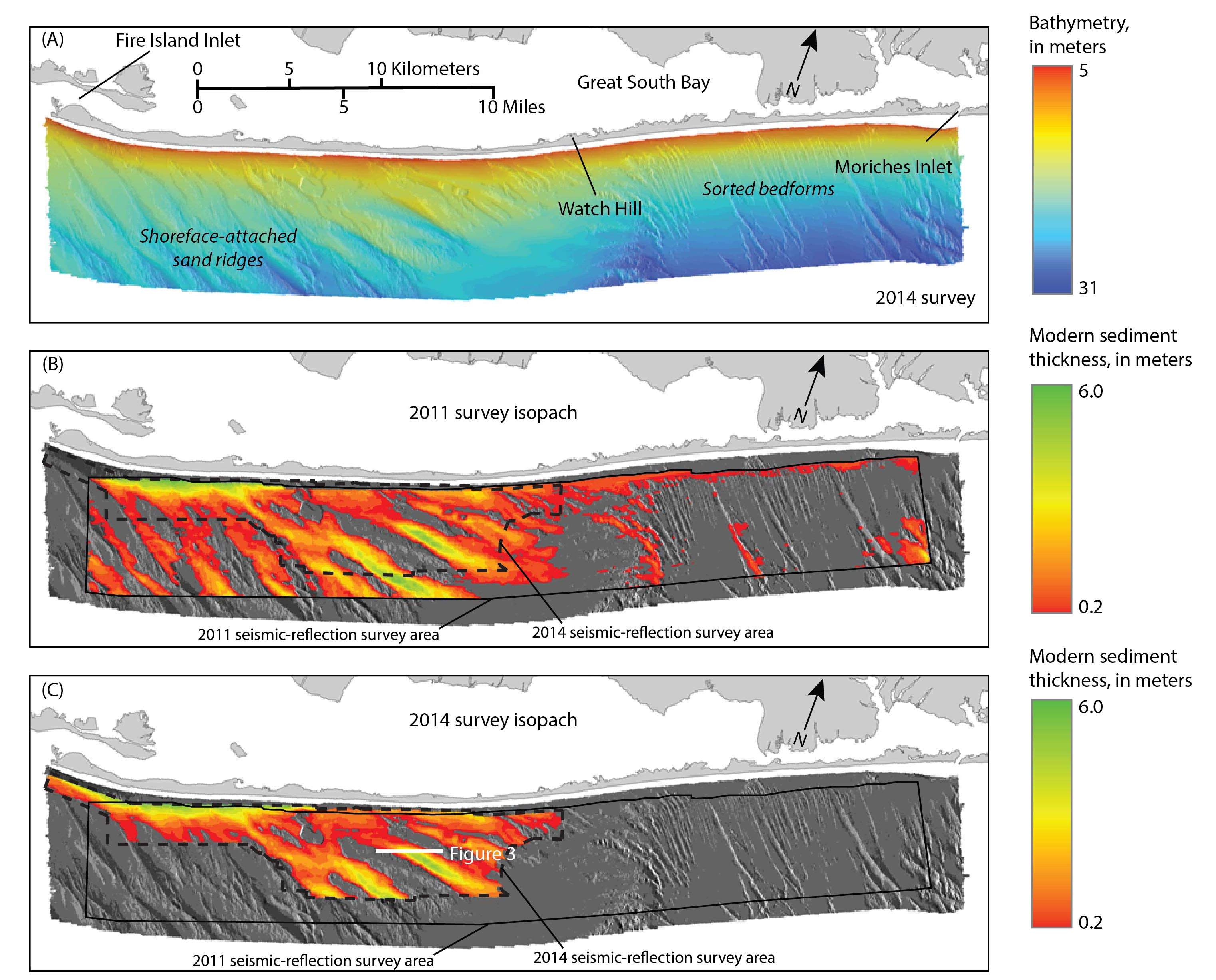
Figure 2. A, Map showing the interpolated bathymetric surface generated from multibeam echosounder data collected offshore of Fire Island, New York, in January 2014 (Denny and others, 2015). Bathymetry is in meters (m) below the North American Vertical Datum of 1988 (NAVD 88). B and C, Maps illustrating the thickness of modern sediment derived from seismic-reflection data collected in 2011 (Schwab, Baldwin, and Denny, 2014) and 2014, respectively. These isopachs are overlain on the sun-illuminated bathymetric surface derived from the bathymetric surface shown in A. West of Watch Hill, the modern sand deposits are organized into a series of shoreface-attached sand ridges oriented obliquely to the shoreline. The Pleistocene glacial outwash units are exposed in the troughs between the ridges and across other portions of the inner continental shelf where the modern deposits are absent. The presence of sorted bedforms on the inner continental shelf east of Watch Hill is indicative of this active erosion of the glacial outwash units (Schwab,Denny, and Baldwin, 2014).
|