Skip past header information
USGS - science for a changing world

Open-File Report 2015-1238


Assessing the Impact of Hurricanes Irene and Sandy on the Morphology and Modern Sediment Thickness on the Inner Continental Shelf Offshore of Fire Island, New York


Skip past contents information/ Title Page / List of Figures / Conversion Factors / Abbreviations / Abstract / Introduction / Geologic Setting / Methods / Mapping Results / Discussion / Summary / Acknowledgments / References Cited / Citation Page /


Map showing backscatter and bathymetry collected in 2011 and 2014 offshore of Fire Island, New York. Sharp transitions between high and low backscatter identified along the margins of discrete sediment distribution patterns and sedimentary structures form the 2011 and 2014 surveys are overlain on the backscatter data from the 2014 survey.


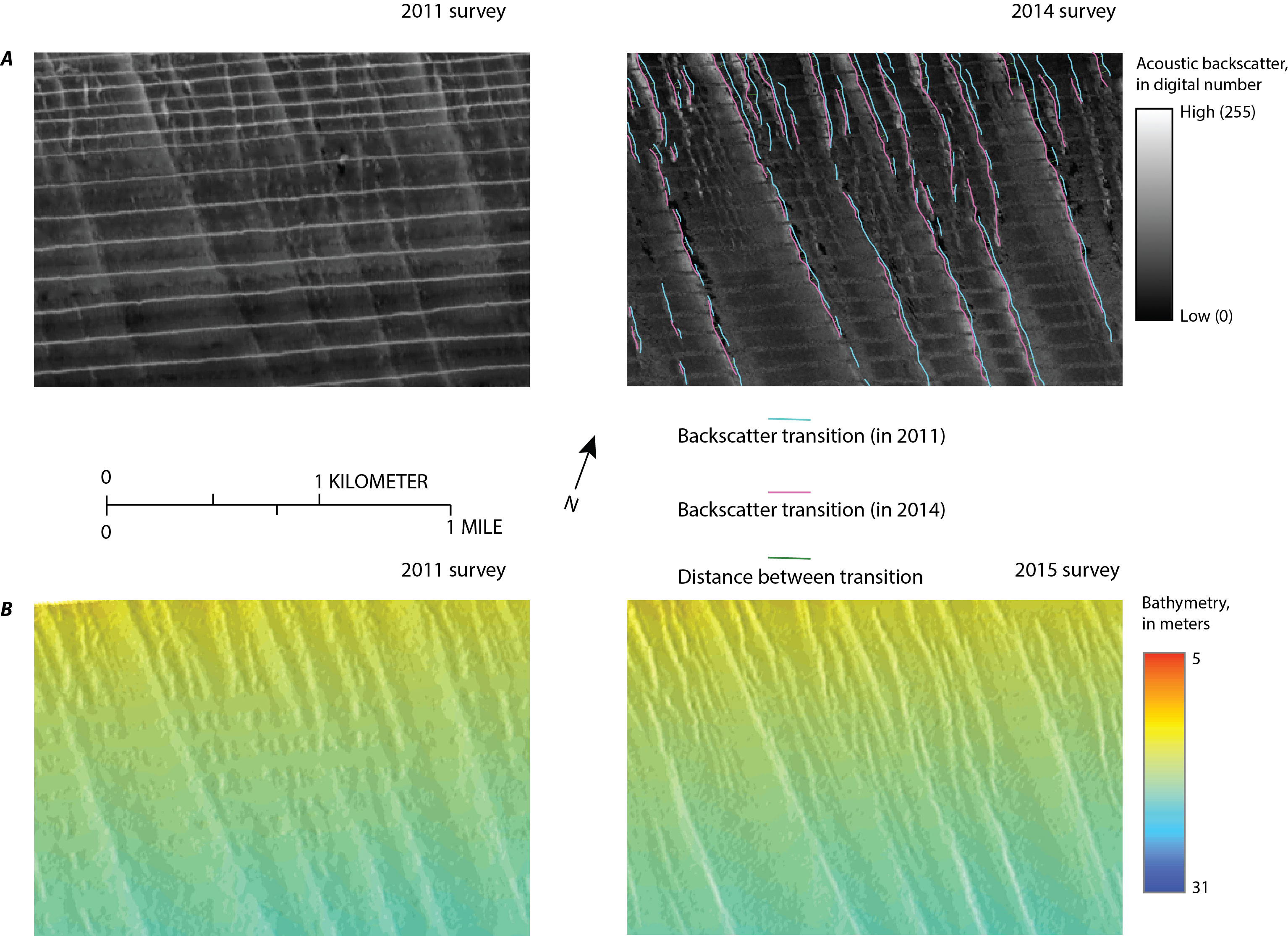
Figure 6.
Maps showing A, backscatter and B, bathymetry collected in 2011 (Schwab, Denny, and Baldwin, 2014) and 2014 (Denny and others, 2015) in an area of sorted bedforms offshore of eastern Fire Island, New York. Location of maps shown on figure 4B. A, Sharp transitions between high and low backscatter identified along the margins of discrete sediment distribution patterns and sedimentary structures from the 2011 and 2014 surveys are overlain on the backscatter data from the 2014 survey and aid in detecting change. B, Coincident bathymetry illustrates that change detection is prohibitive largely because of the subtlety of changes in this area. Change detection is further complicated because of artifacts in the data from the 2011 survey as described in the “Methods” section of this report.

Accessibility FOIA Privacy Policies and Notices

Take Pride in America logo USA.gov logo U.S. Department of the Interior | U.S. Geological Survey
URL: http://pubsdata.usgs.gov/pubs/of/2015/1238/ofr2015-1238-figure6.html
Page Contact Information: GS Pubs Web Contact
Page Last Modified: Wednesday, 07-Dec-2016 21:49:33 EST