U.S. Geological Survey Open-File Report 2010-1332
GLORIA Sidescan-Sonar Imagery for Parts of the U.S. Exclusive Economic Zone and Adjacent Areas
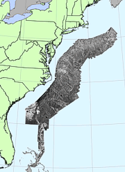
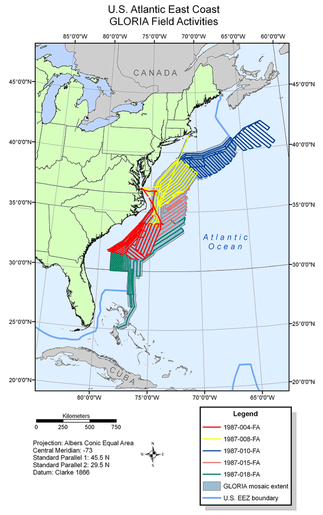
BackgroundFrom February to May 1987 five cruises totalling 113 days at sea were conducted to cover the U.S. EEZ Atlantic Continental Margin seaward of the continental shelf edge, from the Canadian border southward to the northern Blake Plateau off Florida (EEZ-SCAN 87 Scientific Staff, 1991). The first cruise (1987-004-FA), completed in February 1987, covered a portion of the EEZ region that included the northern Blake Plateau and the Continental Slope and rise off Georgia, South Carolina, and North Carolina from the 400-m isobath to the 200-nm EEZ boundary. The second cruise (1987-008-FA) was completed in March 1987 and surveyed the U.S. Mid-Atlantic region of Cape Hatteras and Hudson Canyon off shore of New Jersey, Delaware, Maryland, Virginia, and North Carolina. The third survey (1987-010-FA) began on March 28, 1987, and was completed on April 25, 1987. It surveyed an area of the New England continental slope and rise as well as the Hudson Canyon area. In addition, this cruise extended outside of the U.S. EEZ and covered a portion of the Nova Scotia continental rise as depicted on the field activities map. The survey was completed in conjunction with the Geological Survey of Canada and the Canadian Hydrographic Service and the data were retained by these organizations (Lubinski and others, 1990). The fourth cruise (1987-015-FA) conducted from April 27 to May 8, 1987, was a gap-filling cruise to complete an area off the North Carolina continental slope and rise that was not completed on previous cruises (1987-004-FA and 1987-008-FA) due to bad weather. The final cruise (1987-018-FA) completed the final survey of Hatteras Canyon and added the Blake Plateau and Blake Escarpment. In addition, permission was granted by the government of the Bahamas to extend the survey south into Bahamian waters in order to map prominent geologic features more completely. The U.S. Atlantic GLORIA sidescan-sonar mosaic covers approximately 526,772 sq km of a passive continental margin. The innermost area north of latitude 30oN and most of the plateau south of that latitude were not imaged during 1987 because of lack of time (EEZ-SCAN 87 Scientific Staff, 1991).
|