U.S. Geological Survey Open-File Report 2010-1332
GLORIA Sidescan-Sonar Imagery for Parts of the U.S. Exclusive Economic Zone and Adjacent Areas
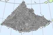
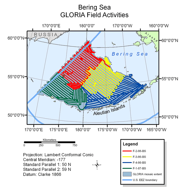
BackgroundThe Bering Sea was the first area to be mapped as survey of the Alaskan EEZ began in 1986. The GLORIA image of the deep water of the U.S. EEZ Bering Sea area covers approximately 830,000 sq km of seafloor, and does not include the vast, shallow continental shelf. The area surveyed covered the Aleutian Basin and Bowers Basin deeper than 200 m east of the U.S.-U.S.S.R Convention Line of 1876. The GLORIA data for the Bering Sea were acquired during four cruises over a two year period. The first three cruises completed in 1986 acquired approximately 75 percent of the data used to create the mosaic. The first cruise (F-2-86-BS) conducted from July 6 - August 2, 1986, surveyed an area which extends seaward of the Bering Sea shelf between the Aleutian Island ridge and the US-USSR 1867 convention line (Carlson, 1987). The second cruise (F-3-86-BS) from August 6 - September 1, 1986, completed the survey of the central Aleutian Basin and Beringian margin (Gardner and others, 1986). The final cruise of 1986, (F-4-86-BS), was conducted from September 3 - 30 surveyed the southern Bering Sea between the Bering continental shelf, south of Pribilof Canyon, and Bowers Ridge (Cooper and others, 1986). The fourth and final cruise, (F-1-87-BS), conducted from June 28 - July 28, 1987 completed the survey of the Bering Sea which included Bowers Basin, Bowers Ridge, and the southwestern part of the Aleutian Basin. A small area south of Attu, Agattu, Shemya, and Buldir Islands (western Aleutian Islands) also was surveyed (Cooper and others, 1987).
|