Data Series 1005
| IntroductionBreton and Gosier Islands, located at the southern end of the Chandeleur Island chain, Louisiana, are part of the Breton National Wildlife Refuge (NWR), which was established in 1904 (fig. 1). The Breton NWR is recognized as a globally significant bird habitat because of the resources it provides, and it hosts one of Louisiana's largest historical brown pelican nesting colonies. However, this colony has declined by approximately 50 percent between 2008 and 2012, primarily because of the reduced island area (James Harris, U. S. Fish and Wildlife Service (USFWS), written commun. 2014). The loss of area through relative sea-level rise, diminished sediment supply, and storm impacts such as Hurricane Katrina, which submerged the island in 2005, constitutes a major and ongoing threat (Lavoie, 2009; Martinez and others, 2009; Kindinger and others, 2013). Since the 1920s, the island area has decreased by over 90 percent (Martinez and others, 2009). Without island restoration, Breton Island is expected to be completely submerged within the next two decades, transforming into an emergent sandbar (Lavoie, 2009). Submergence would render the island unusable by any of the seabird populations. To restore Breton Island to pre-Katrina conditions, the USFWS proposes rebuilding the shoreface, dune, and back-barrier marsh to provide nesting and foraging habitat for pelicans, terns, skimmers, and gulls. Prior to restoration, it is necessary to characterize the geomorphology of the island and the island platform. The data can provide geologic information about island evolution, recent change, and support modeling of future island change in response to restoration and storm impacts. Over the past few decades, the U.S. Geological Survey (USGS) has investigated the geology and morphology of the Chandeleur Islands, primarily focusing on the northern portion. Baseline data needed to characterize these aspects of island geomorphology were either insufficient or missing. In July and August 2014, the USGS St. Petersburg Coastal and Marine Science Center (SPCMSC) conducted high-resolution geophysical and sedimentologic investigations around the island to construct a comprehensive baseline dataset. The surveys included single-beam bathymetry; interferometric swath bathymetry; chirp (compressed high-intensity radar pulse) subbottom survey; side-scan sonar survey; and sediment cores and sediment grab sample collection. This data series includes Differential Global Positioning System (DGPS) navigation, single-beam and interferometric swath bathymetry (seafloor morphology), high-resolution chirp seismic-reflection profiles (shallow stratigraphy), and side-scan sonar imagery (seafloor surface-sediment variations). All data were collected during two USGS cruises: one in July 2014 and one in August 2014 (USGS Field Activity Numbers (FAN)) 2014-314-FA and 2014-317-FA respectively. This data series includes acquisition methods, data processing methods, processed bathymetry data files, and other survey products. The seismic-reflection data and the sedimentological data for these cruises are reported separately. Processed data, maps, and imagery products are downloadable in a geographic information system (GIS) format from the Data Downloads page. 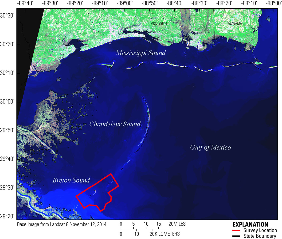 Figure 1. Study area and location map of the 2014 geophysical surveys nearshore Breton Island and Gosier Islands, Breton National Wildlife Refuge, Louisiana. [Click to enlarge] |

![]() U.S. Department of the Interior |
U.S. Geological Survey
U.S. Department of the Interior |
U.S. Geological Survey
URL: http://pubsdata.usgs.gov/pubs/ds/1005/ds1005-introduction.html
Page Contact Information: GS Pubs Web Contact
Page Last Modified: Monday, 28-Nov-2016 20:51:10 EST
