|
PHOTOGRAPHS |
|
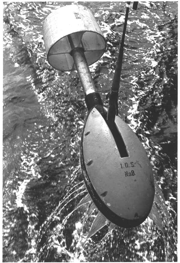
A 3.5 KHz echo-sounder towfish (Photo Credit: Dann Blackwood, Woods Hole Field Center) |
MORE PHOTOGRAPHS |
| : looking northeast from atop the Punta Tuna lighthouse |
| : looking west along a beach west of San Juan |
| : looking north from a mountain in east central Puerto Rico |
| The research vessel Farnella entering the harbor at San Juan, Puerto Rico |
| : used for collecting surficial sediment samples |
| two scientists retrieve a sediment grab sampler from the stern |
| over eastern Puerto Rico, taken from the R/V JeanA |
| looking north across rain forest vegetation in the El Yunque area |
| palm trees, one fallen, line an eroding beach at Yabucoa on the east coast |
| at the dock at Yabucoa in eastern Puerto Rico |
| life ring on the bulkhead of the R/V Jean A. |
| The R/V Jean A approaches the dock. |
| A 3.5 KHz echo-sounder towfish is retrieved at the end of a cruise |
| A 3.5 KHz echo-sounder towfish is retrieved at the end of a cruise |
| : a spectacular tropical sunset over Puerto Rico, taken from the R/V Jean A |
| a helmet conch shell (left) and a queen conch shell rest on a ship’s hawser |
| An airgun sound source for seismic reflection profiling boils the water at sunset |
| Lightning illuminates clouds near El Yunque |
Hurricane Hugo on the morning of September 18, 1989 |
Puerto Rico coastline in October, 1984. |
R/V Farnella’s Chief Officer’s log book and barometric pressure printout |
Puerto Rico's North Shore, just west of San Juan |
Puerto Rico's North Coast during a hurricane |
Hurricane winds drive a 10-foot 2X4 through a palm tree |
El Moro - the entrance to San Juan Harbor, 1975 |
Testing the GLORIA launching system |
A rainbow over San Juan in the aftermath of a storm. |
Another view of the Puerto Rico coastline in October, 1984. |
Crashing waves: are breaking on eolianite ridges, lithified remnants of a Pleistocene beach. |